Area Overview for CT9 5AQ
Photos of CT9 5AQ


Area Information
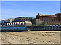
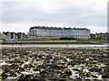
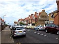
Westbrook, identified by the postcode CT9 5AQ, is a Victorian seaside resort located on the western edge of Margate in Kent. This small residential cluster covers just 3,385 square metres and accommodates a population of 1,502 people. You will find yourself living in a distinct pocket of the wider Margate area, positioned within the Canterbury district. The history here dates back to the Victorian era as a seaside resort, with notable landmarks including All Saints Church, which was constructed in 1894 using ragstone and features specific architectural additions from the late 19th and early 20th centuries. Daily life for residents is defined by its compact nature, situated at coordinates 51.385275, 1.361642. This setting offers a specific residential identity separate from the broader commercial zones of Immediate Margate. When considering homes in CT9 5AQ, you are entering a defined ward with a strong historical footprint. The area provides a quiet residential environment while remaining connected to the amenities of the larger town. Living in this postcode means you are part of a community with deep roots in the South East English Region, balancing Victorian heritage with modern coastal living.
- Area Type
- Postcode
- Area Size
- 3385 m²
- Population
- 1502
- Population Density
- 6278 people/km²
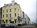
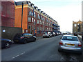
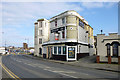
The housing stock in CT9 5AQ is characterised by a specific occupancy model where flats dominate the market. Only 35% of residents own their homes, suggesting a considerable reliance on the rental sector within this postcode. When you look for homes in CT9 5AQ, you will primarily encounter flats rather than traditional family houses. This mix is defined by the Victorian origins of the ward, where architectural constraints often favoured block living over sprawling gardens. The concentration of adults aged 30 to 64 years further supports a demand for low-maintenance, efficient living spaces that appeal to professionals or empty nesters. Because the ward constitutes just 3,385 square metres, the supply of available properties is intrinsically limited compared to surrounding areas. The low home ownership rate indicates that you may face increased competition in the rental market or need to target specific niches if purchasing directly. The property landscape here is not a showcase of luxury estates but a functional, dense accommodation zone typical of the Canterbury district's urban fringe.
House Prices in CT9 5AQ
No properties found in this postcode.
Energy Efficiency in CT9 5AQ
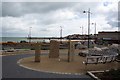
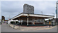
Living in CT9 5AQ places you within practical reach of a suite of amenities in Margate and the wider Thanet peninsula. Retail options include major supermarkets such as Tesco Margate, Iceland Margate, and Morrisons Margate, ensuring your daily shopping needs are met without significant travel. You have access to five railway stations within easy reach, including Margate Railway Station, Westgate, and Birchington, facilitating straightforward travel across the region. The Ramsgate Ferry Terminal serves as a key ferry point, while Kent International Airport offers air travel connectivity just one station away. For local leisure and community gatherings, the historic All Saints Church stands as the principal landmark in the ward, serving both spiritual and community roles. The area benefits from five notable rail hubs and several retail destinations that define the local lifestyle. This proximity means you can blend coastal living with city convenience without needing a car for most daily tasks.
Amenities
Schools
| Rank | School | Type | Entry gender | Ages |
|---|
Explore more schools in this area
Go to Schools tabDemographics
The community within CT9 5AQ reflects a mature demographic profile with a median age of 47 years. The most common age range is adults between 30 and 64 years, indicating a population typically occupied by working-age families or established professionals. Home ownership stands at 35%, meaning a significant portion of the 1,502 residents exist within the rented sector. Flats are the predominant accommodation type in this specific cluster, contrasting with the detached or semi-detached houses often found in wider suburban developments. Ethnically, White residents form the predominant group within the ward. You can expect a neighbourhood character that aligns with an older, perhaps single-generation household model given the high concentration of middle-aged adults. The lower home ownership rate compared to the national average suggests that if you are considering buying, you are looking at a specialised market with limited stock suited to family-sized units or those seeking the convenience of flat living. The density of 443,742 people per square kilometre is a localized metric for this small footprint, reflecting the high intensity of occupancy typical of urban wards in significant seaside towns.
Household Size
Accommodation Type
Tenure
Ethnic Group
Religion
Household Composition
Age
Household Deprivation
NS-SEC
Explore more demographic insights in this area
Go to Demographics tabPlanning
Planning Constraints
- Flood RiskPremium
- Ramsar Wetland SitesPremium
- Area of Outstanding Natural BeautyPremium
- Protected Nature ReservePremium
- Protected WoodlandPremium
- Crime RiskPremium