Area Overview for CT9 3LR
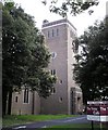
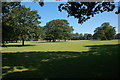
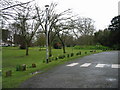
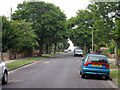
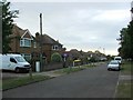
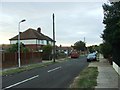
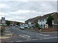
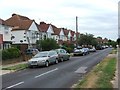
Photos of CT9 3LR

Area Information
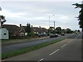
Living in CT9 3LR offers a specific residential experience within the Dane Valley Ward of Kent. This postcode covers a small residential cluster containing 7,688 square metres of land. Despite the modest physical size, the area supports a population of 1,536 people, creating a relatively enclosed community environment. You will find yourself navigating a location with very high population density, recorded at 199,779 people per square kilometre. This density figure reflects the specific nature of the postcode as a concentrated housing zone. The ward sits within the Thanet District Council unitary authority, distinct from Canterbury city wards, yet part of the broader Isle of Thanet area. The geographical coordinates place you near 51.380441, 1.40441, positioning the homes in Broadstairs. Daily life here is defined by the proximity of the coast and the town centre. Residents benefit from a setting that connects the immediate locality to wider transport hubs like rail stations and airports. The layout supports a lifestyle where ground-level access to local services is a priority, given the shrunken footprint of the designated area.
- Area Type
- Postcode
- Area Size
- 7688 m²
- Population
- 1536
- Population Density
- 3250 people/km²
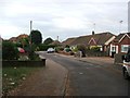
The property market in CT9 3LR is heavily weighted towards private ownership. With 62% home ownership, the area functions primarily as an owner-occupied locale rather than a student village or high-rented zone. Houses are the dominant accommodation type, which shapes the character of the streets. You will mostly encounter detached, semi-detached, or terraced houses that define the residential aesthetic. The total land area of 7,688 square metres limits the scale of new developments. The modest size of the postcode suggests a finite number of properties available for sale or rent within these exact boundaries. Buyers looking at homes in CT9 3LR should expect a traditional suburban stock rather than modern apartment blocks or luxury conversions. The high home ownership rate of 62% indicates stability and low tenant turnover. This concentration of owner-occupiers often drives property prices and creates a slower pace of change compared to heavily rented districts. The inventory consists of established housing built for local families. When you view properties in this cluster, you are entering a market where residents have deep roots. The scarcity of land reinforces the value of each individual plot within the tightly packed postcode.
House Prices in CT9 3LR
No properties found in this postcode.
Energy Efficiency in CT9 3LR
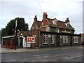
Daily life in CT9 3LR relies on a network of nearby amenities located within practical reach. For shopping, five retail venues serve the population. You can visit Tesco Margate, Co-op Cliftonville, and Co-op St for your weekly grocery needs. These supermarkets are accessible without needing long drives. Transport options are diverse, with five railway stations nearby. Broadstairs Railway Station, Margate Railway Station, and Dumpton Park Railway Station allow for easy commute planning. The area is also close to Kent International Airport, offering international gateways. For coastal travel, the Ramsgate Ferry Terminal provides a direct route across the water. With 1,536 residents sharing 7,688 square metres, local interactions are frequent. The presence of major retailers and transport hubs creates a suburban lifestyle where convenience is prioritised. You do not need to travel far for daily essentials. The cluster acts as a sleeping node connected to the wider Thanet infrastructure. This balance between quiet residential space and easy access to retail and transport defines the character of living in this postcode.
Amenities
Schools
Families paying attention to education will find Northdown Primary School and St Anthony's School within practical reach of CT9 3LR. Northdown Primary School operates as a primary institution and holds a current Ofsted rating of good. This status confirms that the school meets national standards for quality teaching and student welfare. St Anthony's School functions as a special educational needs provision. This school is designed for students with specific support requirements, forming an essential part of the local educational ecosystem. The presence of both a standard primary school and a special needs institution ensures that families with diverse requirements have options nearby. The mix of educational facilities caters to the adult median age of 47. While the area does not contain secondary schools or universities directly within the 7,688 square metres, the nearby primary provision supports young families residing in the cluster. Northdown Primary School is specifically noted for its commendable rating, which is a key consideration for buyers prioritising education. The proximity of these institutions means you can pick up children locally before they move to secondary education elsewhere in the Thanet district.
| Rank | School | Type | Entry gender | Ages |
|---|---|---|---|---|
| 1 | Northdown Primary School | primary | N/A | N/A |
| 2 | St Anthony's School | special | N/A | N/A |
| 3 | Northdown Primary School | primary | N/A | N/A |
Explore more schools in this area
Go to Schools tabDemographics
The community within CT9 3LR is characterised by a mature demographic profile. The median age stands at 47 years, indicating that families and empty nesters dominate the local population. Adults between 30 and 64 years old represent the most common age range. This age distribution suggests a neighbourhood where long-term residents and established households are the norm rather than a transient population. Home ownership levels are strong, with 62% of residents owning their homes outright or with a mortgage. The remaining 38% likely reside in rental properties. Houses form the predominant accommodation type, meaning terraced or semi-detached single-family dwellings make up the stock. The ethnic makeup is predominantly white, reflecting the historical development of the area in Kent. There is no data provided regarding specific deprivation indices or income levels. The absence of such figures means you cannot currently measure economic disparity within this specific cluster. The 1,536 residents share the 7,688 square metre footprint, creating a tight-knit social environment. The large proportion of older adults often correlates with specific community needs, such as proximity to medical facilities or local shops, rather than nightlife or youth-focused amenities.
Household Size
Accommodation Type
Tenure
Ethnic Group
Religion
Household Composition
Age
Household Deprivation
NS-SEC
Explore more demographic insights in this area
Go to Demographics tabPlanning
Planning Constraints
- Flood RiskPremium
- Ramsar Wetland SitesPremium
- Area of Outstanding Natural BeautyPremium
- Protected Nature ReservePremium
- Protected WoodlandPremium
- Crime RiskPremium