Area Overview for CT9 1RE
Photos of CT9 1RE


Area Information
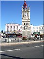
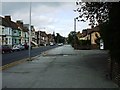
Living in CT9 1RE means being part of a tightly knit residential cluster in Margate, a historic seaside town in Kent. With a population of 2,153 spread over just 2,997 square metres, this area is compact yet rich in heritage. Margate’s roots as a maritime port date back to the Middle Ages, and its development as a seaside resort accelerated in the late 18th century. Today, CT9 1RE reflects a community shaped by its coastal past, with modern life balanced against historical landmarks like the Roman villa in Tivoli Park Avenue. The area’s density means a strong sense of local identity, though its small size means residents often look beyond the postcode for broader amenities. Proximity to Margate’s railway stations, ferry terminals, and nearby towns like Broadstairs offers connectivity, while the town’s history as part of the Cinque Ports adds a layer of cultural significance. For those seeking a blend of coastal charm and practical living, CT9 1RE offers a snapshot of a town where the past and present coexist.
- Area Type
- Postcode
- Area Size
- 2997 m²
- Population
- 2153
- Population Density
- 5630 people/km²
The property market in CT9 1RE is characterised by a high proportion of rental properties, with only 22% of homes owner-occupied. Flats dominate the housing stock, reflecting the area’s density and the practicality of smaller units in a compact postcode. This suggests a market skewed towards tenants rather than long-term buyers, potentially limiting opportunities for property appreciation. The small size of CT9 1RE means buyers must consider nearby areas for larger homes or alternative layouts. For those seeking investment, the rental demand may offer stability, though the lack of owner-occupation could indicate lower perceived value or limited appeal for permanent residency. The prevalence of flats also means limited scope for home extensions or renovations, which may deter buyers prioritising flexibility. Overall, CT9 1RE functions more as a transitional or secondary residence than a primary market for property ownership.
House Prices in CT9 1RE
No properties found in this postcode.
Energy Efficiency in CT9 1RE
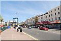
Residents of CT9 1RE have access to a range of local amenities within practical reach. The area is served by five retail outlets, including Iceland Margate, Morrisons Margate, and Aldi Cliftonville, offering everyday shopping needs. Rail connectivity is robust, with five stations providing links to broader networks. The proximity to Kent International Airport and Ramsgate Ferry Terminal adds to the area’s appeal for those reliant on air or sea travel. While the postcode itself is small, its integration with Margate’s historic and modern infrastructure means residents can enjoy the town’s cultural heritage, including its 18th-century seaside developments. The compact nature of the area encourages walking or cycling to nearby points of interest, though larger retail or leisure options may require a short trip to adjacent towns. This balance of convenience and connectivity supports a lifestyle that prioritises accessibility over sprawling suburban sprawl.
Amenities
Schools
| Rank | School | Type | Entry gender | Ages |
|---|
Explore more schools in this area
Go to Schools tabDemographics
The community in CT9 1RE is predominantly middle-aged, with a median age of 47 and most residents falling within the 30–64 age range. Only 22% of homes are owner-occupied, indicating a rental-heavy market, while flats are the primary accommodation type. This suggests a population that may include professionals working elsewhere or those prioritising convenience over long-term investment. The predominant ethnic group is White, though no specific diversity metrics are provided. The high population density of 718,312 people per square kilometre underscores the area’s compact nature, which can foster a close-knit environment but may also contribute to a lack of private outdoor space. With a low proportion of homeowners, the area likely experiences higher turnover, affecting community continuity. These factors shape a lifestyle where transient elements coexist with local traditions, reflecting Margate’s historical role as a hub for seasonal and maritime activity.
Household Size
Accommodation Type
Tenure
Ethnic Group
Religion
Household Composition
Age
Household Deprivation
NS-SEC
Explore more demographic insights in this area
Go to Demographics tabPlanning
Planning Constraints
- Flood RiskPremium
- Ramsar Wetland SitesPremium
- Area of Outstanding Natural BeautyPremium
- Protected Nature ReservePremium
- Protected WoodlandPremium
- Crime RiskPremium