Area Overview for CT9 1DG
Photos of CT9 1DG


Area Information
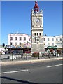
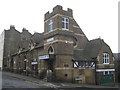
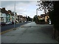
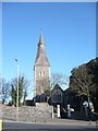
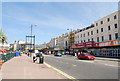
Living in CT9 1DG means being part of a small, tightly knit residential cluster in Margate, a historic seaside town in Kent. With a population of 2,153, the area reflects Margate’s long-standing role as a maritime hub, dating back to the Middle Ages. Its compact size fosters a quiet, community-oriented lifestyle, with residents often walking or cycling to nearby amenities. The area’s demographic profile suggests a mature population, with a median age of 47 and most residents falling between 30 and 64. This creates a stable, established community with a focus on local traditions and services. Proximity to Margate’s historic core, combined with modern retail and transport links, offers a blend of heritage and convenience. The nearby presence of rail stations, a ferry terminal, and an airport underscores its accessibility, while the low flood risk and absence of protected natural areas suggest a practical, low-maintenance environment for residents.
- Area Type
- Postcode
- Area Size
- Not available
- Population
- 2153
- Population Density
- 5630 people/km²
The property market in CT9 1DG is characterised by a low home ownership rate of 22%, indicating that the majority of housing stock is rented rather than owner-occupied. The accommodation type is predominantly flats, which aligns with the area’s compact residential nature. This suggests a market tailored to tenants, possibly including professionals or commuters seeking short-term or flexible housing. The limited size of the area means housing options are constrained, and buyers may find fewer opportunities for long-term investment compared to larger towns. The prevalence of flats also implies a focus on practical, low-maintenance living, which could appeal to those prioritising convenience over property ownership. For buyers, this small cluster may serve as a stepping stone or secondary residence rather than a primary market.
House Prices in CT9 1DG
No properties found in this postcode.
Energy Efficiency in CT9 1DG
Residents of CT9 1DG have access to a range of amenities within walking or short driving distance. Retail options include Iceland Margate, Morrisons Margate, and Aldi Cliftonville, offering everyday shopping needs. The area’s rail network, with stations such as Margate and Westgate, connects to broader regional routes, while the nearby Ramsgate Ferry Terminal provides maritime travel links. Kent International Airport is also within reach, catering to those requiring air travel. These amenities contribute to a lifestyle that balances local convenience with broader connectivity. The presence of multiple retail outlets and transport hubs suggests a practical, service-oriented environment, ideal for those prioritising accessibility over sprawling urban or rural settings.
Amenities
Schools
| Rank | School | Type | Entry gender | Ages |
|---|
Explore more schools in this area
Go to Schools tabDemographics
CT9 1DG’s population of 2,153 is predominantly composed of adults aged 30 to 64, with a median age of 47. This indicates a mature, settled community with fewer young families or retirees. Home ownership is low at 22%, suggesting most residents rent their properties, likely in flats given the accommodation type. The predominant ethnic group is White, though no data on minority representation is provided. The age profile implies a workforce-centric area, with residents likely employed in nearby sectors such as retail, transport, or tourism. The low home ownership rate may reflect the area’s role as a rental market, possibly influenced by its proximity to Margate’s amenities and transport links. This demographic structure shapes a community focused on stability and local services rather than rapid growth or change.
Household Size
Accommodation Type
Tenure
Ethnic Group
Religion
Household Composition
Age
Household Deprivation
NS-SEC
Explore more demographic insights in this area
Go to Demographics tabPlanning
Planning Constraints
- Flood RiskPremium
- Ramsar Wetland SitesPremium
- Area of Outstanding Natural BeautyPremium
- Protected Nature ReservePremium
- Protected WoodlandPremium
- Crime RiskPremium