Area Overview for CT7 0BQ
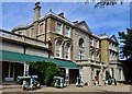
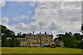
Photos of CT7 0BQ


Area Information
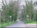
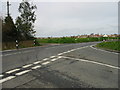
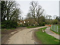
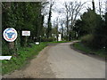
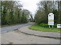
Living in CT7 0BQ means being part of a tightly knit residential cluster in England’s southeast, where the population of 1,530 residents occupies a densely populated area with 979 people per square kilometre. This small postcode area is characterised by its proximity to coastal and historical sites, including Birchington-on-Sea, a village with roots dating to the 13th century. Daily life here is shaped by its compact size and proximity to amenities such as rail stations, retail outlets, and coastal access. The area’s appeal lies in its balance of quiet residential living and practical connectivity, with easy access to Kent International Airport and Ramsgate Ferry Terminal. Residents benefit from a well-maintained infrastructure, including a low crime risk score of 72, which places it below average for safety. The mix of historic architecture and modern conveniences, such as Co-op stores and railway links, reflects a community that values both heritage and accessibility. For those seeking a peaceful yet functional neighbourhood, CT7 0BQ offers a snapshot of traditional English coastal living with modern infrastructure.
- Area Type
- Postcode
- Area Size
- Not available
- Population
- 1530
- Population Density
- 979 people/km²
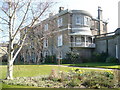
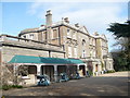
The property market in CT7 0BQ is defined by its high home ownership rate of 63% and a predominance of houses, indicating a community where long-term residency is common. This suggests a stable market with limited turnover, as opposed to a rental-focused area. The concentration of houses rather than flats or apartments points to a preference for larger, private properties, which may appeal to families or retirees. Given the area’s small size, the housing stock is likely limited, meaning buyers should consider proximity to surrounding regions for more options. The absence of data on property prices or recent sales trends means the market’s competitiveness cannot be assessed, but the high ownership rate implies a strong sense of local attachment. For buyers, this means a focus on quality over quantity, with homes likely to be well-maintained and suited to those prioritising space and privacy.
House Prices in CT7 0BQ
No properties found in this postcode.
Energy Efficiency in CT7 0BQ
The lifestyle in CT7 0BQ is enriched by its proximity to a range of amenities. Nearby, five retail outlets include Morrisons Daily and two Co-op stores, providing convenience for grocery shopping. Rail access is extensive, with five stations offering links to nearby towns and cities. For travel beyond the area, Kent International Airport and Ramsgate Ferry Terminal are within reach, facilitating both domestic and international travel. The area’s historical and natural attractions, such as All Saints’ Church and Quex Park, add cultural and recreational value. The presence of a primary school and special school ensures families have educational options. While the area is small, its amenities are practical and varied, supporting both daily needs and leisure activities. The blend of retail, transport, and cultural sites creates a lifestyle that balances convenience with access to broader opportunities.
Amenities
Schools
Near CT7 0BQ, two schools are within practical reach: Birchington Church of England Primary School, a primary school with a good Ofsted rating, and The Llewellyn School and Nursery, a special school also rated good. The presence of both primary and special educational institutions reflects a diverse need, catering to both mainstream and specialist education. This mix ensures families have options for their children’s schooling, from early years to primary education. The good Ofsted ratings indicate that both schools meet or exceed national standards, which is a significant consideration for parents prioritising quality education. The proximity of these schools to the area enhances its appeal, particularly for families with children. While no secondary schools are listed, the nearby railway stations may provide access to larger educational hubs in surrounding towns.
| Rank | School | Type | Entry gender | Ages |
|---|---|---|---|---|
| 1 | Birchington Church of England Primary School | primary | N/A | N/A |
| 2 | The Llewellyn School and Nursery | special | N/A | N/A |
Explore more schools in this area
Go to Schools tabDemographics
The community in CT7 0BQ is predominantly middle-aged, with a median age of 47 and the most common age range being adults between 30 and 64 years. Home ownership is strong, with 63% of residents owning their homes, reflecting a stable, long-term population. The area is largely composed of houses, indicating a preference for single-family dwellings over flats or apartments. The predominant ethnic group is White, though no specific data on diversity or deprivation levels is provided. The age profile suggests a mature demographic, likely with established careers and families. This profile aligns with the area’s low crime risk and quiet residential character, making it appealing to those seeking a settled lifestyle. The absence of rental properties in the data implies a focus on owner-occupied homes, which may influence the local property market’s dynamics.
Household Size
Accommodation Type
Tenure
Ethnic Group
Religion
Household Composition
Age
Household Deprivation
NS-SEC
Explore more demographic insights in this area
Go to Demographics tabPlanning
Planning Constraints
- Flood RiskPremium
- Ramsar Wetland SitesPremium
- Area of Outstanding Natural BeautyPremium
- Protected Nature ReservePremium
- Protected WoodlandPremium
- Crime RiskPremium