Area Overview for CT6 8RQ
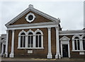
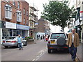
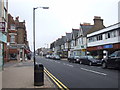
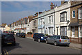
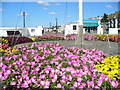
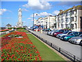
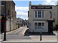
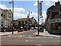
Photos of CT6 8RQ
Area Information
Living in CT6 8RQ means inhabiting a compact residential cluster in the eastern part of Herne Bay, a seaside town on Kent’s north coast. The area covers 2194 square metres and is densely populated, with 1542 residents packed into a space that feels both intimate and defined by its proximity to the Queen Victoria Memorial Hospital. This postcode is part of Herne Ward, a suburban zone that includes the hospital’s inpatient facilities, a 1930s building recently refurbished. Daily life here is shaped by the hospital’s presence and the surrounding residential character. The area is not expansive, but its proximity to Herne Bay’s coastal amenities and transport links to Canterbury and beyond offers a balance of local convenience and regional connectivity. With a median age of 47, the community leans towards adults in their 30s to 60s, suggesting a mix of long-term residents and those seeking stability. The high population density means the area feels lived-in, with a focus on practical living rather than sprawling development. For those prioritising proximity to healthcare and a compact, well-defined neighbourhood, CT6 8RQ offers a specific, if limited, footprint of residential life.
- Area Type
- Postcode
- Area Size
- 2194 m²
- Population
- 1542
- Population Density
- 5988 people/km²
The property market in CT6 8RQ is characterised by a high proportion of flats, with 43% of homes owner-occupied and the remainder likely rented. Given the area’s small size and high population density, the housing stock is limited, making it a niche market for buyers seeking a compact, defined postcode. The prevalence of flats suggests a focus on multi-unit developments, possibly linked to the nearby Queen Victoria Memorial Hospital, which may influence land use and housing availability. With only 43% of residents owning their homes, the area leans more towards a rental market, which could mean competition for available properties and limited scope for long-term investment. Buyers should consider the area’s constraints: its small footprint and proximity to healthcare infrastructure may appeal to those prioritising convenience over space, but the limited housing options could lead to higher demand and potentially inflated prices. For those seeking a specific postcode with immediate access to services, CT6 8RQ offers a focused, if constrained, market.
House Prices in CT6 8RQ
No properties found in this postcode.
Energy Efficiency in CT6 8RQ
The lifestyle in CT6 8RQ is shaped by its proximity to retail and rail amenities. Within practical reach are five retail venues, including Tesco Herne Bay, Morrisons Herne, and Aldi Herne, offering everyday shopping needs. These stores suggest the area is well-equipped for routine errands, though no dining or leisure facilities are listed in the data. The four nearby railway stations—Herne Bay, Chestfield & Swalecliffe, and Whitstable—provide access to broader regional networks, enhancing mobility for commuting or weekend trips. While the area’s compact size limits local parks or recreational spaces, its integration with Herne Bay’s coastal setting may offer nearby leisure opportunities. The mix of retail and rail connectivity implies a practical, service-oriented lifestyle, with convenience prioritised over expansive amenities. For those valuing proximity to shops and transport, CT6 8RQ delivers a functional, if modest, environment.
Amenities
Schools
The nearest school to CT6 8RQ is St Philip Howard Catholic Primary School, a primary education institution serving the area. No secondary schools are listed in the data, so families requiring secondary education would need to look beyond the immediate postcode. The presence of a primary school suggests the area is suitable for young children, though the absence of secondary options may necessitate commuting to nearby towns like Herne Bay or Canterbury. The school’s religious affiliation indicates a community with specific educational preferences, though no Ofsted rating or performance data is provided. For families prioritising proximity to a primary school, St Philip Howard Catholic Primary School offers a local option, but those requiring a broader range of educational facilities may find the area’s offerings limited.
| Rank | School | Type | Entry gender | Ages |
|---|---|---|---|---|
| 1 | St Philip Howard Catholic Primary School | primary | N/A | N/A |
Explore more schools in this area
Go to Schools tabDemographics
The population of CT6 8RQ is 1542, with a density of 702,946 people per square kilometre, reflecting a tightly packed residential cluster. The median age is 47, with the majority of residents falling within the 30-64 age range, indicating a mature adult population. Home ownership here is relatively low at 43%, suggesting a higher proportion of renters compared to owner-occupied properties. The predominant accommodation type is flats, which aligns with the area’s compact nature and the presence of the Queen Victoria Memorial Hospital, which may influence housing availability. The predominant ethnic group is White, though no specific data on diversity or deprivation levels is provided. This demographic profile suggests a community focused on practical living, with a mix of professionals and families likely drawn to the area’s proximity to healthcare and transport. The low home ownership rate may reflect a transient population or a reliance on rental markets, which could impact long-term stability for residents.
Household Size
Accommodation Type
Tenure
Ethnic Group
Religion
Household Composition
Age
Household Deprivation
NS-SEC
Explore more demographic insights in this area
Go to Demographics tabPlanning
Planning Constraints
- Flood RiskPremium
- Ramsar Wetland SitesPremium
- Area of Outstanding Natural BeautyPremium
- Protected Nature ReservePremium
- Protected WoodlandPremium
- Crime RiskPremium