Area Overview for CT6 8NA
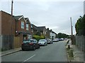
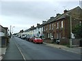
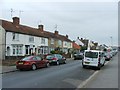
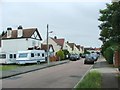
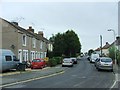
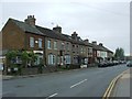
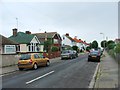
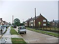
Photos of CT6 8NA
Area Information
Living in CT6 8NA places you in a specific residential cluster within Herne Bay, Kent. This postcode covers precisely 7272 square metres, creating a tightly knit neighbourhood rather than a sprawling district. You are part of a community of 1575 people, resulting in an exceptionally high density of 216588 people per square kilometre. Such density indicates a very compact living environment where your property is close to neighbours and local infrastructure. The area has been identified as part of the West Bay Ward under Canterbury City Council, linking it to the broader administrative structure of the region. Although search results sometimes associate the name West Bay with a different location in Dorset, your coordinates (51.363713, 1.099994) firmly sit you in the coastal district of Canterbury. Daily life here is defined by this concentrated setting, meaning you access services without needing to travel far. You will find yourself surrounded by a small, dense residential population where the distance between your front door and essential amenities is minimal.
- Area Type
- Postcode
- Area Size
- 7272 m²
- Population
- Not available
- Population Density
- Not available
The property market in CT6 8NA is characterised by a strong presence of owner-occupiers, with 62% of the population owning their homes. This majority indicates that the local housing stock is largely stable and not driven by short-term tenancy fluctuations. You are likely looking at houses, as this is the predominant accommodation type recorded for this postcode. The area encompasses a small residential cluster where the mix of properties caters to families and established adults in their mid-years. Because this is a specific postcode area covering a small footprint, the number of available properties may be limited compared to larger districts. Buying homes here often means entering a market where sellers have a long-term connection to the neighbourhood. The high home ownership rate suggests that many of the current listings will be from individuals who plan to stay in the area for the foreseeable future. This dynamic can lead to a stable market but may also mean competition for available stock. Prospective buyers should understand that this is a market for those seeking to join the existing community of homeowners rather than entering a letting scheme.
House Prices in CT6 8NA
No properties found in this postcode.
Energy Efficiency in CT6 8NA
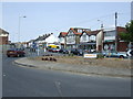
Your lifestyle as a resident of CT6 8NA is supported by a network of nearby amenities within practical reach. Retail options include Lidl Herne, the Co-op Sea, and Tesco Herne Bay, giving you access to everyday grocery shopping without driving far. You have five retail outlets available, ensuring that routine errands can be completed quickly. For outings or a change of pace, you are near several railway stations, including Herne Bay Railway Station, Chestfield and Swalecliffe Railway Station, and Whitstable Railway Station. These transport hubs provide rail links to wider Kent and beyond. You can choose between these stations depending on your destination, whether that is commuting to work or traveling for leisure. The variety of retail and rail options means you do not need a car for all your weekly trips. Living in CT6 8NA balances the convenience of local shops with the flexibility of public transport. You have your essentials close to home while retaining access to the wider transport network of South East England.
Amenities
Schools
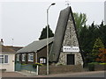
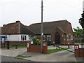
Families living in CT6 8NA have access to Hamptton Primary School, which is located within practical reach of the neighbourhood. This institution is a primary school and holds a good Ofsted rating, providing a solid educational foundation for children in the area. The availability of a school with a good rating is a significant factor for parents considering homes in CT6 8NA. There are no secondary schools or special academy centres listed in the immediate data for this specific cluster, so families relying on which schools their children attend will need to look slightly beyond this postcode. The proximity to Hampton Primary School ensures that younger children can access education locally without long commutes. You should verify transport links to secondary institutions if your family includes teenagers, as the provided school list is specific to primary education levels. The presence of a rated primary school supports the argument that this is a family-oriented residential zone. Parents can feel confident that the nearest educational option meets standard government quality benchmarks.
| Rank | School | Type | Entry gender | Ages |
|---|---|---|---|---|
| 1 | Hampton Primary School | primary | N/A | N/A |
| 2 | Hampton Primary School | primary | N/A | N/A |
Explore more schools in this area
Go to Schools tabDemographics
The community in CT6 8NA is dominated by adults, with 62% of residents owning their homes outright or with a mortgage. This high level of home ownership suggests a settled population invested in the long-term stability of the area. The median age for residents is 47 years, and the vast majority fall into the 30 to 64 year bracket. This demographic profile points to families and established households who have put down roots in the Kent coast. The predominant ethnic group in this cluster is White, reflecting the traditional character of the locality. You will find primarily houses making up the accommodation type, rather than apartments or flats. While specific data on deprivation is not included in the provided statistics, the high age and home ownership figures imply a stable, mature community. There is no data provided on income levels to draw specific conclusions about financial standing, but the property tenure strongly suggests established住户. The area does not report any specific diversity metrics beyond the primary ethnic group, indicating a relatively homogenous local population consistent with its location in South East England.
Household Size
Accommodation Type
Tenure
Ethnic Group
Religion
Household Composition
Age
Household Deprivation
NS-SEC
Explore more demographic insights in this area
Go to Demographics tabPlanning
Planning Constraints
- Flood RiskPremium
- Ramsar Wetland SitesPremium
- Area of Outstanding Natural BeautyPremium
- Protected Nature ReservePremium
- Protected WoodlandPremium
- Crime RiskPremium