Area Overview for CT6 7XZ
Photos of CT6 7XZ
Area Information
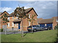
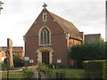
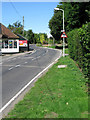
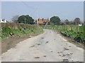
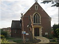
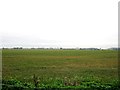
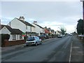
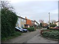
Living in CT6 7XZ means being part of a small, tightly knit residential cluster nestled between the villages of Sturry and Herne Bay, approximately 9 km south-south-west of Canterbury. With a population of 2,580, this area reflects a blend of historical significance and modern convenience. The parish of Herne and Broomfield, which includes this postcode, has grown substantially in recent decades, though CT6 7XZ itself remains a compact community. Its location on the A291 road, historically a key route from the coast to Canterbury and Dover, ensures easy access to nearby towns. Residents benefit from proximity to both rural tranquillity and urban amenities, with the nearby villages offering a mix of heritage sites, such as St Martin’s Church with Anglo-Saxon origins, and contemporary facilities. The area’s character is shaped by its medieval street patterns and its role on ancient trade routes, creating a unique sense of place that balances history with practical living.
- Area Type
- Postcode
- Area Size
- Not available
- Population
- 2580
- Population Density
- 3124 people/km²
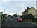
The property market in CT6 7XZ is dominated by owner-occupied homes, with 79% of residences owned by their occupants. This contrasts with areas where rental markets dominate, indicating a community of long-term residents rather than transient tenants. The accommodation type is primarily houses, which are typical of rural and semi-rural settings. This suggests a housing stock that prioritises space and privacy over high-density living. For buyers, this means a focus on individual properties rather than apartments or shared housing. However, the small size of the postcode area and its integration into the larger Herne and Broomfield parish may limit immediate housing options, requiring buyers to consider nearby villages for broader choices. The stability of the market, combined with low crime risk, could appeal to those seeking secure, family-oriented living.
House Prices in CT6 7XZ
No properties found in this postcode.
Energy Efficiency in CT6 7XZ
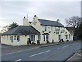
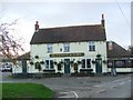
The lifestyle in CT6 7XZ is supported by a range of nearby amenities, including five retail venues such as Sainsburys Margate, Co-op Eddington, and Tesco Herne, ensuring daily shopping needs are met. Rail access to Herne Bay, Chestfield & Swalecliffe, and Sturry stations connects residents to broader networks for work, leisure, and socialising. The area’s historical character, including St Martin’s Church and the original micropub The Butchers Arms, adds cultural depth to daily life. While the postcode itself is small, its integration into Herne and Broomfield’s expanded villages means residents can access a wider array of parks, dining options, and community events. The presence of medieval street patterns and historic sites underscores a lifestyle that values heritage alongside modern convenience.
Amenities
Schools
| Rank | School | Type | Entry gender | Ages |
|---|
Explore more schools in this area
Go to Schools tabDemographics
The community in CT6 7XZ is predominantly composed of adults aged 30–64, with a median age of 47. Home ownership is high, at 79%, indicating a stable, long-term resident base. The area is characterised by houses rather than flats, reflecting a traditional housing stock. The predominant ethnic group is White, aligning with broader demographic trends in the region. While specific data on deprivation is not provided, the high home ownership rate and low crime risk suggest a relatively affluent and secure environment. The age profile suggests a mature population, potentially with established careers and family ties, contributing to a community with a strong sense of continuity. However, the absence of detailed diversity metrics means the full range of social dynamics remains less defined.
Household Size
Accommodation Type
Tenure
Ethnic Group
Religion
Household Composition
Age
Household Deprivation
NS-SEC
Explore more demographic insights in this area
Go to Demographics tabPlanning
Planning Constraints
- Flood RiskPremium
- Ramsar Wetland SitesPremium
- Area of Outstanding Natural BeautyPremium
- Protected Nature ReservePremium
- Protected WoodlandPremium