Area Overview for CT6 7LH
Photos of CT6 7LH

Area Information
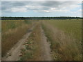
CT6 7LH is a small residential postcode in Kent, encompassing parts of the village of Sturry, a historic settlement near Canterbury. With a population of 1,536 spread across 2,701 square metres, it is a low-density area characterised by rural charm and proximity to Canterbury. The village sits on the Great Stour river, with roots tracing back to the Roman era and a history marked by agricultural use and medieval settlements. Daily life here blends rural tranquillity with commuter accessibility, given its proximity to Canterbury’s urban centre. The area includes satellite housing estates from the 1960s, making it a dormitory village for Canterbury workers. Despite modern development, Sturry retains historic features such as the Grade I listed St Nicholas Church and remnants of ancient Roman roads. The community is small but connected, with nearby railway stations and a network of local amenities. Living here offers a balance of seclusion and convenience, with access to Canterbury’s cultural and economic hubs just a short drive away.
- Area Type
- Postcode
- Area Size
- 2701 m²
- Population
- 1536
- Population Density
- 146 people/km²
The property market in CT6 7LH is dominated by owner-occupied homes, with 84% of properties owned outright. This high rate of home ownership suggests a community of long-term residents rather than a rental market. The accommodation type is primarily houses, which is typical for rural areas with low population density. The small size of the postcode area and its proximity to Canterbury mean that property availability is limited, and buyers should consider the surrounding regions for more options. The predominance of houses over flats or apartments reflects the area’s traditional layout and the presence of satellite housing estates. For buyers, this implies a focus on family-friendly, standalone properties rather than high-density developments. The lack of major planning constraints, aside from protected woodland, means that property transactions are likely straightforward, though buyers should verify any local restrictions before proceeding.
House Prices in CT6 7LH
No properties found in this postcode.
Energy Efficiency in CT6 7LH
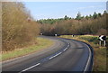
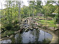
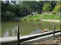
Residents of CT6 7LH have access to five retail venues, including Co-op Eddington, Co-op Sturry, and Lidl Herne, providing everyday shopping and grocery needs. The nearby railway stations offer connections to Canterbury and coastal areas, facilitating both commuting and leisure travel. The area’s rural character is complemented by historic sites such as the St Nicholas Church and medieval tithe barn, offering cultural and recreational value. While the postcode itself is small, the surrounding region includes satellite housing estates and fields, blending rural and suburban elements. The presence of local shops and transport links ensures a self-contained lifestyle, though residents may need to travel further for more specialised services. This mix of convenience and natural surroundings supports a lifestyle that balances practicality with a connection to the area’s heritage.
Amenities
Schools
Near CT6 7LH are two schools: Montgomery School, a primary school, and Spires Academy, an academy with a good Ofsted rating. Montgomery School caters to younger children, providing foundational education, while Spires Academy offers secondary-level schooling with a rating that indicates satisfactory performance. The presence of both a primary and secondary school within practical reach makes the area appealing to families seeking a comprehensive education for their children. The academy’s good rating suggests a reasonable standard of teaching and facilities, though no specific data on student outcomes or curriculum is provided. The mix of school types ensures that residents have access to both early education and secondary schooling without needing to travel far. This combination supports a family-oriented lifestyle, reducing the need for long commutes to education hubs in Canterbury.
| Rank | School | Type | Entry gender | Ages |
|---|---|---|---|---|
| 1 | Montgomery School | primary | N/A | N/A |
| 2 | Spires Academy | academy | N/A | N/A |
Explore more schools in this area
Go to Schools tabDemographics
The population of CT6 7LH has a median age of 47, with the majority of residents aged between 30 and 64. This suggests a mature, stable community with a strong presence of families and professionals. Home ownership is high, at 84%, indicating a preference for long-term residency over rental properties. The accommodation type is predominantly houses, reflecting the area’s rural character and lower population density. The predominant ethnic group is White, with no specific data provided on other demographics. The population density of 146 people per square kilometre is low, aligning with the area’s small-scale, spread-out housing. This demographic profile implies a community focused on stability and family life, with limited diversity in terms of age and ethnicity. The absence of specific data on deprivation or socioeconomic status means the area’s quality of life is inferred from its safety, amenities, and historical assets rather than economic indicators.
Household Size
Accommodation Type
Tenure
Ethnic Group
Religion
Household Composition
Age
Household Deprivation
NS-SEC
Explore more demographic insights in this area
Go to Demographics tabPlanning
Planning Constraints
- Flood RiskPremium
- Ramsar Wetland SitesPremium
- Area of Outstanding Natural BeautyPremium
- Protected Nature ReservePremium
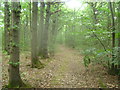
- Protected WoodlandPremium
- Crime RiskPremium