Area Overview for CT6 7GG
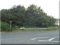
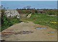
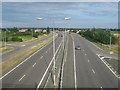
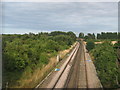
Photos of CT6 7GG


Area Information
Living in CT6 7GG means residing within a small residential cluster spanning just 2.7 hectares. This specific postcode covers a neighbourhood with a population of 1,822 people, creating an intimate community atmosphere. The area sits near the historic civil parish of Herne and Broomfield, which lies between Herne Bay to the north and Sturry to the south. This location offers easy access to Canterbury, situated approximately 9 kilometres away. The low population density of 729 people per square kilometre ensures spacious surroundings, yet the streets remain close enough for quick social interaction. You are positioned on a route that historically connected the coast at Reculver with Canterbury. Settlements here have grown significantly while retaining a connection to deeper history. Archaeological evidence from Neolithic to post-medieval periods shows layers of activity, from Iron Age settlements to medieval trades. You live in a zone where the modern and ancient overlap. St Martin's Church stands as a testament to local heritage, featuring an early Anglo-Saxon nave discovered during excavations. The presence of The Butchers Arms, a micropub established in 2005, adds a modern touch to the village character. For a homebuyer, CT6 7GG offers a strategic foothold near established villages without the density of larger urban centres. The area provides a quiet setting while remaining within practical reach of coastal towns and historic city districts.
- Area Type
- Postcode
- Area Size
- 2.7 hectares
- Population
- 1822
- Population Density
- 729 people/km²
The property market in CT6 7GG reflects a community where stability is the norm. With 83% of residents owning their homes, the area functions as a predominantly owner-occupied zone rather than a rental hub. The accommodation type is exclusively houses, meaning the housing stock consists of detached, semi-detached, or terrace properties rather than flats or maisonettes. You will not find purpose-built apartments within this postcode cluster. This high ownership percentage indicates that most transactions involve families moving between larger properties or retirees down-sizing within the existing stock. The area size of 2.7 hectares limits the volume of privately owned land available, yet the demand for homes remains steady. The population of 1,822 people resides across relatively few properties, ensuring each home commands individual attention from buyers. The rural character combined with proximity to Herne Bay and Sturry attracts those seeking a house with green space but without isolation. The lack of rental units suggests that investors looking for buy-to-let opportunities will find fewer entries compared to more urban districts. Instead, the market revolves around seller-motivated moves between homeowners. If you are looking to purchase a house in CT6 7GG, you are entering a market driven by primary residents rather than landlords. The high ownership rate also implies lower property turnover, meaning available homes may sit on the market longer, requiring patience or a prepared bid strategy.
House Prices in CT6 7GG
No properties found in this postcode.
Energy Efficiency in CT6 7GG
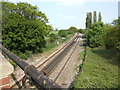
Your lifestyle in CT6 7GG benefits from proximity to essential amenities without requiring long journeys. Five retail outlets sit within easy reach, including Sainsburys Margate, Co-op Herne, and Tesco Herne. These supermarkets provide everything from fresh groceries to household goods, ensuring daily shopping is straightforward. You do not need to travel far for basic needs. Four railway stations also fall within practical distance, functioning as a lifeline for getting to larger towns or the seaside. Herne Bay Railway Station offers convenient access to coastal leisure, while Chestfield & Swalecliffe and Sturry stations provide routes to Canterbury and beyond. The character of the neighbourhood is enriched by local institutions like St Martin's Church, which anchors the historic fabric of the area. The original micropub, The Butchers Arms, opened in 2005 and adds a social focal point close to home. During Neolithic periods, the land supported settlements, and this history persists in the medieval street patterns you walk along today. With a population of 1,822 people spread across 2.7 hectares, the neighbourhood maintains a manageable scale. You live near the boundary between Herne and Sturry, allowing quick access to the wider Herne and Broomfield civil parish. This position means you can enjoy village life while remaining minutes away from the expanded community of over 8,000 people in the wider parish. The blend of history and modern convenience creates a practical yet interesting daily environment.
Amenities
Schools
| Rank | School | Type | Entry gender | Ages |
|---|
Explore more schools in this area
Go to Schools tabDemographics
The community in CT6 7GG is defined by a mature population profile. The median age sits at 47 years, placing the area squarely among adults between 30 and 64 years. This demographic dominates the neighbourhood, meaning you are likely to encounter residents currently in their peak earning years or approaching retirement. Home ownership stands at a high 83%, indicating that the vast majority of households have their own property. This stability suggests a settled population rather than a transient rental market. The predominant ethnic group is White, reflecting a fairly traditional settlement pattern typical of historic Kentish villages. Accommodation types are exclusively houses, which aligns with the owner-occupied statistics and the preference for family living. The absence of flats or high-rise blocks creates a uniform residential landscape where neighbours often know each other well. With 729 people living per square kilometre, you do not face the congestion associated with high-density housing. The combination of older residents and middle-aged adults fosters a community with established family roots. There is a focus on long-term residence rather than short-term letting. The demographic data paints a picture of a stable, rooted community where household structures are likely to persist across generations. This profile appeals to buyers seeking a neighbourhood with low turnover and strong local ties.
Household Size
Accommodation Type
Tenure
Ethnic Group
Religion
Household Composition
Age
Household Deprivation
NS-SEC
Explore more demographic insights in this area
Go to Demographics tabPlanning
Planning Constraints
- Flood RiskPremium
- Ramsar Wetland SitesPremium
- Area of Outstanding Natural BeautyPremium
- Protected Nature ReservePremium
- Protected WoodlandPremium
- Crime RiskPremium