Area Overview for CT6 7FY
Photos of CT6 7FY


Area Information
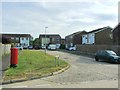
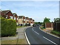
Greenhill Ward sits approximately 1.1 kilometres from the sea on the Kent coast, forming a distinct residential cluster within the Canterbury district. You will find the postal code CT6 7FY covers an area of 9910 square metres, accommodating a population of 2029 residents. The location falls within the Herne Bay and Sandwich parliamentary constituency, represented by Sir Roger Gale. Services for the ward are administered by Kent County Council and Canterbury City Council, with water utilities provided by South East Water and Southern Water. This specific postcode group operates as an urban area further from a major town or city centre, yet it remains integrated with the wider Greenhill Ward infrastructure. Life here is characterised by its proximity to coastal amenities while maintaining a structured, suburban environment. The area balances its distance from the immediate coastline with practical access to regional services and transport links. For those considering moving to this postcode, understanding its integration into the broader ward is essential. The location offers a settled environment with established governance and local authority support structures in place.
- Area Type
- Postcode
- Area Size
- 9910 m²
- Population
- 2029
- Population Density
- 346 people/km²
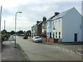
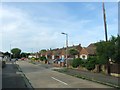
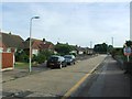
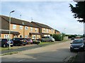
The housing stock in CT6 7FY is almost exclusively composed of houses. The data shows that 81% of homes in this postcode are owner-occupied, meaning the vast majority of residents buy and live in their properties. This contrasts significantly with rental-dominated markets found in city centres or student areas. Because the area consists of houses rather than flats or apartments, the proportions of bungalows, terraced homes, and detached properties are relevant to your search. This high ownership rate signals a long-term residential community where residents are likely to stay for many years. When viewing homes in CT6 7FY, you will be looking at a traditional owner-occupied market. This makes the area particularly suitable for buyers who intend to live in their property long term. The lack of significant rental stock means the local market reflects family and professional needs rather than short-term letting demand.
House Prices in CT6 7FY
No properties found in this postcode.
Energy Efficiency in CT6 7FY
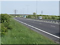
Daily life in CT6 7FY offers clear access to essential retail and transport hubs within practical reach. You will find five nearby retail outlets, including the Lidl in Herne Bay, the Co-op on Sea, and the Tesco in Herne Bay. These supermarkets provide for all your weekly shopping needs without requiring a long journey. For rail travel, five stations are within easy reaching distance. The Herne Bay Railway Station stands at a 0 km distance, making it the nearest point for train travel. Alternatively, the Chestfield and Swalecliffe station and the Whitstable station are further options. This layout means you can combine local shopping trips with convenient access to wider rail networks. The presence of multiple rail stations ensures flexibility in commuting. Whether you choose the immediate proximity of Herne Bay station or the other lines, you have robust options for travelling to Kent and beyond.
Amenities
Schools
| Rank | School | Type | Entry gender | Ages |
|---|
Explore more schools in this area
Go to Schools tabDemographics
The community within CT6 7FY is defined by a mature and established population. The median age is 47 years, and the most common age range consists of adults between 30 and 64 years. This profile suggests a neighbourhood dominated by working professionals and families in the prime adult life stage. Long-term stability is evident, with 81% of residents owning their homes. This high level of home ownership indicates a settled community where most people reside in houses rather than renting properties. The predominant ethnic group in the area is White. With a population density of 346 people per square kilometre, the area is neither overly sparse nor densely packed. You will find a residential environment where the majority of neighbours are homeowners. The age distribution and housing ownership rates create a quiet, stable atmosphere typical of areas that have been developed for several decades.
Household Size
Accommodation Type
Tenure
Ethnic Group
Religion
Household Composition
Age
Household Deprivation
NS-SEC
Explore more demographic insights in this area
Go to Demographics tabPlanning
Planning Constraints
- Flood RiskPremium
- Ramsar Wetland SitesPremium
- Area of Outstanding Natural BeautyPremium
- Protected Nature ReservePremium
- Protected WoodlandPremium