Area Overview for CT6 6TF
Photos of CT6 6TF

Area Information
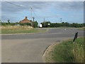
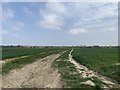
Living in CT6 6TF means residing in a small, tightly knit residential cluster within Reculver Ward, a coastal village in Kent’s north-eastern reaches. With a population of 2,659 and a density of 382 people per square kilometre, this area balances compact living with a distinct sense of place. Situated near the former Wantsum Channel, it retains historical echoes of Roman and medieval settlements, yet today it thrives as a quiet coastal resort. The village’s character is shaped by its proximity to Reculver Country Park, a protected landscape that supports rare flora and fauna. Daily life here is defined by a slower pace, with amenities like local shops and rail links offering practical connectivity. The area’s appeal lies in its blend of natural beauty, low crime rates, and a community rooted in home ownership, with 86% of residents living in their own homes. For those seeking a peaceful, historically rich environment with easy access to nature, CT6 6TF offers a compelling alternative to busier coastal towns.
- Area Type
- Postcode
- Area Size
- Not available
- Population
- 2659
- Population Density
- 382 people/km²
The property market in CT6 6TF is characterised by high home ownership (86%) and a predominance of houses over flats, suggesting a focus on owner-occupied, family-friendly housing. This small area’s limited size means the housing stock is likely concentrated within a narrow geographic range, with few new developments. The lack of rental properties implies a community prioritising stability and long-term investment. For buyers, this means competition for existing homes, though the area’s low crime risk and proximity to nature reserves may offset limited availability. The absence of commercial or industrial zones means properties are unlikely to be part of larger estates or business parks. Those considering CT6 6TF should view it as a niche market, ideal for those seeking a tranquil, historically rich environment with strong community ties.
House Prices in CT6 6TF
No properties found in this postcode.
Energy Efficiency in CT6 6TF
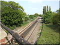
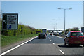
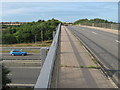
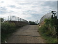
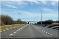
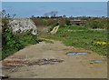
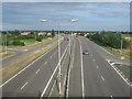
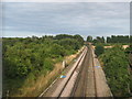
Life in CT6 6TF is enriched by a mix of natural and practical amenities. The Reculver Country Park, a 64-acre nature reserve, offers walking trails, wildlife observation, and scenic coastal views, making it a focal point for outdoor enthusiasts. Nearby, five retail outlets provide essentials, while rail stations like Herne Bay and Sturry offer easy access to larger towns. The village’s historical sites, such as the Roman fort and Reculver Towers, add cultural depth to daily life. With a low crime score and a focus on home ownership, the area fosters a relaxed, community-oriented lifestyle. The blend of natural beauty, accessible shopping, and transport links ensures a balanced existence, ideal for those who value both tranquillity and connectivity.
Amenities
Schools
The nearest school to CT6 6TF is Reculver Church of England Primary School, which serves the area with an outstanding Ofsted rating. This primary school is the only educational institution listed in the data, meaning families would need to look beyond the immediate vicinity for secondary education. The presence of a high-rated primary school is a significant advantage for those prioritising early education, though the lack of secondary schools nearby may require commuting. The school’s proximity to the village and its strong performance reflect the area’s commitment to education, particularly for younger children. Parents should consider the need for additional schooling options when planning long-term family needs.
| Rank | School | Type | Entry gender | Ages |
|---|---|---|---|---|
| 1 | Reculver Church of England Primary School | primary | N/A | N/A |
| 2 | Reculver Church of England Primary School | primary | N/A | N/A |
Explore more schools in this area
Go to Schools tabDemographics
The community in CT6 6TF is predominantly composed of adults aged 30 to 64, with a median age of 47. This suggests a mature, stable population, likely with established careers and family ties. Home ownership is exceptionally high at 86%, indicating a strong preference for long-term residency over renting. The area is largely composed of houses rather than flats, reflecting a residential profile suited to families and individuals seeking private, spacious living. The predominant ethnic group is White, aligning with broader demographic trends in rural Kent. While no specific data on deprivation is provided, the high home ownership and low crime score (75/100) imply a relatively affluent and secure environment. The absence of significant demographic diversity, however, may mean limited cultural or social variety compared to more urban areas.
Household Size
Accommodation Type
Tenure
Ethnic Group
Religion
Household Composition
Age
Household Deprivation
NS-SEC
Explore more demographic insights in this area
Go to Demographics tabPlanning
Planning Constraints
- Flood RiskPremium
- Ramsar Wetland SitesPremium
- Area of Outstanding Natural BeautyPremium
- Protected Nature ReservePremium
- Protected WoodlandPremium
- Crime RiskPremium