Area Overview for CT6 6EB
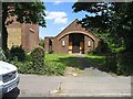
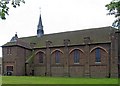
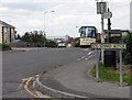
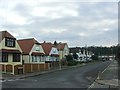
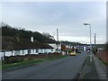
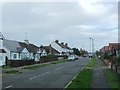
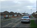
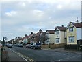
Photos of CT6 6EB
Area Information
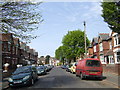
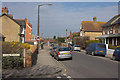
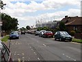
Living in CT6 6EB means inhabiting a small, tightly knit residential cluster within the easternmost part of Herne Bay, Kent. The area spans 9380 m² and is home to 1581 residents, creating a high population density of 168,542 people per km². This coastal suburb blends low-density housing with maritime heritage, perched on gently sloping cliffs overlooking the Thames Estuary and North Sea. Its history stretches back to the Domesday Book, with influences from Victorian seaside tourism and post-war development. Today, it features a mix of 1930s Arts & Crafts semis, 1960s bungalows, and post-war housing, offering a unique coastal lifestyle. Proximity to St Bartholomew’s Church (1908) and the Saxon Shore Way footpath adds to its character. The area’s low flood risk and absence of environmental constraints make it a practical choice for those seeking a quieter, community-focused life near coastal landscapes and practical transport links.
- Area Type
- Postcode
- Area Size
- 9380 m²
- Population
- Not available
- Population Density
- Not available
The property market in CT6 6EB is dominated by owner-occupied homes, with 79% of properties in private hands. The area’s accommodation type is primarily houses, suggesting a mix of detached and semi-detached properties. This contrasts with areas dominated by flats or rental stock, making CT6 6EB more suited to those seeking long-term, stable housing. The limited area size (9380 m²) means the housing stock is concentrated, with a blend of 1930s Arts & Crafts semis, 1960s bungalows, and post-war developments. Buyers should consider the small footprint of the area and its proximity to coastal landscapes, which may influence property values and availability. The lack of planning constraints also means new developments are unlikely to disrupt the existing character.
House Prices in CT6 6EB
No properties found in this postcode.
Energy Efficiency in CT6 6EB
Residents of CT6 6EB have access to essential amenities within walking or short driving distance. Retail options include Tesco Herne, Tesco Mortimer, and Iceland Herne, offering everyday shopping needs. The area’s proximity to the Saxon Shore Way footpath provides opportunities for coastal walks, while the nearby Thanet Coast SSSI adds ecological value to leisure activities. The low cliffs and maritime grasslands are home to skylarks, offering a peaceful natural setting. The presence of St Bartholomew’s Church and historical sites like WWII pillboxes adds cultural depth. The combination of practical retail, coastal access, and historical features creates a lifestyle that balances convenience with a connection to the region’s heritage and natural beauty.
Amenities
Schools
| Rank | School | Type | Entry gender | Ages |
|---|
Explore more schools in this area
Go to Schools tabDemographics
CT6 6EB has a median age of 47, with the elderly (65+ years) forming the most common age range. This suggests a community skewed toward mature residents, many of whom may be retired or semi-retired. Home ownership is high at 79%, indicating a stable, long-term resident base. The predominant accommodation type is houses, reflecting a traditional, low-density residential pattern. The area’s predominant ethnic group is White, though no specific diversity statistics are provided. With 79% of homes owner-occupied, the area likely has fewer rental properties, fostering a sense of permanence. The high population density, however, means living spaces are closely packed, which may influence local dynamics and access to shared amenities.
Household Size
Accommodation Type
Tenure
Ethnic Group
Religion
Household Composition
Age
Household Deprivation
NS-SEC
Explore more demographic insights in this area
Go to Demographics tabPlanning
Planning Constraints
- Flood RiskPremium
- Ramsar Wetland SitesPremium
- Area of Outstanding Natural BeautyPremium
- Protected Nature ReservePremium
- Protected WoodlandPremium
- Crime RiskPremium