Area Overview for CT6 5TE
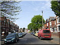
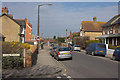
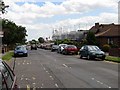
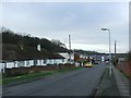
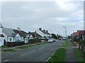
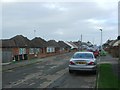
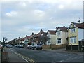
Photos of CT6 5TE
Area Information
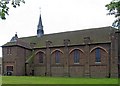
CT6 5TE occupies a specific residential cluster within the Herne Bay postcode district, covering 1.2 hectares. You will find a tight-knit community of 2,605 residents living in an area characterised by high population density of 2,031 people per square kilometre. This small ward represents a suburban settlement on the north Kent coast, part of the City of Canterbury local government district. The location includes the inpatient facilities of the Queen Victoria Memorial Hospital, which stands as a notable landmark defined by its 1930s architecture and subsequent refurbishments. Daily life here revolves around this established residential zone rather than a commercial hub or coastal tourist strip. Living in CT6 5TE means residing in a defined area where housing dominates the landscape alongside essential local infrastructure. The ward encompasses the space around the Queen Victoria Memorial Hospital at coordinates approximately 51.362132, 1.120921. You are looking at a functional residential environment situated within the broader seaside town of Herne Bay. The area provides a quiet backdrop for larger households, away from the immediate bustle of the seafront or industrial zones. Its size and population create a micro-community feel, making it a distinct enclave within the wider Canterbury district.
- Area Type
- Postcode
- Area Size
- 1.2 hectares
- Population
- 2605
- Population Density
- 2031 people/km²
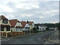
Homes in CT6 5TE form a traditional owner-occupied market defined by a strong preference for detached and semi-detached properties. You will find that 85% of residents own their homes, signifying a stable market where sellers are often motivated by life changes rather than quick profits. The area consists primarily of houses, meaning you will encounter a mix of single-storey and multi-storey family dwellings rather than apartment blocks. This landscape makes CT6 5TE less attractive to buyers seeking luxury flats but ideal for those requiring space and gardens. The prevalence of owner-occupiers creates a slower, more deliberate sales cycle. You are likely to deal with people who have lived in the property for many years, knowing the local quirks intimately. This contrasts with rental hotspots where landlords buy and sell frequently. The stock here reflects the needs of families and retirees who typically repurpose the main floor for living and store items in extensions or cellars. Buying here means entering a community where property values likely reflect long-term residency rather than speculative investment returns.
House Prices in CT6 5TE
No properties found in this postcode.
Energy Efficiency in CT6 5TE
Living in CT6 5TE offers straightforward access to essential amenities within a short drive or walk. Retail options are concentrated around three major supermarkets: Co-op Eddington, Tesco Herne, and Aldi Herne. These five retail outlets provide comprehensive daily shopping needs from fresh produce to household supplies. You do not need to travel far to stock your cupboards or pick up routine groceries. 交通运输 and leisure options extend beyond shopping to include five railway stations nearby. Herne Bay Railway Station serves as the primary hub, while Chestfield & Swalecliffe and Sturry stations offer further connectivity. This network allows you to commute into London or Kent towns efficiently. The area balances convenience with a lack of nightlife or high-end dining venues, fitting a family-oriented lifestyle. Visitors to the Co-op or Tesco in Herne will find full-service stores, reducing the need for online shopping deliveries. The layout prioritises utility over entertainment, making it a practical base for families and those who value time over impulse buys.
Amenities
Schools
Two educational institutions serve the community near CT6 5TE, both operating under the name Herne Bay High School. One functions as a primary school, catering to the earliest stages of compulsory education. The other operates as an academy and holds a 'good' Ofsted rating, indicating a standard of education that meets government expectations. This mix allows children in the area to access different educational philosophies depending on the specific intake age of the academy. Having an academy rated 'good' provides a solid baseline for academic performance without guaranteeing top-tier results across the board. The proximity of both primary and secondary provisions simplifies decisions for families moving into the Herne Bay area. You do not face long commutes to the nearest educational facilities, as the schools are integrated into the local ward. This configuration supports families who prioritise convenience alongside educational quality. The presence of an academy suggests adherence to specific network standards rather than local authority management, which can influence school culture and uniform policies.
| Rank | School | Type | Entry gender | Ages |
|---|---|---|---|---|
| 1 | Herne Bay High School | primary | N/A | N/A |
| 2 | Herne Bay High School | academy | N/A | N/A |
Explore more schools in this area
Go to Schools tabDemographics
The community in CT6 5TE reflects a mature population with a median age of 47 years. Adults aged between 30 and 64 years represent the most common age range in this neighbourhood. You are looking at a settled demographic where stability is prevalent, rather than a high-turnover area filled with students or young professionals. This older demographic profile influences local demand for larger properties and smaller school catchment areas. Home ownership stands at 85%, indicating that the vast majority of residents own their homes outright or with a significant mortgage. Houses form the predominant accommodation type, replacing flats as the primary housing solution. The population is predominantly White, mirroring the historic character of the Canterbury district. You will not find micro-dwellings or high-rise blocks here; the housing stock consists of established homes suited to long-term living. This high ownership rate suggests a community invested in the long-term health of the area. The absence of large rental blocks further confirms that this is a landlord-resident market rather than an investor-driven zone.
Household Size
Accommodation Type
Tenure
Ethnic Group
Religion
Household Composition
Age
Household Deprivation
NS-SEC
Explore more demographic insights in this area
Go to Demographics tabPlanning
Planning Constraints
- Flood RiskPremium
- Ramsar Wetland SitesPremium
- Area of Outstanding Natural BeautyPremium
- Protected Nature ReservePremium
- Protected WoodlandPremium
- Crime RiskPremium