Area Overview for CT6 5SF
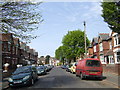
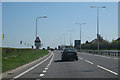
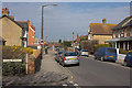
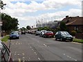
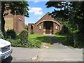
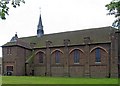
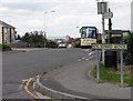
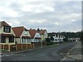
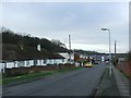
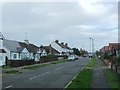
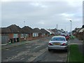
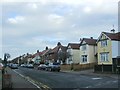
Photos of CT6 5SF
Area Information
CT6 5SF is a specific postcode covering a small residential cluster within Herne Bay, a seaside town on the north Kent coast. This area spans just 8,942 square metres, making it a concentrated living environment within the Heron Ward. The population stands at 1,422 residents, creating a defined community feel for those choosing to live in this part of Canterbury. You will find the area situated near the Queen Victoria Memorial Hospital, a 1930s building that underwent significant refurbishment and recently reopened. Daily life here revolves around a satellite neighbourhood structure where the hospital facilities define the immediate landscape. The location balances suburban quiet with the accessibility of the wider Herne Bay market. Prospective buyers should view CT6 5SF as a distinct pocket of residential housing rather than a sprawling district. The tight footprint ensures a sense of locality, yet access to the main town services remains practical. This specific postcode serves as a gateway to the coast, linking directly to the infrastructure that supports the wider region. Understanding the physical boundaries is key, as this cluster exists within a broader context of South East England housing.
- Area Type
- Postcode
- Area Size
- 8942 m²
- Population
- Not available
- Population Density
- Not available
The property market in CT6 5SF is characterised by a strong owner-occupier sector, where 64% of homes have been purchased outright or via mortgage by their current owners. This high ownership rate contrasts sharply with typical urban rental hubs, pointing to a market where stability and long-term tenure are priorities. The primary accommodation type consists of houses, which aligns with the preference for space and gardens found in the outer Kent coast. Living in CT6 5SF often means purchasing a home designed for family life or retirement, rather than high-density blocks common in city centres. This small residential cluster focuses on established housing stock rather than new build projects. Buyers looking at this area should expect a market where properties have remained in the same families for generations. The lack of rental pressure helps maintain property values and reduces the likelihood of sudden market shifts driven by investor sales. If you are a first-time buyer, the lower density might be attractive, though competition for specific houses could be fierce given the limited supply within this postcode. The market dynamics here favour those seeking a permanent home over a landlord.
House Prices in CT6 5SF
No properties found in this postcode.
Energy Efficiency in CT6 5SF
Everyday convenience in CT6 5SF is enhanced by a range of local amenities available within walking or driving distance. For shopping needs, you have access to Tesco Herne, Aldi Herne, and Morrisons Herne, providing a full choice of supermarkets for weekly groceries. The retail sector offers five key locations to support your daily provisions. Transport connectivity further enhances lifestyle options with five rail stations nearby. Herne Bay Railway Station, Chestfield & Swalecliffe Railway Station, and Whitstable Railway Station provide easy escapes for weekends or daily commutes. The area serves as a practical base for those who want local town services without the congestion of central transport hubs. Your daily life involves easy access to food at these major supermarkets and convenient rail links for travel. The presence of these specific venues defines the commercial reach of the postcode.
Amenities
Schools
Families considering CT6 5SF benefit from two key educational institutions located in the immediate vicinity. Herne Bay Infant School operates as a primary school offering education to younger children and holds a "good" Ofsted rating. Herne Bay Junior School also serves as a primary institution catering to older children and shares the same "good" Ofsted rating. The presence of these two entities ensures a continuous primary education pathway directly accessible to residents in this postcode. You can expect reliable educational standards without needing to commute far to alternative institutions. The combination of infant and junior provision simplifies school runs and allows parents to plan for their children's entire primary years from a single neighbourhood base. This arrangement is particularly practical for those living in this specific cluster where space is limited. The consistent "good" rating across both schools suggests a robust local education network.
| Rank | School | Type | Entry gender | Ages |
|---|---|---|---|---|
| 1 | Herne Bay Infant School | primary | N/A | N/A |
| 2 | Herne Bay Junior School | primary | N/A | N/A |
Explore more schools in this area
Go to Schools tabDemographics
The community in CT6 5SF reflects a mature population, with a median age of 47 years. Adults between 30 and 64 years represent the most common age range, suggesting a resident base seeking stable family environments or retirement planning. Sixty-four percent of households are owner-occupiers, indicating a high level of resident stability and investment in the local property market. Homes in this area predominantly take the form of detached or semi-detached structures, consistent with the accommodation type classification. While the predominant ethnic group is White, the area benefits from the diversity inherent in coastal Kent towns. You are living in an area where long-term tenure is the norm, which often correlates with lower turnover rates and established neighbourhood ties. The age profile suggests a quiet atmosphere rather than a transient hub. This demographic composition creates a settled environment where residents likely value privacy and proximity to medical and educational facilities. The dominance of owner-occupation means that development is usually driven by local needs rather than speculative rental strategies.
Household Size
Accommodation Type
Tenure
Ethnic Group
Religion
Household Composition
Age
Household Deprivation
NS-SEC
Explore more demographic insights in this area
Go to Demographics tabPlanning
Planning Constraints
- Flood RiskPremium
- Ramsar Wetland SitesPremium
- Area of Outstanding Natural BeautyPremium
- Protected Nature ReservePremium
- Protected WoodlandPremium
- Crime RiskPremium