Area Overview for CT6 5NQ
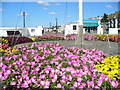
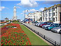
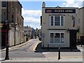
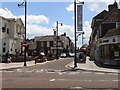
Photos of CT6 5NQ
Area Information
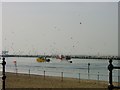
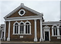
CT6 5NQ lies within the seaside town of Herne Bay, a small residential cluster on the north Kent coast. With a population of 1807, it is a compact area defined by its proximity to the Queen Victoria Memorial Hospital, a 1930s building recently refurbished and serving as a key local landmark. The area’s character is shaped by its suburban layout and limited size, making it a tight-knit community. Residents benefit from proximity to Herne Bay’s coastal charm, though the area itself is more residential than coastal. Daily life here is influenced by the presence of the hospital, which anchors the ward’s identity. The demographic profile suggests a mature population, with a median age of 47, and a focus on adults aged 30–64. This reflects a community that may be more established, with a mix of long-term residents and those drawn to the area’s quiet, low-rise living. The small footprint of CT6 5NQ means its immediate surroundings are limited, but nearby towns like Whitstable and Canterbury offer broader amenities.
- Area Type
- Postcode
- Area Size
- Not available
- Population
- Not available
- Population Density
- Not available
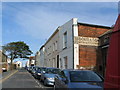
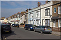
The property market in CT6 5NQ is characterised by a 42% home ownership rate, which is below the national average and suggests a rental-heavy market. The predominant accommodation type is flats, reflecting the area’s limited land availability and suburban layout. This means the housing stock is primarily composed of smaller, purpose-built units rather than detached or semi-detached homes. For buyers, this implies that CT6 5NQ is not a traditional owner-occupied area but one where rental demand may be more pronounced. The small size of the postcode area means that property options are limited to the immediate vicinity, with little scope for expansion into surrounding regions. Buyers seeking larger properties or family homes may need to look beyond CT6 5NQ, though the area’s proximity to larger towns like Herne Bay and Whitstable could offer alternative opportunities. The flat-dominated market may appeal to those prioritising convenience and lower maintenance costs over space.
House Prices in CT6 5NQ
No properties found in this postcode.
Energy Efficiency in CT6 5NQ
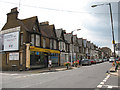
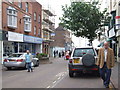
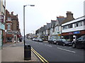
Residents of CT6 5NQ have access to a range of local amenities within practical reach. The retail sector includes Iceland Herne, Morrisons Herne, and Aldi Herne, offering everyday shopping needs. These stores provide convenience for residents who prefer to avoid longer trips to larger centres. The area’s rail connections, with stations at Herne Bay, Chestfield & Swalecliffe, and Whitstable, enhance mobility, allowing easy access to broader regional services. While the area is primarily residential, the presence of the Queen Victoria Memorial Hospital adds a healthcare dimension to daily life. The small size of CT6 5NQ means that its lifestyle is defined by proximity to essential services and the quiet, suburban character of the ward. For those who enjoy a balance between local convenience and nearby coastal towns, the area offers a practical base with easy access to larger amenities in Herne Bay and beyond.
Amenities
Schools
| Rank | School | Type | Entry gender | Ages |
|---|
Explore more schools in this area
Go to Schools tabDemographics
The population of CT6 5NQ is 1807, with a median age of 47, indicating a mature demographic. The majority of residents fall within the 30–64 age range, suggesting a community of working-age adults and older individuals. Home ownership here is relatively low at 42%, meaning a significant proportion of residents rent their homes. The predominant accommodation type is flats, which aligns with the area’s compact nature and limited space for larger properties. The dominant ethnic group is White, reflecting the broader demographic trends in the region. While specific data on deprivation is not provided, the lower home ownership rate and flat-dominated housing stock suggest a mix of rental-focused households and possibly younger or transient populations. The area’s small size and defined boundaries mean its social dynamics are closely tied to local institutions like the Queen Victoria Memorial Hospital, which likely plays a central role in community life.
Household Size
Accommodation Type
Tenure
Ethnic Group
Religion
Household Composition
Age
Household Deprivation
NS-SEC
Explore more demographic insights in this area
Go to Demographics tabPlanning
Planning Constraints
- Flood RiskPremium
- Ramsar Wetland SitesPremium
- Area of Outstanding Natural BeautyPremium
- Protected Nature ReservePremium
- Protected WoodlandPremium
- Crime RiskPremium