Area Overview for CT6 5NJ
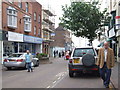
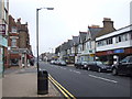
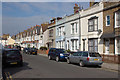
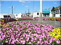
Photos of CT6 5NJ

Area Information
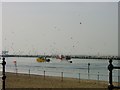
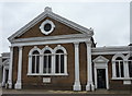
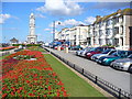
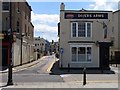
CT6 5NJ is a small residential postcode area nestled in the seaside town of Herne Bay, on the north Kent coast. With a population of 1,807, it is a compact cluster of homes primarily serving the local community. The area is closely linked to the Queen Victoria Memorial Hospital, a 1930s building that has been refurbished and remains a focal point for healthcare in the region. Its proximity to the hospital and the surrounding suburban layout define daily life here, offering a mix of quiet residential living and access to essential services. The postcode falls within the City of Canterbury local government district, placing it in a region with historical significance and coastal appeal. Residents benefit from being near the coast, though the area itself is more suburban than seaside. The small size of CT6 5NJ means it is tightly integrated with nearby neighbourhoods, creating a cohesive local environment. For those considering living here, the area’s blend of practicality and proximity to key facilities makes it a viable option for those prioritising accessibility over expansive landscapes.
- Area Type
- Postcode
- Area Size
- Not available
- Population
- Not available
- Population Density
- Not available
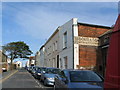
The property market in CT6 5NJ is characterised by a high proportion of rental properties, with only 42% of homes owned by residents. This suggests a market skewed towards tenants rather than owner-occupiers. The accommodation type is predominantly flats, reflecting the area’s small scale and suburban layout. For buyers, this means the housing stock is limited to smaller, often purpose-built units rather than detached or semi-detached homes. The small size of the postcode area means the immediate surroundings offer few alternatives, making property choices more constrained. However, the presence of nearby railway stations and retail amenities may offset the lack of variety by providing connectivity to broader regions. Potential buyers should consider the rental market dynamics and the need for proximity to services like healthcare, which are central to the area’s appeal.
House Prices in CT6 5NJ
No properties found in this postcode.
Energy Efficiency in CT6 5NJ
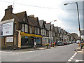
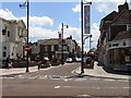
Living in CT6 5NJ offers access to essential retail and transport hubs within practical reach. The area is served by five retail outlets, including Morrisons Herne, Iceland Herne, and Aldi Herne, providing convenience for daily shopping. Nearby railway stations—Herne Bay, Chestfield & Swalecliffe, and Whitstable—connect residents to broader networks, facilitating travel to coastal towns, cultural centres, and employment hubs. While the area lacks detailed information on parks or leisure facilities, its proximity to Herne Bay’s seaside location suggests opportunities for outdoor activities. The presence of the Queen Victoria Memorial Hospital adds to the area’s practicality, ensuring healthcare is readily accessible. The combination of retail options, transport links, and healthcare services creates a functional lifestyle, though the small scale of the postcode means amenities are concentrated rather than spread out.
Amenities
Schools
| Rank | School | Type | Entry gender | Ages |
|---|
Explore more schools in this area
Go to Schools tabDemographics
The population of CT6 5NJ is predominantly adults aged 30–64, with a median age of 47. This suggests a community of established professionals and families, reflecting a mature demographic profile. Home ownership in the area is relatively low at 42%, indicating that a significant portion of residents are likely to be renting. The accommodation type is primarily flats, which aligns with the area’s compact residential character. The predominant ethnic group is White, though specific data on diversity is not provided. The age range and home ownership statistics imply a mix of long-term residents and those in transitional housing situations. The absence of detailed deprivation data means it is unclear how economic factors might influence quality of life, but the presence of essential amenities and proximity to services like the Queen Victoria Memorial Hospital suggest basic needs are met.
Household Size
Accommodation Type
Tenure
Ethnic Group
Religion
Household Composition
Age
Household Deprivation
NS-SEC
Explore more demographic insights in this area
Go to Demographics tabPlanning
Planning Constraints
- Flood RiskPremium
- Ramsar Wetland SitesPremium
- Area of Outstanding Natural BeautyPremium
- Protected Nature ReservePremium
- Protected WoodlandPremium
- Crime RiskPremium