Area Overview for CT6 5EP
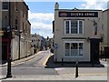
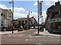
Photos of CT6 5EP


Area Information
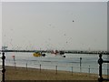
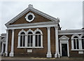
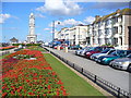
CT6 5EP represents a specific residential cluster within the wider Herne Bay wards on the north Kent coast. This postcode area holds a population of 1,807 people, forming a compact community focused on suburban living. The location sits within the Herne Bay area of South East England, falling under the City of Canterbury local government district. Residents here navigate a neighbourhood defined by its role as a housing zone rather than a commercial hub. The area surrounds the Heron Ward, a specific electoral district that once housed the inpatient facilities of the Queen Victoria Memorial Hospital. Although the hospital building itself is not part of the CT6 5EP postcode, the proximity to this significant 1930s structure provides historical context to the local landscape. Life in this small area feels intimate because the population is limited and the footprint is concentrated. You will notice the influence of the wider seaside town, with access to the coast remaining a key feature of daily life for those calling this area home. The setting offers a quiet residential experience situated away from the busiest parts of Herne Bay but connected to it by rail and road. Understanding this specific postcode means recognising it as a slice of the broader Herne Bay community rather than a standalone settlement.
- Area Type
- Postcode
- Area Size
- Not available
- Population
- Not available
- Population Density
- Not available
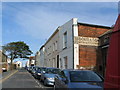
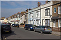
Homes in CT6 5EP are defined by a predominance of flats, a fact shaped directly by the local planning and land value. The market operates with a relatively low homeownership rate of 42%, which contrasts with many other parts of Kent where terraced or semi-detached houses dominate. This statistic indicates that the majority of the 1,807 residents in this postcode live in rented properties or shared homes. The housing stock is therefore likely small-scale and vertically oriented rather than sprawling. You will find that buying a standalone house here may be difficult because the prevailing structure is flat-based accommodation. This configuration appeals specifically to professional tenants or those who do not wish to own their primary residence. The limited size of the residential cluster reinforces this dynamic, as there is simply little room for large detached developments. Prospective buyers looking for semi-detached homes in the immediate vicinity of CT6 5EP will need to expand their search to neighbouring postcodes that accommodate different property types. The area functions as a functional part of Herne Bay where the property market prioritises density and rental yield over private ownership of large dwellings.
House Prices in CT6 5EP
No properties found in this postcode.
Energy Efficiency in CT6 5EP
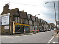
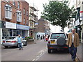
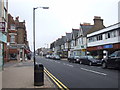
Living in CT6 5EP offers convenient access to major retail and transport hubs located within practical reach. You can shop at Iceland Herne, Tesco Mortimer, and Morrisons Herne without needing a car, as these three large supermarkets serve the immediate needs of the 1,807 residents. Retail options are well represented by these specific chains, ensuring you have no trouble finding groceries or household essentials. For commuting, four railway stations lie nearby, including Herne Bay Railway Station, Chestfield and Swalecliffe Railway Station, and Whitstable Railway Station. These stations provide a direct rail link to urban centres, making daily travel manageable for professionals. The area research highlights that this postcode sits within Heron Ward, a zone known for its proximity to the Queen Victoria Memorial Hospital. This medical landmark adds a community function to the local geography. While the area itself focuses on housing, its proximity to the hospital and the main station ensures that services are just a short walk or train ride away. You benefit from a lifestyle where daily amenities and transport are integrated into a compact environment.
Amenities
Schools
| Rank | School | Type | Entry gender | Ages |
|---|
Explore more schools in this area
Go to Schools tabDemographics
The community in CT6 5EP reflects a mature demographic profile with a median age of 47 years. The majority of residents fall within the 30 to 64 age range, indicating a settlement dominated by adults rather than families with young children or retirees over 65. Only 42% of households in this area own their homes, meaning rental properties make up the significant majority of tenancies. This low ownership rate suggests that many people are renting within this small cluster. The predominant ethnic group in the area is White, mirroring the broader patterns seen in the region. Flats constitute the primary accommodation type, aligning with the density expected in a concentrated residential zone. With a population of 1,807, the area maintains a stable size that does not fluctuate wildly. The high proportion of renters points to a market where flexibility is common. You might find a mix of professionals and older adults seeking flexibility rather than outright ownership. The age skew towards adults creates a relatively calm environment where daily life is not disrupted by the younger demographic. Understanding these numbers helps you see the area not as a family haven but as a home for established adults living in flats.
Household Size
Accommodation Type
Tenure
Ethnic Group
Religion
Household Composition
Age
Household Deprivation
NS-SEC
Explore more demographic insights in this area
Go to Demographics tabPlanning
Planning Constraints
- Flood RiskPremium
- Ramsar Wetland SitesPremium
- Area of Outstanding Natural BeautyPremium
- Protected Nature ReservePremium
- Protected WoodlandPremium
- Crime RiskPremium