Area Overview for CT6 5BZ
Photos of CT6 5BZ


Area Information
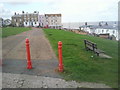
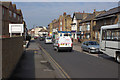
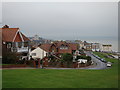
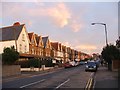
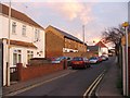
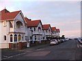
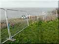
Living in CT6 5BZ means being part of a small, residential cluster in Herne Bay, a seaside town on the north Kent coast. This area, part of the City of Canterbury local government district, is defined by its suburban character and proximity to the Queen Victoria Memorial Hospital, a 1930s building that has been refurbished. With a population of 1,422, CT6 5BZ is a tight-knit community where daily life revolves around local amenities and coastal proximity. The area’s compact size means residents can access nearby attractions, such as Herne Bay’s beaches, within minutes. While not a bustling urban hub, CT6 5BZ offers a quiet, stable environment with a focus on residential living. The presence of the hospital’s inpatient facilities adds to the area’s distinct identity, blending healthcare infrastructure with suburban comfort. For those seeking a low-key, family-oriented environment with easy access to coastal amenities, CT6 5BZ provides a straightforward, practical lifestyle.
- Area Type
- Postcode
- Area Size
- Not available
- Population
- Not available
- Population Density
- Not available
CT6 5BZ is primarily an owner-occupied area, with 64% of homes owned by residents rather than rented. The accommodation type is predominantly houses, which is typical for a suburban setting. This suggests a housing stock that is largely family-focused, with properties designed for long-term occupancy rather than short-term rental. The small size of the area means the housing market is limited, but the presence of houses indicates a potential for character homes with garden spaces. For buyers, this means a focus on established properties rather than new developments. The lack of rental data implies that the market is not heavily driven by tenants, which could affect property values and availability. Those considering CT6 5BZ should expect a niche market where properties are likely to be well-maintained and suited to settled households.
House Prices in CT6 5BZ
No properties found in this postcode.
Energy Efficiency in CT6 5BZ
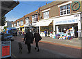
CT6 5BZ offers a range of practical amenities within easy reach. Retail options include Tesco Mortimer, Iceland Herne, and Tesco Herne, providing everyday shopping needs. The area’s rail stations, such as Herne Bay and Whitstable, connect residents to broader networks, enabling travel to nearby towns and cities. While the data does not specify parks or leisure facilities, the proximity to Herne Bay’s coastal environment suggests opportunities for outdoor activities. The presence of multiple retail outlets and transport links contributes to a convenient lifestyle, where daily essentials and commuting are efficiently managed. The compact nature of CT6 5BZ means residents can access these amenities without long journeys, supporting a balanced approach to work, leisure, and family life.
Amenities
Schools
Residents of CT6 5BZ have access to two primary schools: Herne Bay Infant School and Herne Bay Junior School. Both institutions hold an Ofsted rating of “good,” reflecting their effectiveness in delivering education. The presence of both infant and junior schools within the area provides a seamless transition for families with children starting primary education. This mix of school types ensures that parents do not need to travel far for their children’s schooling, which is a key consideration for families. The “good” ratings indicate that the schools meet national standards, though no data on secondary education or specialist provision is available. For those prioritising quality schooling, the proximity of these two primary schools is a practical advantage.
| Rank | School | Type | Entry gender | Ages |
|---|---|---|---|---|
| 1 | Herne Bay Infant School | primary | N/A | N/A |
| 2 | Herne Bay Junior School | primary | N/A | N/A |
Explore more schools in this area
Go to Schools tabDemographics
The population of CT6 5BZ has a median age of 47, with the most common age range being adults aged 30–64. This suggests a community that is largely middle-aged, with a focus on established households rather than younger families or retirees. Home ownership stands at 64%, indicating a stable, long-term resident base. The predominant accommodation type is houses, which aligns with the area’s suburban character. The predominant ethnic group is White, reflecting the broader demographic patterns of the region. While no specific data on deprivation is provided, the high home ownership rate and age profile suggest a relatively stable economic environment. The absence of detailed diversity metrics means the community’s social composition remains largely unexplored in the data, but the figures highlight a settled, mature demographic.
Household Size
Accommodation Type
Tenure
Ethnic Group
Religion
Household Composition
Age
Household Deprivation
NS-SEC
Explore more demographic insights in this area
Go to Demographics tabPlanning
Planning Constraints
- Flood RiskPremium
- Ramsar Wetland SitesPremium
- Area of Outstanding Natural BeautyPremium
- Protected Nature ReservePremium
- Protected WoodlandPremium
- Crime RiskPremium