Area Overview for CT6 5AL
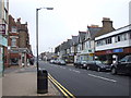
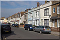
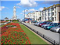
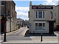
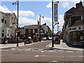
Photos of CT6 5AL


Area Information
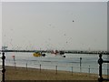
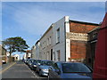
CT6 5AL is a small residential postcode in the seaside town of Herne Bay, Kent, part of the City of Canterbury district. With a population of just 1,807, it is a compact area defined by its proximity to the Queen Victoria Memorial Hospital, a 1930s building that serves as a focal point for local healthcare. The area’s character is shaped by its suburban layout and proximity to coastal amenities, though it lacks the dense urban infrastructure of larger towns. Daily life here is influenced by its position on the north Kent coast, offering a mix of quiet residential living and access to nearby towns like Whitstable and Canterbury. The postcode’s small size means it is tightly integrated with surrounding areas, with residents often relying on nearby rail stations and retail hubs for convenience. While the area is not a tourist hotspot, its connection to healthcare facilities and transport links makes it a practical choice for those prioritising accessibility over coastal views. The demographic profile—primarily adults aged 30–64—suggests a mature, stable community, though the 42% home ownership rate indicates a significant rental market.
- Area Type
- Postcode
- Area Size
- Not available
- Population
- Not available
- Population Density
- Not available
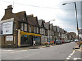
The property market in CT6 5AL is characterised by a high proportion of flats, with 42% of residents owning their homes. This suggests a rental-heavy market, where flats are the primary housing stock. The small size of the postcode means property options are limited, and buyers must consider proximity to nearby amenities like the Queen Victoria Memorial Hospital and rail stations. The flat-dominated landscape may appeal to those seeking low-maintenance living, but it also limits opportunities for larger family homes. Given the area’s integration with surrounding towns, property buyers might look beyond CT6 5AL to nearby postcode areas for more varied housing options. The 42% home ownership rate indicates a mix of long-term residents and renters, with potential for investment in rental properties. However, the lack of detailed data on property prices or recent developments means buyers should conduct local inspections to assess market conditions.
House Prices in CT6 5AL
No properties found in this postcode.
Energy Efficiency in CT6 5AL
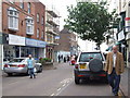
Residents of CT6 5AL have access to a range of retail and transport amenities within practical reach. Nearby shops include Iceland Herne, Tesco Mortimer, and Morrisons Herne, providing essential grocery and convenience services. These stores cater to daily needs, reducing the necessity for long commutes to larger towns. The area’s rail network, with stations like Herne Bay and Whitstable, offers direct links to cultural and employment hubs, enhancing lifestyle flexibility. While the postcode itself is small, its integration with surrounding areas ensures residents can access broader leisure opportunities, from coastal walks to historic sites in Canterbury. The presence of the Queen Victoria Memorial Hospital also adds a layer of local significance, though the area’s character is defined by its quiet residential nature. For those prioritising convenience over sprawling amenities, CT6 5AL offers a compact, serviceable environment with minimal need to venture far for essentials.
Amenities
Schools
| Rank | School | Type | Entry gender | Ages |
|---|
Explore more schools in this area
Go to Schools tabDemographics
The population of CT6 5AL is 1,807, with a median age of 47, reflecting a community dominated by middle-aged adults (30–64 years). This age range suggests a settled population, likely with established careers and family ties. Home ownership is relatively low at 42%, indicating that nearly 60% of residents are likely to rent, which may influence the local property market’s dynamics. The predominant accommodation type is flats, a common feature in smaller residential clusters with limited land availability. The predominant ethnic group is White, though no specific data on diversity or deprivation levels is provided. This demographic profile implies a community focused on practical living, with fewer young families or students compared to other areas. The absence of detailed diversity statistics means the area’s social composition remains largely unexplored in public records, but the age and ownership data suggest a balance between long-term residents and transient renters.
Household Size
Accommodation Type
Tenure
Ethnic Group
Religion
Household Composition
Age
Household Deprivation
NS-SEC
Explore more demographic insights in this area
Go to Demographics tabPlanning
Planning Constraints
- Flood RiskPremium
- Ramsar Wetland SitesPremium
- Area of Outstanding Natural BeautyPremium
- Protected Nature ReservePremium
- Protected WoodlandPremium
- Crime RiskPremium