Area Overview for CT5 3TR
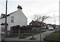
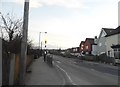
Photos of CT5 3TR


Area Information
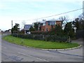
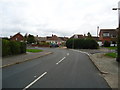
Living in CT5 3TR means inhabiting a small, tightly knit residential cluster in the Canterbury district of Kent, England. This postcode area, part of the unparished Whitstable, spans 4,117 square metres and is home to 1,457 residents, translating to a high population density of 1,454 people per square kilometre. The area’s history as a salt-producing village from the Iron Age and its medieval ties to the Archbishop of Canterbury add a layer of heritage to daily life. Today, CT5 3TR is a quiet, mature community with a median age of 47, where most residents own their homes. Its proximity to the North Sea and the Isle of Sheppey offers a coastal backdrop, while nearby railway stations like Whitstable and Herne Bay provide links to larger towns. The area’s compact size means amenities are within practical reach, and its integration into Whitstable ensures access to broader services. For those seeking a blend of history, convenience, and a low-density residential feel, CT5 3TR offers a distinct alternative to busier urban centres.
- Area Type
- Postcode
- Area Size
- 4117 m²
- Population
- 1457
- Population Density
- 1454 people/km²
The property market in CT5 3TR is dominated by owner-occupied homes, with 87% of properties owned by residents rather than rented. The accommodation type is exclusively houses, reflecting the area’s small, residential nature. This suggests a limited housing stock, as the postcode covers only a compact cluster of properties. The high home ownership rate indicates a community with long-term residents, which can stabilise property values but may also reduce availability for new buyers. Given the area’s integration into Whitstable, buyers should consider nearby areas for more extensive housing options. The predominance of houses over flats or apartments means properties are likely larger and more traditional, appealing to those prioritising space and privacy. However, the small size of CT5 3TR means the market is niche, requiring careful consideration of proximity to amenities and transport links.
House Prices in CT5 3TR
No properties found in this postcode.
Energy Efficiency in CT5 3TR
Residents of CT5 3TR have access to a range of local amenities within practical reach. Retail options include Aldi Seasalter, M&S Estuary, and The Southern Co-operative Co, offering everyday shopping needs. The area’s railway stations provide links to nearby towns, while its coastal location connects to the North Sea and the Isle of Sheppey. Historically, the area was renowned for oyster beds and maritime activity, a legacy reflected in local landmarks such as St Alphege Church, a Grade II listed building with a 12th-century chancel. The exposed wreck of the Old Brig, a 18th-century merchant ship, adds to the area’s historical intrigue. These features contribute to a lifestyle blending practicality with heritage, where daily life is shaped by proximity to both modern conveniences and historical sites. The compact nature of the area means amenities are closely clustered, fostering a sense of community.
Amenities
Schools
| Rank | School | Type | Entry gender | Ages |
|---|
Explore more schools in this area
Go to Schools tabDemographics
CT5 3TR’s population of 1,457 is predominantly composed of adults aged 30–64, reflecting a mature demographic with a median age of 47. Home ownership is exceptionally high at 87%, indicating a community of long-term residents rather than transient renters. The accommodation type is largely houses, which aligns with the area’s small, residential character. The predominant ethnic group is White, with no specific data on other demographics provided. This profile suggests a stable, established population with strong ties to the local area. The high home ownership rate implies lower rental demand and a focus on owner-occupied properties, which may influence property values and market dynamics. The age range of residents also suggests a community with a mix of working-age individuals and retirees, potentially shaping local services and amenities.
Household Size
Accommodation Type
Tenure
Ethnic Group
Religion
Household Composition
Age
Household Deprivation
NS-SEC
Explore more demographic insights in this area
Go to Demographics tabPlanning
Planning Constraints
- Flood RiskLocked
- Ramsar Wetland SitesLocked
- Area of Outstanding Natural BeautyLocked
- Protected Nature ReserveLocked
- Protected WoodlandLocked
- Crime RiskLocked