Area Overview for CT5 1GQ
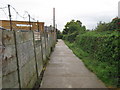
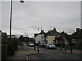
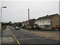
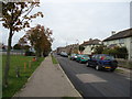
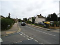
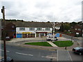
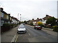
Photos of CT5 1GQ


Area Information
Living in CT5 1GQ, a small residential cluster in Whitstable, Kent, offers a quiet, tightly knit community within easy reach of coastal and historic sites. The area is part of the Gorrell electoral ward, which includes sub-areas like the Harbour (northern coastal section) and Lower Gorrell (south of the railway line). With a population of 1,226, it is a compact postcode where daily life is shaped by proximity to Whitstable’s town centre and the historic Canterbury and Whitstable Railway, known locally as the Crab and Winkle line. The area’s character is defined by its mix of traditional housing and proximity to rail links, making it appealing to those seeking a balance between rural tranquillity and accessible urban amenities. Residents benefit from being near Whitstable’s amenities while retaining the charm of a smaller, less densely populated environment. The area’s small size means it is well-suited for those prioritising community cohesion and a slower pace of life, with local landmarks and transport routes playing a central role in daily routines.
- Area Type
- Postcode
- Area Size
- Not available
- Population
- Not available
- Population Density
- Not available
The property market in CT5 1GQ is dominated by owner-occupied homes, with 74% of properties owned by their residents. This high home ownership rate suggests a community where long-term residency is common, and the housing stock is largely composed of houses rather than flats or apartments. The absence of rental properties indicates limited availability for renters, which may make the area more attractive to buyers seeking a permanent home rather than temporary accommodation. The prevalence of houses also points to a market that caters to families and those prioritising space and privacy. For prospective buyers, this means a focus on purchasing rather than renting, with properties likely to be in demand for their stability and alignment with local lifestyle preferences. The small size of the area means that the immediate surroundings may offer similar housing options, though the limited data does not specify price ranges or property types beyond the general category of houses.
House Prices in CT5 1GQ
No properties found in this postcode.
Energy Efficiency in CT5 1GQ
Residents of CT5 1GQ enjoy access to a range of local amenities, including five retail outlets such as The Southern Co-operative Co, Co-op Whitstable, and Sainsburys Whitstable. These shops provide convenience for daily needs, from groceries to household supplies. The proximity to three railway stations—Whitstable, Chestfield & Swalecliffe, and Herne Bay—ensures easy access to broader regional networks, supporting both commuting and leisure travel. While the area does not list specific parks or leisure facilities in the data, the presence of multiple retail and transport options suggests a lifestyle that prioritises practicality and connectivity. The combination of local shopping and rail access creates a convenient environment for residents, allowing them to manage daily tasks efficiently while maintaining links to nearby towns and cities.
Amenities
Schools
Residents of CT5 1GQ have access to a range of educational institutions, including the outstanding-rated Whitstable and Seasalter Endowed Church of England Junior School, which serves primary-age children. For independent education, the Isp Whitstable offers a private option, while the special needs-focused ISP School Whitstable provides tailored support for students with specific requirements. This mix of school types ensures families can choose between state, private, and specialist education, catering to diverse needs. The presence of an Ofsted-outstanding primary school is a strong draw for families prioritising academic quality, while the independent school offers flexibility for those seeking alternative curricula. The special school’s inclusion highlights the area’s commitment to inclusive education, ensuring all children have access to appropriate learning environments. Together, these institutions provide a comprehensive educational landscape for residents.
| Rank | School | Type | Entry gender | Ages |
|---|---|---|---|---|
| 1 | Whitstable and Seasalter Endowed Church of England Junior School | primary | N/A | N/A |
| 2 | Isp Whitstable | independent | N/A | N/A |
| 3 | ISP School Whitstable | special | N/A | N/A |
Explore more schools in this area
Go to Schools tabDemographics
The demographic profile of CT5 1GQ reflects a mature, stable community. The median age is 47, with the majority of residents falling within the 30-64 age range. This suggests a population largely composed of working-age adults and families, though with a notable absence of younger or older demographics. Home ownership is high, at 74%, indicating a strong presence of long-term residents and a focus on property as an investment. The predominant accommodation type is houses, which aligns with the area’s residential character and suggests a preference for family homes over flats. The predominant ethnic group is White, though no specific data on diversity or deprivation is provided. The absence of significant rental properties or younger households may imply a community that values stability and established living arrangements over transient or high-turnover housing.
Household Size
Accommodation Type
Tenure
Ethnic Group
Religion
Household Composition
Age
Household Deprivation
NS-SEC
Explore more demographic insights in this area
Go to Demographics tabPlanning
Planning Constraints
- Flood RiskPremium
- Ramsar Wetland SitesPremium
- Area of Outstanding Natural BeautyPremium
- Protected Nature ReservePremium
- Protected WoodlandPremium