Area Overview for CT5 1BH
Photos of CT5 1BH
Area Information
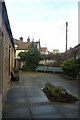
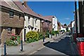
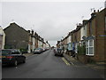
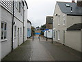
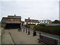
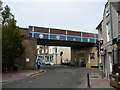
CT5 1BH is a small residential cluster in Whitstable, Kent, with a population of just over 1,200 people. Situated within the Gorrell electoral ward, the area includes sub-areas like ‘Harbour’ and ‘Lower Gorrell’, reflecting its coastal and historic character. This postcode lies along the historic Canterbury and Whitstable Railway, known as the Crab and Winkle line, which divides the northern and southern sections of the ward. Living here means proximity to Whitstable’s town centre, with a mix of residential and commercial spaces. The area’s compact size fosters a tight-knit community, though it remains part of a larger town with access to broader amenities. Its location offers a balance between suburban tranquillity and the convenience of nearby towns like Canterbury and Herne Bay. With a population skewed toward adults aged 30–64, the area likely supports families and professionals seeking a settled lifestyle. The absence of major environmental constraints, such as protected woodlands or wetlands, means development is not restricted, though the small population suggests a low-density, community-focused environment.
- Area Type
- Postcode
- Area Size
- Not available
- Population
- Not available
- Population Density
- Not available
CT5 1BH is primarily a homeownership area, with 54% of properties owned by residents. The accommodation type is predominantly houses, which is typical for smaller, residential postcodes in rural or semi-rural settings. This suggests a community of established homeowners rather than a rental market. The small population and limited housing stock indicate a niche market, where properties may be more sought after by families or retirees looking for a quieter lifestyle. Given the area’s proximity to Whitstable’s town centre and rail links, it could appeal to commuters or those seeking a base near coastal or historic sites. Buyers should consider the limited scale of the area, as property options may be constrained. The focus on houses also implies a preference for larger, more private living spaces, which may be less common in urban settings.
House Prices in CT5 1BH
No properties found in this postcode.
Energy Efficiency in CT5 1BH
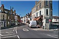
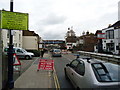
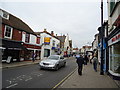
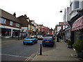
Residents of CT5 1BH have access to a range of nearby amenities, including five retail outlets such as Iceland Whitstable, Sainsburys Whitstable, and The Southern Co-operative. These shops provide convenience for daily needs, from groceries to household items. The area’s proximity to rail stations also opens up access to broader leisure and cultural opportunities in Whitstable and Canterbury. While the postcode itself is small, the surrounding town offers parks, dining options, and community events. The mix of local shops and rail connectivity suggests a lifestyle that balances self-sufficiency with the ability to engage with larger urban amenities. The area’s character is likely defined by its compactness, where everyday essentials are within walking or short driving distance, and public transport links support a wider social and professional network.
Amenities
Schools
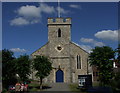
Residents of CT5 1BH have access to two primary schools within practical reach: Whitstable Junior School and St Alphege Church of England Infant School. Both institutions hold an Ofsted rating of ‘good’, indicating a satisfactory standard of education. The presence of two primary schools provides families with options, though the absence of secondary schools nearby means students may need to travel to Whitstable or Canterbury for further education. The mix of a state school and a Church of England school reflects the area’s varied educational offerings. For parents prioritising early education, these schools offer a foundation with established reputations. However, the lack of higher-tier schools within the postcode itself may influence decisions about long-term residency or school planning for older children.
| Rank | School | Type | Entry gender | Ages |
|---|---|---|---|---|
| 1 | Whitstable Junior School | primary | N/A | N/A |
| 2 | St Alphege Church of England Infant School | primary | N/A | N/A |
Explore more schools in this area
Go to Schools tabDemographics
The median age in CT5 1BH is 47, with the majority of residents falling into the 30–64 age range. This suggests a mature, established community, likely comprising professionals, families, and retirees. Home ownership stands at 54%, indicating a mix of owner-occupied properties and rental units. The predominant accommodation type is houses, which aligns with the area’s residential character. The population is predominantly White, reflecting broader demographic trends in the region. While no specific data on deprivation is provided, the age profile and home ownership rate imply a stable, middle-income demographic. The absence of significant ethnic diversity data means the community is likely homogenous, though this does not necessarily reflect a lack of inclusivity. The age range suggests a balance between active professionals and older residents, which may influence local services and amenities.
Household Size
Accommodation Type
Tenure
Ethnic Group
Religion
Household Composition
Age
Household Deprivation
NS-SEC
Explore more demographic insights in this area
Go to Demographics tabPlanning
Planning Constraints
- Flood RiskPremium
- Ramsar Wetland SitesPremium
- Area of Outstanding Natural BeautyPremium
- Protected Nature ReservePremium
- Protected WoodlandPremium
- Crime RiskPremium