Area Overview for CT4 7PP
Photos of CT4 7PP
Area Information
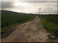
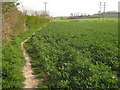
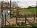
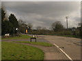
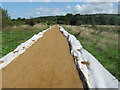
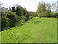
CT4 7PP is a small residential cluster in the Canterbury district of Kent, England, encompassing parts of Chartham, a village 4 km south-west of Canterbury city centre. The area spans 14.1 hectares, with a population of 2,112 people, translating to a density of 161 people per square kilometre. This is a rural and semi-rural community, with much of the surrounding land designated as part of the Kent Downs Area of Outstanding Natural Beauty. Chartham itself is a historic parish with a mix of early manor houses, Tudor buildings, and modern developments, including the St Augustine’s housing estate. Daily life here balances proximity to Canterbury’s amenities with a strong rural character, offering access to arable farms, orchards, and a 3-mile cycle path linking to the city. The village green, Church of St Mary, and nearby rail stations underscore its blend of heritage and practicality. Living here means navigating a small, tight-knit community with a focus on countryside living, though the A28 road and rail links provide connections to larger urban centres.
- Area Type
- Postcode
- Area Size
- 14.1 hectares
- Population
- 2112
- Population Density
- 161 people/km²
The property market in CT4 7PP is dominated by owner-occupied homes, with 80% of residents living in houses rather than flats or apartments. This reflects the area’s semi-rural nature, where larger properties are more common. The housing stock includes a mix of historic buildings—such as 13th-century manor houses and Tudor structures—alongside Victorian, pre-war, and post-war semi-detached properties, bungalows, and modern executive homes. Many older buildings are listed, adding to the area’s architectural distinctiveness. The recent redevelopment of the former St Augustine’s Mental Hospital site into a 500-home estate highlights ongoing growth, though the primary housing market remains rooted in traditional, owner-occupied properties. For buyers, this means limited rental availability and a focus on purchasing rather than leasing. The small area’s proximity to Canterbury also means that property values may be influenced by the city’s demand, though the rural setting offers a contrast to urban living.
House Prices in CT4 7PP
No properties found in this postcode.
Energy Efficiency in CT4 7PP
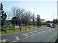
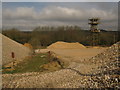
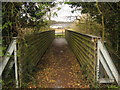
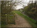
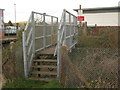
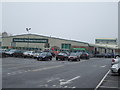
Residents of CT4 7PP have access to a range of local amenities, including Morrisons Thanington, Iceland Thanington, and Aldi Canterbury, all within practical reach. The village itself offers the Church of St Mary, a historic 13th-century landmark, and the Great Stour Way cycle path, which connects to Canterbury. Nearby, the North Downs Way passes through Chartham Hatch, offering walking and cycling opportunities in the Kent Downs Area of Outstanding Natural Beauty. The area’s rural character means daily life is shaped by open spaces, orchards, and farmland, with the St Augustine’s housing estate adding modern convenience. While the village lacks large retail hubs, its proximity to Canterbury ensures access to city amenities. The blend of heritage sites, green spaces, and practical retail options creates a lifestyle that balances tranquillity with connectivity to urban resources.
Amenities
Schools
| Rank | School | Type | Entry gender | Ages |
|---|
Explore more schools in this area
Go to Schools tabDemographics
The population of CT4 7PP has a median age of 47, with the majority of residents aged 30–64. This indicates a mature, stable community, likely with established careers and families. Home ownership is high at 80%, reflecting a predominance of owner-occupied properties rather than rental housing. The accommodation type is primarily houses, which aligns with the area’s semi-rural character and larger plot sizes. The predominant ethnic group is White, though no specific data on diversity or deprivation levels is provided. The age profile suggests a population less reliant on state services or student housing, with potential implications for local schools and healthcare demand. The absence of detailed diversity metrics means the community’s social composition remains largely unexplored in the data, but the high home ownership rate and age range imply a focus on long-term residency over transient populations.
Household Size
Accommodation Type
Tenure
Ethnic Group
Religion
Household Composition
Age
Household Deprivation
NS-SEC
Explore more demographic insights in this area
Go to Demographics tabPlanning
Planning Constraints
- Flood RiskPremium
- Ramsar Wetland SitesPremium
- Area of Outstanding Natural BeautyPremium
- Protected Nature ReservePremium
- Protected WoodlandPremium
- Crime RiskPremium