Area Overview for CT21 4RX
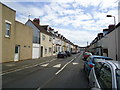
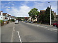
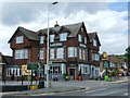
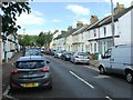
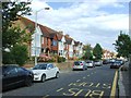
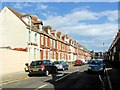
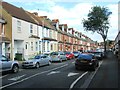
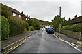
Photos of CT21 4RX


Area Information
CT21 4RX is a small, residential postcode area nestled in Folkestone, a coastal town in Kent. With a population of 1,631, it reflects the character of a close-knit community near the English Channel. The area’s proximity to the sea offers residents access to the Leas promenade and coastal gardens, blending natural beauty with everyday life. Folkestone’s history as a fishing village and 19th-century port is evident in its architecture and landmarks, such as the Church of St Martin and the Folkestone War Memorial. The area is defined by its quiet, suburban charm, with homes predominantly in private ownership. Its location between Dover and Hastings makes it a convenient base for those seeking a balance between coastal living and connectivity to nearby towns. Residents benefit from nearby rail links, including Folkestone Central and Sandling stations, and the Eurotunnel Terminal for cross-channel travel. The area’s small size means it is easy to navigate, with amenities within walking or cycling distance. For buyers, CT21 4RX offers a stable, family-oriented environment with a strong sense of place, though its limited size means the housing market is tightly focused on the immediate vicinity.
- Area Type
- Postcode
- Area Size
- Not available
- Population
- 1631
- Population Density
- 3536 people/km²
The property market in CT21 4RX is dominated by owner-occupied homes, with 79% of properties in private hands. This high level of home ownership suggests a stable, long-term resident base and limited rental demand. The area is characterised by houses rather than flats, reflecting a suburban, family-friendly housing stock. Given the small size of the postcode area, the available properties are likely limited to the immediate vicinity, with buyers needing to consider nearby areas for broader options. The focus on owner-occupied homes may indicate a community prioritising long-term residency over short-term investment. However, the limited scale of the area means the market is niche, with fewer choices compared to larger towns. For buyers, this could mean a need to look beyond CT21 4RX itself, though the proximity to Folkestone’s amenities and transport links may offset this limitation. The housing stock’s age and style, influenced by the area’s historical development, may appeal to those seeking traditional properties.
House Prices in CT21 4RX
No properties found in this postcode.
Energy Efficiency in CT21 4RX
Living in CT21 4RX provides access to a mix of practical amenities and coastal charm. The area is within reach of five retail outlets, including Sainsburys West and Tesco Folkestone, ensuring everyday shopping needs are met. Rail stations such as Folkestone Central, Sandling, and Hythe offer easy access to nearby towns and cities, while the Folkestone Eurotunnel Terminal provides direct links to France. The proximity to the English Channel coastline means residents can enjoy the Leas promenade and coastal gardens, blending natural scenery with recreational opportunities. The area’s small size ensures a compact lifestyle, with amenities like shops and transport hubs within walking or cycling distance. The presence of multiple rail options also supports a commuter-friendly environment. For those seeking a balance between convenience and location, CT21 4RX offers a practical base with the added appeal of coastal proximity. The mix of retail, transport, and natural features contributes to a lifestyle that is both functional and rooted in the region’s historic character.
Amenities
Schools
| Rank | School | Type | Entry gender | Ages |
|---|
Explore more schools in this area
Go to Schools tabDemographics
The community in CT21 4RX is predominantly composed of adults aged 30–64, with a median age of 47. This suggests a mature, established population, likely including professionals, families, and retirees. Home ownership is high, at 79%, indicating a stable, long-term resident base. The area is characterised by houses rather than flats, reflecting a traditional, suburban housing stock. The predominant ethnic group is White, aligning with broader trends in the region. The population size of 1,631 means the area is small but cohesive, with limited density. The absence of specific deprivation data in the provided information implies that the community is not marked by significant socioeconomic challenges, though this is not explicitly confirmed. The age profile suggests a balance between active professionals and older residents, shaping a community focused on local amenities and family life. The high home ownership rate also points to a preference for long-term investment in property, which may influence the local real estate dynamics.
Household Size
Accommodation Type
Tenure
Ethnic Group
Religion
Household Composition
Age
Household Deprivation
NS-SEC
Explore more demographic insights in this area
Go to Demographics tabPlanning
Planning Constraints
- Flood RiskPremium
- Ramsar Wetland SitesPremium
- Area of Outstanding Natural BeautyPremium
- Protected Nature ReservePremium
- Protected WoodlandPremium
- Crime RiskPremium