Area Overview for CT2 9AT
Photos of CT2 9AT

Area Information
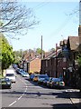
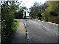
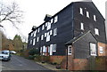
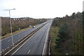
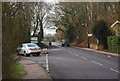
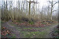
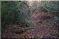
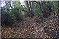
CT2 9AT occupies a small residential cluster within Harbledown and Rough Common, a civil parish immediately west of Canterbury city centre. This specific postcode covers 2,657 square metres and houses a population of 1,216 people, resulting in a population density of 98 people per square kilometre. You are looking at a tightly knit neighbourhood that is contiguous with the larger town, offering a blend of village tranquillity and proximity to urban amenities. The area is defined by High Street, a conservation zone containing listed buildings and a tall, intact Georgian terrace. Surrounding this historic core are orchards on the outskirts, contributing to the rural character of the settlement. First mentioned as Herebealding dun around 1175, the locality has deep historical roots, including the nearby Grade I listed former leper church of St Nicholas. Daily life here balances quiet residential streets with easy access to Canterbury, which is just 0.9 miles away. You will find distances to other major towns include Dover at 15.4 miles and London at 66.1 miles. Living in CT2 9AT means choosing a home in a historic setting with a strong connection to the wider Canterbury market while retaining a distinct village identity.
- Area Type
- Postcode
- Area Size
- 2657 m²
- Population
- 1216
- Population Density
- 98 people/km²
The property market in CT2 9AT is defined by a decisive lack of rental properties within the immediate cluster. With an 83% home ownership rate, the local housing stock is overwhelmingly owned by residents. This statistic confirms that the area is not a rental hotspot but a location where people buy to stay long term. You will primarily find houses within this 2,657 square metre area, aligning with the full 100% of accommodation types recorded for this postcode. Buyers viewing this location are almost certainly looking at purchase options rather than buy-to-let investment through the local channel for a one-off property. The dominance of houses and high ownership suggests a market driven by local families and owners who have moved into the housing stock through purchase. When you look at the context of Harbledown and Rough Common, including the nearby conservation area High Street, you are dealing with established property stock. This profile means competition for homes here comes from purchasers seeking stability in a historic village setting. There is no significant tenant market visible in these figures, making CT2 9AT a predictable environment for buyer-focused transactions.
House Prices in CT2 9AT
No properties found in this postcode.
Energy Efficiency in CT2 9AT
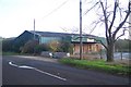
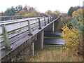
Residents of CT2 9AT benefit from a selection of amenities within practical reach, tailored to both daily essentials and social interaction. There are five retail options nearby, including specific venues like Spar, Co-op Kent, and Morrisons Thanington. These supermarkets provide comprehensive grocery shopping without the need to travel long distances. For travel and commuting, the area is well-positioned relative to rail links. Five stations are cited as nearby, including Chartham Railway Station, Canterbury West Railway Station, and Canterbury East Railway Station. This network allows you to access national rail services quickly while remaining in a village setting. The presence of these specific facilities means your daily life does not require a car for all essential trips, though owning one is likely beneficial given the rural character of the surrounding orchards and highways. Living in CT2 9AT grants you access to reliable food shopping and convenient train connections. The combination of local high-street retail and nearby major railway hubs creates a balanced lifestyle where you have the convenience of town services without moving into the city centre itself.
Amenities
Schools
For families considering schools near CT2 9AT, the immediate local offering is limited to just one institution listed for this area. That school is Kent College Nursery, Infant and Junior School, which operates as an independent school. This single entry means that local families relying strictly on schools physically located in this specific postcode cluster have access to private education options. The presence of an independent school serves a specific demographic, likely aligning with the higher median age and stable home ownership of the resident population. There are no state schools listed within this immediate 2,657 square metre footprint. Residents seeking state education will need to look further afield to Canterbury or other nearby villages, given that only one school type is recorded here. The mix implies an educational choice oriented towards private provision for the younger generation living in these houses. If you are moving here intending to raise children locally, you must factor in the reliance on this specific independent facility or the commute to larger city schools beyond this narrow postcode boundary.
| Rank | School | Type | Entry gender | Ages |
|---|---|---|---|---|
| 1 | Kent College Nursery, Infant and Junior School | independent | N/A | N/A |
Explore more schools in this area
Go to Schools tabDemographics
The community in this specific postcode is characterised by a mature population. The median age is 47 years, with adults aged between 30 and 64 years representing the most common age range. As a result, the area possesses a demographic profile typical of established, family-oriented or later-career neighbourhoods rather than a young student housing hub. Home ownership stands at a high level of 83%, indicating that the vast majority of residents own their properties outright or with a mortgage rather than renting. The predominant demographic group is White, reflecting the typical composition of historic Kentish parishes. All accommodation listed for this small postcode consists of houses, meaning you will not find flats or purpose-built apartments within this specific cluster. This data suggests a stable, settled environment where long-term residents have their homes. The high ownership rate and consistent age profile point towards a community where people put down roots. When considering living in CT2 9AT, you are joining a neighbourhood where the resident population is well-established, favouring continuity over transient housing needs.
Household Size
Accommodation Type
Tenure
Ethnic Group
Religion
Household Composition
Age
Household Deprivation
NS-SEC
Explore more demographic insights in this area
Go to Demographics tabPlanning
Planning Constraints
- Flood RiskPremium
- Ramsar Wetland SitesPremium
- Area of Outstanding Natural BeautyPremium
- Protected Nature ReservePremium
- Protected WoodlandPremium
- Crime RiskPremium