Area Overview for CT2 8HU
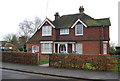
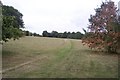
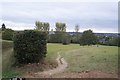
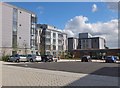
Photos of CT2 8HU


Area Information
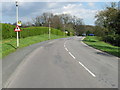
Living in CT2 8HU means inhabiting a tightly knit residential cluster in the heart of Kent, just 2 miles north-west of Canterbury. The area covers 3.4 hectares, housing 1,604 residents in a high-density layout of 46,856 people per square kilometre. This postcode is part of the Blean parish, an ancient forest district with a rich history of woodland preservation. The Blean itself spans over 11 square miles, making it one of England’s largest ancient woodlands. Daily life here is shaped by proximity to Canterbury’s cultural and economic hubs, with easy access to rail networks and local amenities. The area’s compact size means residents are close to both historical sites and modern conveniences, blending rural tranquillity with urban connectivity. Its location on the Whitstable railway line adds to its appeal, though specific journey times to major cities are not detailed. For those seeking a balance between seclusion and accessibility, CT2 8HU offers a unique blend of natural heritage and practical living.
- Area Type
- Postcode
- Area Size
- 3.4 hectares
- Population
- Not available
- Population Density
- Not available
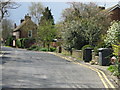
The property market in CT2 8HU is characterised by a high rate of home ownership (72%), with houses making up the majority of the housing stock. This suggests a predominantly owner-occupied area, rather than a rental market, which may appeal to buyers seeking stability and long-term investment. The compact size of the postcode—just 3.4 hectares—means the housing stock is limited, with properties likely concentrated in a small residential cluster. Given the proximity to Canterbury and the Blean’s natural surroundings, properties here may benefit from both scenic views and access to urban amenities. However, the small area size also means competition for available homes could be fierce. Buyers should consider the local infrastructure, such as transport links and schools, as key factors in assessing value and suitability for their needs.
House Prices in CT2 8HU
No properties found in this postcode.
Energy Efficiency in CT2 8HU
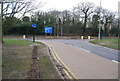
The lifestyle in CT2 8HU is shaped by its proximity to retail and transport hubs. Nearby amenities include five retail outlets, such as Co-op Kent, Sainsburys Canterbury St, and Co-op University of, offering everyday shopping convenience. The area’s rail network, with stations like Canterbury West and Sturry, provides easy access to Canterbury’s cultural and commercial centres. While the data does not mention parks or leisure facilities, the Blean’s ancient woodland nearby offers opportunities for outdoor recreation. The compact size of the postcode means residents are close to both local shops and transport links, fostering a convenient, self-contained lifestyle. The mix of retail and rail connectivity suggests a community that balances practicality with access to broader urban amenities.
Amenities
Schools
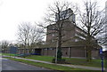
The nearest school to CT2 8HU is St Edmund’s School Canterbury, an independent institution. While no Ofsted rating is provided, its status as an independent school suggests it may cater to families seeking private education. The absence of state schools in the immediate vicinity means families may need to look beyond the postcode for public education options. This mix of school types could indicate a community with varied educational preferences, though the limited data makes it difficult to assess the full range of choices available. For those prioritising private schooling, St Edmund’s offers a clear option, but buyers should investigate further to understand the broader educational landscape in the area.
| Rank | School | Type | Entry gender | Ages |
|---|---|---|---|---|
| 1 | St Edmund's School Canterbury | independent | N/A | N/A |
Explore more schools in this area
Go to Schools tabDemographics
The population of CT2 8HU is predominantly adults aged 30–64, with a median age of 47. This suggests a mature, stable community with a focus on family and long-term residency. Home ownership is high at 72%, indicating a strong presence of owner-occupied properties, primarily houses. The accommodation type data reinforces this, noting that houses are the dominant housing stock. The predominant ethnic group is White, reflecting the area’s traditional demographic profile. While no specific deprivation data is provided, the high home ownership and low crime risk (85/100) suggest a relatively affluent and secure environment. The absence of significant diversity metrics means the community is likely homogenous, which may influence social dynamics and local services. For buyers, this profile implies a neighbourhood with established infrastructure and a focus on long-term residency over transient populations.
Household Size
Accommodation Type
Tenure
Ethnic Group
Religion
Household Composition
Age
Household Deprivation
NS-SEC
Explore more demographic insights in this area
Go to Demographics tabPlanning
Planning Constraints
- Flood RiskPremium
- Ramsar Wetland SitesPremium
- Area of Outstanding Natural BeautyPremium
- Protected Nature ReservePremium
- Protected WoodlandPremium
- Crime RiskPremium