Area Overview for CT2 7NZ
Photos of CT2 7NZ
Area Information
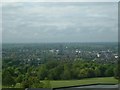
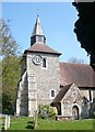
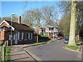
CT2 7NZ is a small residential postcode cluster in England, nestled in the Blean parish, approximately 2 miles north-west of Canterbury. Covering just 1.5 hectares, it is a compact area with a population of 5,447, translating to a density of 536 people per square kilometre. This is a young community, with a median age of 22 and a majority of residents aged 15–29. The area’s character is shaped by its proximity to the ancient Blean Woods, a vast expanse of woodland that has been a defining feature of the region for centuries. The parish itself is historically significant, with roots in Anglo-Saxon and medieval periods, and includes remnants of ecclesiastical and royal landholdings. Daily life here is influenced by its rural setting, with easy access to Canterbury’s amenities and transport links. The mix of young adults and owner-occupied homes suggests a stable, community-focused environment, though the area’s small size means it is tightly knit and reliant on nearby towns for broader services.
- Area Type
- Postcode
- Area Size
- 1.5 hectares
- Population
- 5447
- Population Density
- 536 people/km²
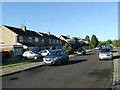
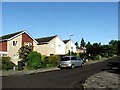
CT2 7NZ is predominantly an owner-occupied area, with 77% of residents living in homes they own. The accommodation type is largely houses, which is unusual for a small postcode area but aligns with the broader Blean parish’s historical and rural character. This suggests a market with limited rental availability, as the area is not a traditional commuter suburb but rather a residential cluster with a focus on private ownership. The small size of the postcode means property choices are limited, but the presence of houses may offer larger living spaces compared to other parts of the region. Buyers should consider the proximity to Canterbury, which provides access to a broader range of housing options and amenities. The high home ownership rate indicates a stable market, though the small area size means competition for properties could be keen.
House Prices in CT2 7NZ
No properties found in this postcode.
Energy Efficiency in CT2 7NZ
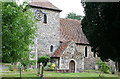
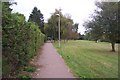
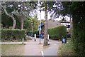
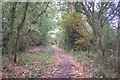
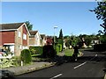
The lifestyle in CT2 7NZ is shaped by its proximity to retail and transport hubs, as well as the natural and historical features of the surrounding Blean parish. Nearby shops include Co-op University of, Co-op Kent, and Sainsburys Canterbury St, offering essential services for daily living. The area’s rail stations—Canterbury West, Canterbury East, and Sturry—provide easy access to Canterbury’s cultural and commercial centres. Beyond retail, the Blean Woods Nature Reserve offers a significant green space, ideal for walking, cycling, or nature enthusiasts. The parish also includes a small church and remnants of historical sites, such as the former workhouse converted into Herne Hospital. This blend of natural beauty, historical interest, and practical amenities creates a lifestyle that balances rural tranquillity with urban connectivity, though the small area size means residents may need to travel for more specialised services.
Amenities
Schools
The schools near CT2 7NZ include Blean Primary School, which holds an outstanding Ofsted rating, and the University of Kent, a major higher education institution. Additionally, Bemix is a special school catering to specific educational needs. This mix of primary and special education facilities suggests a well-rounded provision for families, with Blean Primary School’s high rating offering reassurance for parents seeking quality early education. The presence of the University of Kent also means the area is likely to have a student population, contributing to a dynamic local environment. However, no secondary schools are listed in the data, so families may need to look beyond CT2 7NZ for comprehensive schooling. The combination of primary and special schools ensures that the area can accommodate a range of educational requirements, though further research into secondary options would be necessary for long-term planning.
| Rank | School | Type | Entry gender | Ages |
|---|---|---|---|---|
| 1 | Blean Primary School | primary | N/A | N/A |
| 2 | University of Kent | other | N/A | N/A |
| 3 | Bemix | special | N/A | N/A |
Explore more schools in this area
Go to Schools tabDemographics
The population of CT2 7NZ is overwhelmingly young, with a median age of 22 and 77% of residents aged 15–29. This demographic skew indicates a community centred on students, young professionals, and families starting out. Home ownership is high at 77%, reflecting a strong presence of owner-occupied properties, predominantly houses. The area’s ethnic composition is largely White, with no specific data on other groups provided. The age profile and home ownership rates suggest a stable, long-term resident base, though the young population may influence local demand for housing and services. With 536 people per square kilometre, the area is moderately dense for its size, balancing residential living with the surrounding rural landscape. This density, combined with a young, owner-occupied population, points to a community that is both active and invested in its local environment.
Household Size
Accommodation Type
Tenure
Ethnic Group
Religion
Household Composition
Age
Household Deprivation
NS-SEC
Explore more demographic insights in this area
Go to Demographics tabPlanning
Planning Constraints
- Flood RiskPremium
- Ramsar Wetland SitesPremium
- Area of Outstanding Natural BeautyPremium
- Protected Nature ReservePremium
- Protected WoodlandPremium
- Crime RiskPremium