Area Overview for CT2 7DF
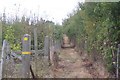
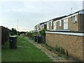
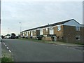
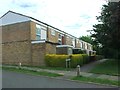
Photos of CT2 7DF

Area Information
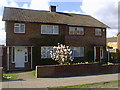
CT2 7DF represents a specific residential cluster within the St Stephen's ward of Canterbury, Kent. This small area covers 3840 square metres and houses a population of 1444 people. You are stepping into a community that evolved from the historic village of Hackington, a name derived from Old English meaning "settlement amongst the hacks" or thorn bushes. While the area developed as a separate entity, significant growth during the 1930s linked it firmly to Canterbury, and it remains a distinct suburb today. Residents enjoy the integration of historical landmarks with modern convenience. The area retains a village character despite its position within the larger city of Canterbury. You gain easy access to a city centre that offers extensive services while living in a quieter, more personalised environment. The proximity to the University of Kent adds a dynamic element to the daily rhythm of life here, blending academic activity with resident needs. This postcode area provides a practical option for those who want the amenities of a major city without the necessarily chaotic pace found in the core zones of Canterbury.
- Area Type
- Postcode
- Area Size
- 3840 m²
- Population
- 1444
- Population Density
- 7673 people/km²
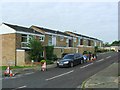
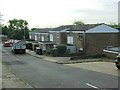
Living in CT2 7DF means entering a market characterised by high rental demand and a predominantly young tenant base. The data confirms that 77% of residents do not own their homes, as only 23% hold the title deed to their property. This statistic indicates a rental-heavy environment where Tenancy agreements are common. The predominant accommodation type listed for this area is Houses, likely referring to detached or semi-detached structures found in the older parts of St Stephen's built on the historic Hackington land. With a population of 1444 residents occupying just 3840 square metres, the housing density is significant for a village ward. You will find large detached houses dominating the Terrace and surrounding roads, a legacy of post-war development and the expansion of the University of Kent campus. Prospective buyers should note that the low ownership rate suggests price sensitivity or a strategic preference for renting among current occupants. The housing stock reflects the historical roots of the area, with manor houses converted into flats or university accommodation alongside modern builds. If you are buying, you are looking at a market where properties serve as bases for transient lifestyles as much as family homes.
House Prices in CT2 7DF
No properties found in this postcode.
Energy Efficiency in CT2 7DF
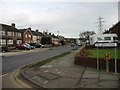
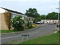
Daily life in CT2 7DF relies on a few key commercial hubs that serve the immediate needs of 1444 residents. You will find five retail locations nearby, providing essential shopping without needing a car for basic groceries. Asda Canterbury, Co-op University of, and Farmfoods Canterbury anchor the retail offering. These stores provide everything from fresh produce to household essentials, catering directly to the young demographic of the ward. Beyond food, transport connectivity anchors your daily mobility options. Five rail stations serve the area, making access to wider Kent and London feasible. Canterbury West Railway Station and Canterbury East Railway Station offer frequent services, while Sturry Railway Station provides convenient stepping stones for specific routes. The lifestyle here balances village heritage with modern utility. You can walk to St Stephen's Church, a landmark dating back to around 1050 AD, or visit the Old Beverlie pub for a historic spot for a drink. This blend of historical leisure spots and modern supermarkets creates a convenient lifestyle. You do not need to travel far for your weekly shop or your evening meal. The presence of the University of Kent further enriches the local scene, bringing young energy and potential social events to your doorstep.
Amenities
Schools
| Rank | School | Type | Entry gender | Ages |
|---|
Explore more schools in this area
Go to Schools tabDemographics
The social fabric of CT2 7DF is defined by a very young demographic profile. The median age in this area is 22 years, which indicates that the population is predominantly young. The most common age range for residents consists of young adults between 15 and 29 years old. This concentration suggests the area attracts students and young professionals closely associated with institutions like the University of Kent. Home ownership figures show that only 23% of residents own their homes outright, meaning the vast majority live in rental accommodation or shared properties. You will find a community heavily populated by younger households rather than families in their prime earning years seeking to build equity. The predominant ethnic group is White, reflecting the typical demographic composition of many Canterbury suburbs. This high proportion of young people creates a lively energy in local cafes and transport hubs. Shops and services often cater to the needs of this younger crowd, from takeaways to budget-friendly retail options rather than high-end luxury services.
Household Size
Accommodation Type
Tenure
Ethnic Group
Religion
Household Composition
Age
Household Deprivation
NS-SEC
Explore more demographic insights in this area
Go to Demographics tabPlanning
Planning Constraints
- Flood RiskPremium
- Ramsar Wetland SitesPremium
- Area of Outstanding Natural BeautyPremium
- Protected Nature ReservePremium
- Protected WoodlandPremium
- Crime RiskPremium