Area Overview for CT19 5BF
Photos of CT19 5BF


Area Information
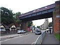
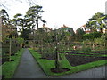
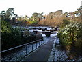
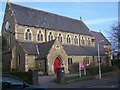
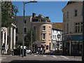
Living in CT19 5BF, a small residential cluster in Folkestone, Kent, offers a blend of coastal charm and practicality. With a population of 1,432, the area is compact yet connected to the broader Folkestone town, known for its historic promenade, The Leas, and proximity to the English Channel. The community here is rooted in the town’s heritage as a former fishing village and 19th-century port, though modern life is shaped by its accessibility to rail, ferry, and motorway networks. Residents benefit from a mix of local amenities, including nearby supermarkets, railway stations, and the Eurotunnel terminal. The area’s compact size means daily errands and leisure are within walking or cycling distance, while its position in Kent provides easy access to London and the south coast. For those seeking a balance between coastal living and commuter convenience, CT19 5BF’s blend of historic character and modern connectivity makes it a compelling choice.
- Area Type
- Postcode
- Area Size
- Not available
- Population
- Not available
- Population Density
- Not available
The property market in CT19 5BF is defined by its focus on owner-occupied homes, with 47% of residents owning their properties. The area’s housing stock consists primarily of houses, which are typically larger and more suited to families or individuals seeking space. This contrasts with areas dominated by rental properties or flats, suggesting a community where long-term residency is common. Given the small size of the postcode and its integration with Folkestone’s broader housing stock, buyers should consider the limited availability of new builds and the potential for competition in the existing market. The predominance of houses may appeal to those prioritising privacy and outdoor space, though the 47% home ownership rate indicates that a significant portion of the housing stock is rented. Prospective buyers should also factor in the area’s proximity to transport links, which may influence property values and desirability.
House Prices in CT19 5BF
No properties found in this postcode.
Energy Efficiency in CT19 5BF
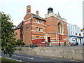
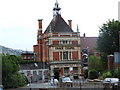
The lifestyle in CT19 5BF is shaped by its proximity to essential amenities and the character of Folkestone. Within practical reach are five retail outlets, including Tesco Folkestone, Co-op Folkestone, and Lidl Central, ensuring access to groceries and everyday essentials. The area’s transport links—rail, metro, and ferry—enhance convenience, with stations like Folkestone Central and the Eurotunnel terminal providing direct access to the UK and continental Europe. While specific parks or leisure facilities are not detailed in the data, the broader Folkestone area includes coastal walks and historic sites, such as The Leas promenade. The presence of multiple railway stations and retail hubs suggests a community where daily life is efficient, with minimal need for long commutes. For residents, the blend of local shops, transport options, and coastal proximity offers a practical yet varied lifestyle.
Amenities
Schools
| Rank | School | Type | Entry gender | Ages |
|---|
Explore more schools in this area
Go to Schools tabDemographics
The community in CT19 5BF is predominantly middle-aged, with a median age of 47 and the most common age group being adults aged 30–64. This suggests a population largely composed of established professionals, families, or retirees. Home ownership rates stand at 47%, indicating a mix of owner-occupied properties and rental homes. The area is characterised by houses rather than flats, reflecting a preference for traditional, family-friendly housing. The predominant ethnic group is White, though specific data on diversity is not provided. With no figures on deprivation or income levels, it is unclear how economic factors shape the area’s quality of life. However, the presence of nearby retail and transport hubs implies a level of convenience that supports daily living. The demographic profile suggests a stable, low-turnover community where many residents have lived for extended periods.
Household Size
Accommodation Type
Tenure
Ethnic Group
Religion
Household Composition
Age
Household Deprivation
NS-SEC
Explore more demographic insights in this area
Go to Demographics tabPlanning
Planning Constraints
- Flood RiskPremium
- Ramsar Wetland SitesPremium
- Area of Outstanding Natural BeautyPremium
- Protected Nature ReservePremium
- Protected WoodlandPremium
- Crime RiskPremium