Area Overview for CT19 4BF
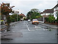
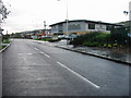
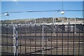
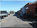
Photos of CT19 4BF


Area Information
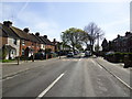
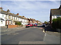
Living in CT19 4BF means being part of a compact, densely populated residential cluster in Folkestone, Kent. With a population of 1,640 spread across 1,215 square metres, the area is characterised by close-knit communities and easy access to coastal amenities. Folkestone itself is a historic port town on the English Channel, offering a mix of seaside charm and modern conveniences. Residents benefit from proximity to multiple rail stations, including Folkestone West and Central, as well as the Folkestone Eurotunnel Terminal for cross-Channel travel. The area’s small size means a strong sense of local identity, with schools, shops, and transport links all within practical reach. Its high population density reflects a focus on housing rather than sprawling development, making it ideal for those seeking a balance between urban and coastal living. The presence of primary schools, retail outlets, and coastal access underscores its appeal to families and commuters alike.
- Area Type
- Postcode
- Area Size
- 1215 m²
- Population
- 1640
- Population Density
- 2435 people/km²
The property market in CT19 4BF is dominated by owner-occupied homes, with 67% of residents living in their own houses. This contrasts with areas where rental demand is higher, indicating a stable, long-term demographic. The prevalence of houses over flats or apartments suggests a focus on family homes, likely with gardens or private outdoor spaces. Given the area’s small size and high population density, property availability may be limited, particularly for those seeking larger homes. Buyers should consider the proximity to amenities such as schools, rail stations, and retail hubs, which enhance the area’s appeal. The compact nature of CT19 4BF means that properties are likely to be in close proximity to each other, making it a convenient choice for those prioritising accessibility over expansive living spaces.
House Prices in CT19 4BF
No properties found in this postcode.
Energy Efficiency in CT19 4BF
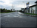
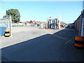
Daily life in CT19 4BF is shaped by its proximity to shops, transport hubs, and coastal access. The area has five retail outlets, including major supermarkets like Sainsburys and Morrisons, making it easy to access groceries and household goods. Rail stations such as Folkestone West and Sandling provide frequent services to nearby towns and cities, while the Folkestone Eurotunnel Terminal connects residents to France. For leisure, the nearby Folkestone coastline offers walking paths, gardens, and historical sites like the Church of St Martin. The presence of Lympne Airport, though not a major commercial hub, adds to the area’s connectivity. The compact nature of CT19 4BF means that amenities are within walking or short driving distance, fostering a convenient, community-focused lifestyle.
Amenities
Schools
The area is served by three primary schools, all named Morehall Primary School, with one explicitly listed as Morehall Primary School and Nursery, which holds an Ofsted rating of “good.” This concentration of primary schools suggests a strong focus on education for young families. The repetition of the name may indicate multiple campuses or affiliated institutions, though the data does not clarify this. The presence of a nursery within one school adds to the convenience for parents seeking early-years education. The “good” Ofsted rating for one of the schools indicates a satisfactory standard of teaching and facilities, which is reassuring for prospective residents. Families in CT19 4BF can rely on these schools for primary education, though the lack of secondary school options may require commuting to nearby towns.
| Rank | School | Type | Entry gender | Ages |
|---|---|---|---|---|
| 1 | Morehall Primary School | primary | N/A | N/A |
| 2 | Morehall Primary | primary | N/A | N/A |
| 3 | Morehall Primary School and Nursery | primary | N/A | N/A |
Explore more schools in this area
Go to Schools tabDemographics
CT19 4BF has a median age of 47, with the majority of residents aged between 30 and 64. This suggests a community skewed towards adults, likely including professionals and families. Home ownership is high at 67%, indicating a stable, long-term population. The accommodation type is predominantly houses, which aligns with the area’s residential focus. The predominant ethnic group is White, reflecting broader trends in the region. The population density of 1,349,974 people per square kilometre is exceptionally high, implying tightly packed housing and a concentration of services. This density may influence daily life, with neighbours likely to be close and amenities readily accessible. However, it also means limited space for expansion, which could affect property availability and pricing. The demographic profile suggests a mature, established community with a strong emphasis on family-oriented living.
Household Size
Accommodation Type
Tenure
Ethnic Group
Religion
Household Composition
Age
Household Deprivation
NS-SEC
Explore more demographic insights in this area
Go to Demographics tabPlanning
Planning Constraints
- Flood RiskPremium
- Ramsar Wetland SitesPremium
- Area of Outstanding Natural BeautyPremium
- Protected Nature ReservePremium
- Protected WoodlandPremium
- Crime RiskPremium