Area Overview for CT17 0UH
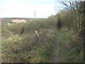
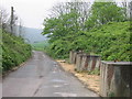
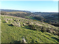
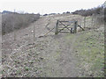
Photos of CT17 0UH


Area Information
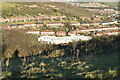
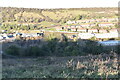
Living in CT17 0UH means being part of a tightly knit residential cluster in the heart of Dover, Kent. With a population of 1,821 and a density of 1,345 people per square kilometre, this postcode area reflects the compact, historic character of Dover itself. The town’s strategic position on the Dover Strait has shaped its identity for centuries, with Roman roots and medieval significance still evident in its architecture and landmarks. Residents here benefit from proximity to Dover’s cultural and historical sites, including St Mary the Virgin Church and Dover Castle, while the area’s small size fosters a close-knit community. The median age of 47 suggests a mature demographic, with adults aged 30–64 forming the majority. This mix of older residents and families creates a balanced, stable environment. While the area lacks large-scale amenities, its integration with Dover’s transport and retail networks ensures practicality for daily life.
- Area Type
- Postcode
- Area Size
- Not available
- Population
- 1821
- Population Density
- 1345 people/km²
The property market in CT17 0UH is characterised by a low home ownership rate of 25%, indicating that most residents rent rather than own their homes. This suggests a rental market with limited availability of owner-occupied properties, which may be due to the area’s small size and focus on older housing stock. The predominant accommodation type is houses, which is atypical for a small postcode area and may reflect historical development patterns. For buyers, this means competition for a limited number of homes, particularly if seeking owner-occupied properties. The area’s proximity to Dover’s transport and retail networks could make it appealing for those prioritising convenience over property investment, though the low home ownership rate may limit long-term equity growth.
House Prices in CT17 0UH
No properties found in this postcode.
Energy Efficiency in CT17 0UH
Residents of CT17 0UH have access to five retail outlets, including Co-op Dover, Co-op Maxton, and Co-op River, providing essential shopping options within walking or short driving distance. The area’s rail, ferry, and metro links ensure easy access to Dover’s amenities, from dining to cultural sites like St Mary the Virgin Church. While the postcode itself is small, its integration with Dover’s transport network means residents can enjoy the town’s historic landmarks, markets, and leisure opportunities. The presence of multiple railway stations and ferry terminals also supports a lifestyle centred on connectivity, whether for commuting, travel, or accessing nearby services.
Amenities
Schools
Residents of CT17 0UH have access to two primary schools: White Cliffs Primary College for the Arts and White Cliffs Primary and Nursery School. The latter holds a ‘good’ Ofsted rating, offering families a reliable option for early years and primary education. However, the absence of secondary schools in the immediate area means students may need to travel to Dover or nearby towns for further education. The presence of two primary schools suggests a focus on younger families, though the lack of secondary options could be a consideration for households planning long-term in the area. The quality of primary education, particularly at White Cliffs Primary and Nursery School, may offset the need for additional schooling elsewhere.
| Rank | School | Type | Entry gender | Ages |
|---|---|---|---|---|
| 1 | White Cliffs Primary College for the Arts | primary | N/A | N/A |
| 2 | White Cliffs Primary and Nursery School | primary | N/A | N/A |
Explore more schools in this area
Go to Schools tabDemographics
CT17 0UH has a median age of 47, with the majority of residents falling within the 30–64 age range. This indicates a community skewed towards middle-aged adults, likely including professionals, retirees, and families. Only 25% of households are owner-occupied, suggesting a rental-dominated market, which may reflect the area’s smaller size and limited housing stock. The predominant accommodation type is houses, which is unusual for a UK postcode area of this scale, hinting at older, perhaps more traditional housing stock. The White ethnic group constitutes the largest share of the population, though specific diversity metrics are not provided. With 25% home ownership, the area may offer fewer long-term investment opportunities for buyers, but its compact nature ensures proximity to essential services and transport links.
Household Size
Accommodation Type
Tenure
Ethnic Group
Religion
Household Composition
Age
Household Deprivation
NS-SEC
Explore more demographic insights in this area
Go to Demographics tabPlanning
Planning Constraints
- Flood RiskPremium
- Ramsar Wetland SitesPremium
- Area of Outstanding Natural BeautyPremium
- Protected Nature ReservePremium
- Protected WoodlandPremium
- Crime RiskPremium