Area Overview for CT16 1BL
Photos of CT16 1BL


Area Information
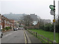
CT16 1BL is a small residential postcode area in Dover, Kent, home to around 2,069 residents. Situated on the Dover Strait, this location has historically been a strategic gateway between Britain and continental Europe, shaping its character as a town with deep maritime and military significance. The area is compact, with a mix of housing types that reflect Dover’s long-standing role as a port and fortress. Daily life here is influenced by proximity to key transport links, including rail stations and ferry terminals, which connect residents to nearby towns and across the Channel. The community is relatively small, fostering a tight-knit environment, though the area’s population size means it lacks the density of larger urban centres. Residents benefit from nearby amenities such as schools, retail outlets, and historical sites like Dover Castle and St Mary the Virgin Church, which offer both practical and cultural value. For those seeking a balance between coastal living and accessibility, CT16 1BL provides a unique blend of historical heritage and modern convenience.
- Area Type
- Postcode
- Area Size
- Not available
- Population
- 2069
- Population Density
- Not available
The property market in CT16 1BL is characterised by a low home ownership rate of 37%, with flats being the predominant accommodation type. This suggests that the area is more rental-oriented than owner-occupied, which may be due to its small size and historical housing stock. Flats are likely to be the primary housing option available, though the limited data on property types means it is unclear whether newer developments or conversions have expanded the market. For buyers, this small area presents challenges: the limited housing stock and high proportion of rentals could mean fewer opportunities for purchase, particularly for those seeking larger properties. The proximity to Dover’s transport links and amenities may make the area attractive for investors, but the low home ownership rate indicates a market that is not dominated by long-term residents. Prospective buyers should consider the area’s compact nature and the potential for competition in the limited available properties.
House Prices in CT16 1BL
No properties found in this postcode.
Energy Efficiency in CT16 1BL
The lifestyle in CT16 1BL is shaped by its proximity to a range of amenities within practical reach. Retail options include major supermarkets such as Asda Dover, Farmfoods Dover, and Morrisons Dover, ensuring daily shopping needs are met. The area’s transport links provide access to broader leisure and cultural opportunities, including historical sites like St Mary the Virgin Church and Dover Castle, which are notable for their historical significance. The presence of multiple rail stations, ferry terminals, and metro stops means residents can easily access nearby towns or travel abroad. While the data does not specify dining or park facilities, the availability of retail and transport infrastructure suggests a functional, practical lifestyle. The area’s small size and historical character may appeal to those seeking a quieter, community-focused environment, though the lack of detailed information on local parks or recreational spaces means further exploration would be needed to fully assess the area’s lifestyle offerings.
Amenities
Schools
The nearest school to CT16 1BL is Dover Grammar School for Girls, a primary school with an Ofsted rating of ‘good’. This school serves the local community, providing education for younger children in the area. The presence of a primary school with a positive rating is a key consideration for families, though the data does not include secondary schools or other educational institutions. The single school listed suggests that families may need to look beyond the immediate postcode area for secondary education options. The school’s ‘good’ rating indicates that it meets acceptable standards, but further research would be needed to assess its performance in detail. For those prioritising proximity to schools, Dover Grammar School for Girls offers a reliable option for primary education, though the limited data means the full range of educational provision in the area remains unclear.
| Rank | School | Type | Entry gender | Ages |
|---|
Explore more schools in this area
Go to Schools tabDemographics
The population of CT16 1BL has a median age of 47, with the most common age range being adults aged 30–64. This suggests a community skewed toward middle-aged and older residents, many of whom may be retired or in established careers. Home ownership in the area is relatively low at 37%, indicating a higher proportion of rental properties compared to owner-occupied homes. The predominant accommodation type is flats, which aligns with the area’s compact nature and historical development patterns. The predominant ethnic group is White, reflecting broader demographic trends in Dover. While specific data on deprivation is not provided, the lower home ownership rate may suggest a reliance on rental housing, which could influence local economic dynamics. The age profile and housing stock suggest a stable, mature community, though the limited data on diversity means the full range of cultural influences in the area remains less defined.
Household Size
Accommodation Type
Tenure
Ethnic Group
Religion
Household Composition
Age
Household Deprivation
NS-SEC
Explore more demographic insights in this area
Go to Demographics tabPlanning
Planning Constraints
- Flood RiskPremium
- Ramsar Wetland SitesPremium
- Area of Outstanding Natural BeautyPremium
- Protected Nature ReservePremium
- Protected WoodlandPremium
- Crime RiskPremium