Area Overview for CT14 6EQ
Photos of CT14 6EQ


Area Information
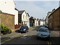
Living in CT14 6EQ means residing within a specific residential cluster in the historic town of Deal, Kent. This postcode covers an area of 481 square metres and serves a population of 1,215 residents. Deal is an ancient parish and market town situated on the coast, located approximately 18 miles from Canterbury and 72 miles from London. The town historically developed as a limb port of the Cinque Ports by the late 13th century and has remained a significant coastal settlement. Today, the area functions as a seaside resort where the economy relies on tourism and its heritage as a historic market town. Residents here experience life in a community with deep historical roots, dating back to the Domesday Book of 1086. The layout of the town comprises three distinct parts—Lower, Middle, and Upper Deal—arranged in long narrow streets parallel to the beach. You are living in a location that balances its maritime history with modern coastal living. The postcode is identified as CT14 6EQ, marking a small but distinct part of this larger coastal heritage. When considering homes in CT14 6EQ, you are looking at a community defined by its proximity to the sea and its status as a traditional Kentish market town rather than a sprawling suburban development.
- Area Type
- Postcode
- Area Size
- 481 m²
- Population
- Not available
- Population Density
- Not available
The property market in CT14 6EQ is characterised by a strong preference for residential homes. Houses dominate the accommodation type, meaning you will find single-family dwellings rather than high-density flats. With 66 per cent of residents owning their homes, the area is largely an owner-occupied market. This high rate of ownership suggests that the local housing stock has been passed down through generations or that affordability has long allowed for outright purchase or mortgage ownership. When looking at homes in CT14 6EQ, you are viewing properties in a small residential cluster where space is at a premium due to the area size of 481 square metres for the whole postcode. The market functions as a traditional local exchange rather than a speculative investment zone. Residents value the stability of house ownership in a quaint coastal location. The prevalence of houses rather than apartment blocks means that privacy and garden space are likely priorities for buyers. This market structure means that prices may reflect the desire to buy into a specific historic location rather than merely seeking a convenient address. Buyers should expect a market driven by local demand and the appeal of the Deal coastline.
House Prices in CT14 6EQ
No properties found in this postcode.
Energy Efficiency in CT14 6EQ
Daily life in CT14 6EQ centres on amenities that are within practical reach of your home. Retail options include Aldi Park, Iceland Deal, and Sainsburys Deal, providing access to essential groceries and household items. There are five notable retail venues nearby, ensuring you do not need to travel far for food shopping. For travel connections, four railway stations offer convenient routes to other parts of the country. Deal Railway Station, Walmer Railway Station, and Sandwich Railway Station provide the primary rail infrastructure for residents. The area itself is infused with history, featuring Deal Castle constructed by Henry VIII. Three parish churches stand as landmarks: St. Leonard's Church in Upper Deal, St. George's Church in Lower Deal, and St. Andrew's Church in West Street. St. George's Church is known for its excellent acoustics and hosts concerts and events regularly. You can enjoy beachside walks near the North and South Forelands while maintaining access to modern conveniences. The combination of historic churches, a working port history, and immediate access to supermarkets and train stations creates a balanced lifestyle. Living in CT14 6EQ gives you both the peace of a historic town and the convenience of essential services just a short distance away.
Amenities
Schools
| Rank | School | Type | Entry gender | Ages |
|---|
Explore more schools in this area
Go to Schools tabDemographics
The community in CT14 6EQ is defined by a mature demographic profile with a median age of 47 years. The most common age range for residents falls between 30 and 64 years. Home ownership is the dominant form of tenure, with 66 per cent of residents owning their properties outright or with a mortgage. This indicates a stable neighbourhood where a significant majority have established roots. The predominant ethnic group in the area is White, reflecting the traditional character of the Deal region. Accommodation within CT14 6EQ consists primarily of houses rather than flats or apartments. This housing stock aligns with the population density of 252,716.6 people per square kilometre, a figure that reflects the compact nature of the town centre and coastal settlements. You would be joining a community where the typical resident is likely further along in their life cycle compared to the national average. The high rate of home ownership suggests fewer tenants and a more settled population. This demographic composition creates a quiet residential atmosphere typical of older coastal towns where families and long-term residents have lived for generations.
Household Size
Accommodation Type
Tenure
Ethnic Group
Religion
Household Composition
Age
Household Deprivation
NS-SEC
Explore more demographic insights in this area
Go to Demographics tabPlanning
Planning Constraints
- Flood RiskPremium
- Ramsar Wetland SitesPremium
- Area of Outstanding Natural BeautyPremium
- Protected Nature ReservePremium
- Protected WoodlandPremium
- Crime RiskPremium