Area Overview for CT14 0NX
Photos of CT14 0NX


Area Information
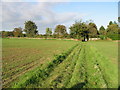
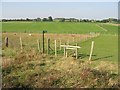
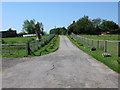
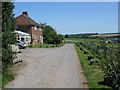
Living in CT14 0NX, a small residential cluster in Kent, offers a quiet, historically rooted lifestyle. The area, part of the village of Tilmanstone, sits near Eastry and Eythorne, with a population of 1,676 spread across 59 people per square kilometre. Its character stems from its industrial past, notably the Tilmanstone Colliery, which operated from 1906 to 1986 and shaped the local economy. Today, the village retains its village feel, with the Grade I listed Church of St Andrew and historic manors like North Court and South Court anchoring its heritage. Residents benefit from proximity to nearby towns like Deal and Dover, with the Dover Eastern Docks Ferry Terminal offering direct links to France. The area’s low population density and mix of traditional housing create a distinct sense of community, where daily life is punctuated by local amenities and easy access to transport networks. For those seeking a balance between rural tranquillity and connectivity, CT14 0NX provides a unique blend of historical charm and practical modernity.
- Area Type
- Postcode
- Area Size
- Not available
- Population
- 1676
- Population Density
- 59 people/km²
The property market in CT14 0NX is characterised by a high rate of home ownership—82%—indicating a strong preference for private residence over rental living. The accommodation type is predominantly houses, which is typical for small rural clusters where larger properties are more common. This suggests a market skewed towards owner-occupiers seeking stable, long-term housing rather than speculative investment. The limited population size of 1,676 means the area has a small housing stock, likely centred around traditional family homes and older properties. For buyers, this implies a niche market with limited competition but potential for value retention. However, the small scale of the area may restrict options for those seeking modern developments or larger properties. Proximity to transport links and historical amenities like the Church of St Andrew adds to the appeal for those prioritising heritage and community over urban convenience.
House Prices in CT14 0NX
No properties found in this postcode.
Energy Efficiency in CT14 0NX
Residents of CT14 0NX have access to a range of nearby amenities, including two metro stations and five rail stations, ensuring easy travel to nearby towns and cities. Retail options are plentiful, with Co-op stores in Shepherdswell and Deal, as well as Tesco in Deal, providing everyday shopping needs. The Dover Eastern Docks Ferry Terminal offers a unique connection to France, adding to the area’s appeal for those with international interests. While the area’s small size means a limited number of local parks or leisure facilities, its proximity to larger towns like Deal and Dover opens up more extensive options for recreation. The presence of historical sites like the Church of St Andrew and the Pike Road Industrial Estate adds cultural and practical value to daily life. Overall, the combination of transport links, retail access, and historical heritage creates a lifestyle that balances convenience with a sense of place.
Amenities
Schools
| Rank | School | Type | Entry gender | Ages |
|---|
Explore more schools in this area
Go to Schools tabDemographics
CT14 0NX has a median age of 47, with the majority of residents aged between 30 and 64. This suggests a mature, stable community with a strong presence of middle-aged families and professionals. Home ownership is high at 82%, indicating a predominantly owner-occupied area with a focus on long-term residency. The accommodation types are primarily houses, reflecting a suburban or semi-rural character rather than high-density living. The predominant ethnic group is White, aligning with broader demographic trends in rural Kent. While no specific data on deprivation is provided, the high home ownership and age profile suggest a relatively affluent, low-turnover population. This demographic structure supports a cohesive community with established social networks, though it may also mean limited generational diversity compared to urban areas.
Household Size
Accommodation Type
Tenure
Ethnic Group
Religion
Household Composition
Age
Household Deprivation
NS-SEC
Explore more demographic insights in this area
Go to Demographics tabPlanning
Planning Constraints
- Flood RiskPremium
- Ramsar Wetland SitesPremium
- Area of Outstanding Natural BeautyPremium
- Protected Nature ReservePremium
- Protected WoodlandPremium
- Crime RiskPremium