Area Overview for CT14 0LU
Photos of CT14 0LU

Area Information
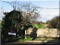
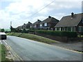
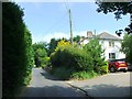
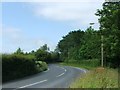
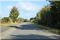
CT14 0LU is a small, residential postcode area in the Dover district of Kent, covering 23.4 hectares with a population of 1,462 people. It is part of the village of Northbourne, a civil parish with historical ties to monastic foundations, including Northbourne Court, which dates back to the 7th century. The area is defined by its compact size and low population density of 105 people per square kilometre, creating a quiet, close-knit community feel. Residents live in predominantly owner-occupied houses, reflecting the area’s stable demographic profile. The median age of 47 suggests a mature population, with the most common age range being adults aged 30–64. Nearby, the hamlets of Finglesham and Little Betshanger add to the rural character, while the proximity to Deal railway station (2.75 miles away) provides access to regional transport networks. The area is served by a mix of primary and independent schools, and residents benefit from good broadband and mobile connectivity scores of 83, ensuring practical digital access for daily life. Living in CT14 0LU offers a blend of historical heritage, small-community charm, and modern amenities within a manageable footprint.
- Area Type
- Postcode
- Area Size
- 23.4 hectares
- Population
- 1462
- Population Density
- 105 people/km²
The property market in CT14 0LU is characterised by high home ownership (76%) and a predominance of houses as the primary accommodation type. This suggests a market skewed towards owner-occupiers rather than renters, with properties likely to be family homes or long-term investments. The small area size (23.4 hectares) and low population density (105 people/km²) mean the housing stock is limited, potentially making the area competitive for buyers. The focus on houses rather than flats or apartments implies a preference for space and privacy, typical of rural or semi-rural settings. For prospective buyers, this means a smaller selection of properties, with potential for character homes given the area’s historical roots. However, the compact size of the postcode area means that the immediate surroundings—such as nearby hamlets like Finglesham—may offer additional options. The market is likely to be stable, with demand driven by the area’s low crime rates and proximity to transport links, though flood risk assessments may influence property values.
House Prices in CT14 0LU
No properties found in this postcode.
Energy Efficiency in CT14 0LU
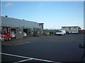
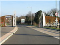
Living in CT14 0LU offers a mix of practical amenities and rural convenience. The area is served by five retail venues, including Co-op Mill, Tesco Deal, and Budgens Deal, providing access to essential shopping and services. Public transport options are varied, with five rail stations (Deal, Walmer, Sandwich) and two metro stations (Eythorne, Shepherdswell) within practical reach, enabling travel to nearby towns and cities. While the data does not specify parks or leisure facilities, the historical and rural setting of Northbourne suggests natural spaces may be available nearby. The presence of both primary and independent schools indicates a focus on education, though secondary options are not listed. Overall, the lifestyle in CT14 0LU balances small-community living with access to regional infrastructure, making it suitable for those prioritising convenience without sacrificing a quieter, more spacious environment.
Amenities
Schools
Residents of CT14 0LU have access to two primary schools: Northbourne Church of England Primary School and a second entry for the same institution, which may reflect duplication in the data. Additionally, Northbourne Park School, an independent school, serves the area. The presence of both state and independent education options provides families with choice, though the limited number of schools suggests a small student population. The primary school’s religious affiliation (Church of England) may appeal to families seeking faith-based education, while the independent school offers alternative curricula or facilities. However, the absence of secondary schools in the immediate area means students may need to travel to nearby towns for higher education. The mix of school types indicates a community that values both traditional and alternative educational pathways, though the limited selection could be a consideration for families prioritising a broad range of school options.
| Rank | School | Type | Entry gender | Ages |
|---|---|---|---|---|
| 1 | Northbourne Church of England Primary School | primary | N/A | N/A |
| 2 | Northbourne Park School | independent | N/A | N/A |
| 3 | Northbourne Church of England Primary School | primary | N/A | N/A |
Explore more schools in this area
Go to Schools tabDemographics
The population of CT14 0LU is 1,462, with a median age of 47 and the most common age range being adults aged 30–64. This suggests a community skewed towards middle-aged and older residents, with fewer younger families or retirees compared to other areas. Home ownership is high at 76%, indicating a stable, long-term resident base rather than a transient rental market. The accommodation type is predominantly houses, which aligns with the area’s rural and semi-rural character. The predominant ethnic group is White, though the data does not provide further breakdowns on diversity or deprivation levels. The population density of 105 people per square kilometre is relatively low, contributing to a spacious, less crowded living environment. This demographic profile suggests a community focused on stability, with residents likely prioritising property ownership and established living conditions. The absence of specific data on deprivation or socioeconomic status means the quality of life is inferred from the available statistics, which point to a balanced but unremarkable mix of age groups and household types.
Household Size
Accommodation Type
Tenure
Ethnic Group
Religion
Household Composition
Age
Household Deprivation
NS-SEC
Explore more demographic insights in this area
Go to Demographics tabPlanning
Planning Constraints
- Flood RiskPremium
- Ramsar Wetland SitesPremium
- Area of Outstanding Natural BeautyPremium
- Protected Nature ReservePremium
- Protected WoodlandPremium
- Crime RiskPremium