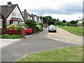
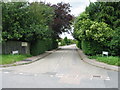
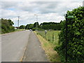
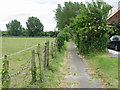
Area Overview for CT14 0BP
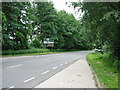
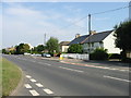
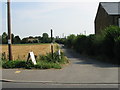
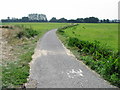
Photos of CT14 0BP
Area Information
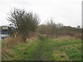
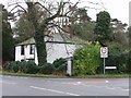
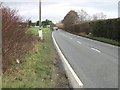
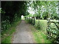
Living in CT14 0BP offers a quiet residential experience within a small cluster covering 5.9 hectares. This postcode serves a population of 1740 people, resulting in a density of 92 people per square kilometre. The location sits in the Dover District of Kent, approximately 2 kilometres south of Sandwich. The local history dates back significantly, with records showing an ancient parish and former chapelry of Eastry dating to the 16th century. Parish registers exist from 1720, and a bishop's transcript from 1564 confirms early habitation in this fertile soil area. The physical character features houses as the primary accommodation type. The area contains two public houses, including the historic Crispin Inn, which holds a local legend claiming King Henry V stayed there after the Battle of Agincourt in 1415. Religious life is centred around the parish church of St Peter and St Paul, a Norman structure from the 12th century restored in 1888. Daily life here is defined by proximity to the coast and agricultural heritage rather than urban sprawl. You will find yourself in a neighbourhood where the landscape supports early farming and the housing stock reflects redbrick traditions from the 16th century.
- Area Type
- Postcode
- Area Size
- 5.9 hectares
- Population
- 1740
- Population Density
- 92 people/km²
The property market in CT14 0BP is characterised by a predominantly owner-occupied landscape. With 85% of homes purchased outright, the area functions more as a settled residential zone than a dynamic rental market. The accommodation type is exclusively houses, which shapes the visual character and street furniture of the residential cluster. You are looking at a housing stock that includes traditional architecture, given the historical notes of 16th-century redbrick housing in the wider parish. This high ownership rate means limited rental availability and a buyer-led dynamic. Properties often stay in the same family for generations, creating a stable local market. When considering homes in CT14 0BP, you should expect properties of varying ages, from historic restorations like those near the 12th-century church to more modern builds accommodating the current population of 1740. The total area size of 5.9 hectares constrains new large-scale developments, focusing the market on existing houses. Buyers should understand that competition may be fierce for desirable properties due to the limited supply created by this small footprint. The market reflects the preferences of a mature demographic, likely favouring established family homes over high-density living.
House Prices in CT14 0BP
No properties found in this postcode.
Energy Efficiency in CT14 0BP
Daily life in CT14 0BP is enriched by a specific set of nearby amenities within easy reach. Residents have access to five retail outlets, including Co-op Sandwich, Spar, and Asda Discovery. These stores form the backbone of local shopping needs. For dining and socialising, you can visit the Crispin Inn, a public house with historical significance. The area also offers convenient rail access to Sandwich Railway Station, Deal Railway Station, and Walmer Railway Station. Further afield, commuters can utilise Ethyorre Station for specific transit needs. The Ramsgate Ferry Terminal provides coastal connections for those who prefer maritime travel. This blend of retail, dining, and transport creates a self-sufficient environment for locals. You do not need to travel far for groceries or daily essentials. The presence of these specific venues means that living here offers practical convenience without requiring long journeys. The amenities cater to standard household requirements, from routine shopping to leisure visits. The character of the area remains residential, with these services supporting rather than dominating the local environment.
Amenities
Schools
Families in CT14 0BP have access to several educational institutions within practical reach. The local school options include Worth Primary School, which serves the immediate community needs. You will also find Sir Roger Manwood's School, which operates as an academy and holds a good Ofsted rating. This positive inspection result indicates a standard of education recognised by the Department for Education. Further options include Sandwich Technology School, which appears twice in the local records with different classifications. One listing identifies it as a primary school, while another classifies it as an academy with an inadequate Ofsted rating. This mix of ratings presents a specific choice for parents. A homebuyer with school-age children must carefully evaluate which institution best fits their educational philosophy. The presence of multiple primary-level schools suggests a robust catchment area for young families. However, the variation in Ofsted ratings means quality is not uniform across all nearby options. You should consult the specific inspection reports for Sir Roger Manwood's School and Sandwich Technology School to understand the full picture. The proximity of these schools ensures that daily travel times remain manageable for residents of CT14 0BP. Schools near CT14 0BP provide the necessary infrastructure for community families to raise their children locally.
| Rank | School | Type | Entry gender | Ages |
|---|---|---|---|---|
| 1 | Worth Primary School | primary | N/A | N/A |
| 2 | Sir Roger Manwood's School | primary | N/A | N/A |
| 3 | Sandwich Technology School | primary | N/A | N/A |
| 4 | Sandwich Technology School | academy | N/A | N/A |
| 5 | Sir Roger Manwood's School | academy | N/A | N/A |
Explore more schools in this area
Go to Schools tabDemographics
The community in CT14 0BP is dominated by adults aged between 30 and 64 years. The median age for residents is 47, indicating a mature population profile. Home ownership is exceptionally high at 85%, suggesting long-term stability within the neighbourhood. This high rate of ownership implies that most families and individuals own their homes outright rather than renting. The predominant ethnic group in the area is White, aligning with the broader demographic trends of the surrounding Kent region. You will find that the local household composition supports low turnover and established roots. The accommodation type is strictly houses, meaning you will not encounter flats or apartments in typical developments. There are no specific data points provided regarding income levels or employment statistics, but the high ownership rate often correlates with settled communities. The environment supports a lifestyle where residents likely prioritize quality of life over rapid urban pace. The population density of 92 people per square kilometre ensures that the area feels spacious enough for privacy while maintaining community cohesion. This demographic profile makes CT14 0BP suitable for those seeking an established, non-transient residential setting with a strong local identity.
Household Size
Accommodation Type
Tenure
Ethnic Group
Religion
Household Composition
Age
Household Deprivation
NS-SEC
Explore more demographic insights in this area
Go to Demographics tabPlanning
Planning Constraints
- Flood RiskPremium
- Ramsar Wetland SitesPremium
- Area of Outstanding Natural BeautyPremium
- Protected Nature ReservePremium
- Protected WoodlandPremium