Area Overview for CT13 0WA
Photos of CT13 0WA


Area Information
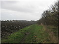
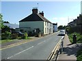
CT13 0WA is a specific postcode covering a small residential cluster within the historic town of Sandwich. This area sits in the Dover District of Kent, located on the River Stour in south-east England. The location draws upon a rich heritage as one of the original Cinque Ports, featuring preserved medieval buildings such as the Guildhall, St Mary Church, and the White Mill. Approximately 4,985 people live within the wider town, though the specific cluster identified by this postcode contains a population of 1,719. Residents benefit from a setting that balances ancient history with modern convenience. You will find yourself in an identifiable spot on the map where local knowledge matters as much as property listings. The area offers a sense of place that distinguishes it from generic suburban developments. Daily life here involves proximity to the harbour, the river, and the stone buildings that have witnessed centuries of English history. You are living in a community with deep roots, yet you remain close enough to the coast and main roads to access wider opportunities.
- Area Type
- Postcode
- Area Size
- Not available
- Population
- Not available
- Population Density
- Not available
The housing market in CT13 0WA is defined by a strong tendency towards owner occupation. With 61 per cent of homes owned, this is clearly an area where residents settle for the long term rather than a transient rental hub. The accommodation stock is dominated by houses, catering to those seeking private gardens and traditional layouts rather than flats or terraced conversions. This post code represents a small residential cluster, meaning inventory turnover will be slower than in larger towns. Buyers looking at homes in this postcode should expect to find traditional properties consistent with the town's medieval character. The high ownership rate often correlates with house prices that reflect the cost of entry into the owner-occupied market. You will find that transactions here involve negotiated agreements rather than the rapid lettings seen in university towns. The nature of the housing stock suggests suitability for families or empty nesters who value space and autonomy.
House Prices in CT13 0WA
No properties found in this postcode.
Energy Efficiency in CT13 0WA
Living in CT13 0WA offers practical access to a range of amenities within easy reach. Retail options include the Co-op Sandwich, Spar, and Asda Discovery, ensuring your weekly shopping needs are met without long journeys. For rail travellers, Sandwich Railway Station, Minster Railway Station, and Deal Railway Station are all considered within practical reach. If you prefer sea travel, the Ramsgate Ferry Terminal is the notable ferry option nearby, while Kent International Airport serves flight requirements. Travel by tram or metro is possible via the nearby Eythorne Station, providing another layer of connectivity. This mix of retail, rail, and transport hubs means your lifestyle is supported by essential services. You will find shops, dining, and travel outlets concentrated enough for convenience but spread enough to avoid overwhelming density.
Amenities
Schools
Education options for residents of CT13 0WA are anchored by one key institution. You have access to Sandwich Junior School, which is a primary school with an Outstanding Ofsted rating. This high standard of education is a significant draw for families considering homes in this postcode. While the data does not list secondary schools within the immediate proximity, the presence of a top-rated primary provider indicates a supportive educational foundation for younger children. Living in CT13 0WA means your children can start their education in an environment recognised for excellence. The specific location on the River Stour places you within practical reach of this school, aligning daily routines with high-quality learning opportunities. For those seeking schools near CT13 0WA, this facility provides a confirmed benchmark of performance without the uncertainty of unverified providers.
| Rank | School | Type | Entry gender | Ages |
|---|---|---|---|---|
| 1 | Sandwich Junior School | primary | N/A | N/A |
Explore more schools in this area
Go to Schools tabDemographics
The demographic profile of CT13 0WA reflects a mature and stable community. The median age in this area is 47 years, with adults between the ages of 30 and 64 forming the most common age range. This indicates a population made up largely of established households rather than young singles or families with very young children. Home ownership stands at a solid 61 per cent, suggesting that most residents own their properties outright or with a mortgage. The predominant ethnic group is White, aligning with the broader demographics of the Dover District. Housing in this cluster primarily consists of houses, which fits the profile of a family-oriented or longevity-led community. There is no data on deprivation levels for this specific postcode, so quality of life metrics rely on other factors. The age structure implies a lower churn rate compared to younger urban centres. You are looking at an area where long-term residents are the norm, creating a predictable environment for buyers seeking stability.
Household Size
Accommodation Type
Tenure
Ethnic Group
Religion
Household Composition
Age
Household Deprivation
NS-SEC
Explore more demographic insights in this area
Go to Demographics tabPlanning
Planning Constraints
- Flood RiskPremium
- Ramsar Wetland SitesPremium
- Area of Outstanding Natural BeautyPremium
- Protected Nature ReservePremium
- Protected WoodlandPremium