Area Overview for CT12 5HE
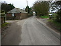
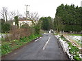
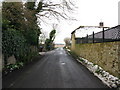
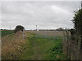
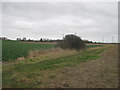
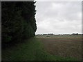
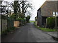
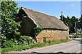
Photos of CT12 5HE


Area Information
CT12 5HE is a small, tightly knit residential postcode area in England, encompassing a compact cluster of homes with a population of 2253 people. Despite its modest size—just 2402 square metres—the area is densely populated, with 937,969 people per square kilometre. This density reflects a community that values proximity to local amenities and historical landmarks. Situated in the Isle of Thanet, the area benefits from its coastal heritage, with Ramsgate’s Royal Harbour—a unique mainland UK feature—just a short distance away. Daily life here is shaped by its seaside roots, blending historic architecture with modern convenience. Residents have easy access to nearby rail networks, ferry services, and retail hubs, while the area’s compact nature ensures a sense of familiarity. The postcode’s proximity to Ramsgate’s cultural and historical sites, such as the Shrine of St Augustine and Regency-era buildings, adds to its distinct character. For those seeking a balance between coastal charm and practical living, CT12 5HE offers a compact, well-connected environment with a strong local identity.
- Area Type
- Postcode
- Area Size
- 2402 m²
- Population
- Not available
- Population Density
- Not available
The property market in CT12 5HE is characterised by a 37% home ownership rate, indicating that a significant portion of the housing stock is rented. This suggests a rental market that may cater to both long-term residents and those seeking temporary accommodation. The accommodation type is primarily houses, which, given the area’s compact size, implies a focus on single-family homes rather than apartments or flats. This mix of ownership and rental properties could present opportunities for buyers seeking to invest in a stable, family-oriented market. However, the small area size and high population density may limit the availability of new developments, making properties in CT12 5HE potentially competitive. Buyers should consider the area’s proximity to transport links and amenities when evaluating its appeal, as these factors often drive demand in such densely populated regions.
House Prices in CT12 5HE
No properties found in this postcode.
Energy Efficiency in CT12 5HE
The lifestyle in CT12 5HE is enriched by a range of nearby amenities, including five retail outlets such as Spar, Tesco Ramsgate, and Morrisons Daily. These shops provide everyday essentials, while the proximity to rail stations and the Ramsgate Ferry Terminal ensures easy access to broader regional networks. The area’s coastal location also offers opportunities for leisure, with Ramsgate’s Royal Harbour and historic sites within reach. For residents, the blend of retail, transport, and historical attractions creates a convenient and varied daily life. The presence of multiple rail stations and a ferry terminal enhances mobility, allowing quick travel to nearby towns or for day trips. The compact nature of the area means that amenities are within practical reach, fostering a sense of community and accessibility. Whether shopping, commuting, or exploring the local heritage, CT12 5HE provides a well-rounded lifestyle.
Amenities
Schools
The nearest school to CT12 5HE is Newington Community Primary School, a primary school serving the local area. While the data does not specify Ofsted ratings, the presence of a primary school underscores the area’s suitability for families with young children. The repetition of the school’s name in the data may indicate its prominence or multiple campuses, though this requires clarification. For families, having a primary school nearby offers convenience and reduces the need for long commutes. However, the absence of secondary schools or additional educational institutions in the data means that parents may need to consider nearby towns for secondary education. The availability of a primary school, combined with the area’s transport links, could make CT12 5HE an attractive choice for those prioritising family-friendly living.
| Rank | School | Type | Entry gender | Ages |
|---|---|---|---|---|
| 1 | Newington Community Primary School | primary | N/A | N/A |
| 2 | Newington Community Primary School | primary | N/A | N/A |
Explore more schools in this area
Go to Schools tabDemographics
The community in CT12 5HE is predominantly composed of adults aged 30–64, with a median age of 47. This suggests a mature, stable population, likely with long-term ties to the area. Home ownership stands at 37%, indicating a mix of owner-occupied and rental properties, though the lower percentage points to a market where renting may be more common. The accommodation type is primarily houses, which, combined with the high population density, implies a mix of family homes and smaller dwellings. The predominant ethnic group is White, reflecting the broader demographic trends of the region. While specific data on deprivation is not provided, the high population density and reliance on rental housing may suggest varying levels of socioeconomic diversity. The age profile suggests a community with established families and professionals, though the absence of younger demographics may influence local services and amenities.
Household Size
Accommodation Type
Tenure
Ethnic Group
Religion
Household Composition
Age
Household Deprivation
NS-SEC
Explore more demographic insights in this area
Go to Demographics tabPlanning
Planning Constraints
- Flood RiskPremium
- Ramsar Wetland SitesPremium
- Area of Outstanding Natural BeautyPremium
- Protected Nature ReservePremium
- Protected WoodlandPremium
- Crime RiskPremium