Area Overview for CT11 9XN
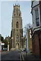
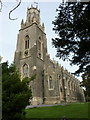
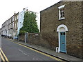
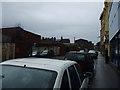
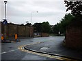
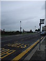
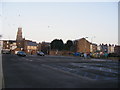
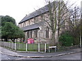
Photos of CT11 9XN
Area Information
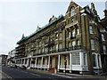
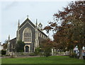
Living in CT11 9XN means being part of a small, tightly knit residential cluster in Ramsgate, a coastal town on the Isle of Thanet in Kent. With a population of 1,791, the area is compact but rich in history, defined by its Royal Harbour—the only one in mainland Britain—built in the 18th century. Ramsgate’s character stems from its role as a historic seaside resort, with Regency-era architecture and landmarks like the Shrine of St Augustine. The area’s proximity to the sea and its strategic location between London and the south coast make it a practical choice for commuters. Daily life here is shaped by its small-town feel, with a focus on local amenities and transport links. While the population is modest, the area’s mix of historical significance and modern infrastructure offers a unique blend of heritage and convenience. Residents benefit from nearby rail connections, a ferry terminal, and proximity to Kent International Airport, ensuring accessibility to both regional and national destinations.
- Area Type
- Postcode
- Area Size
- Not available
- Population
- Not available
- Population Density
- Not available
The property market in CT11 9XN is characterised by a low home ownership rate of 22%, meaning most residents rent their flats. This suggests a rental-focused market, with limited opportunities for owner-occupation within the area itself. The predominance of flats reflects a compact housing stock, likely suited to smaller households or couples. Given the area’s small size, buyers may need to look beyond CT11 9XN for larger properties or alternative housing types. The limited number of homes available also means competition for rentals and purchases is likely to be higher. For those considering the area, the focus should be on proximity to amenities like Ramsgate’s rail network and coastal attractions, which may outweigh the constraints of a small, flat-dominated housing stock.
House Prices in CT11 9XN
No properties found in this postcode.
Energy Efficiency in CT11 9XN
The lifestyle in CT11 9XN is shaped by its proximity to Ramsgate’s amenities, including five retail outlets such as Iceland, Waitrose, and The Southern Co-operative. The Ramsgate Ferry Terminal offers direct access to the Channel, while the nearby railway stations provide frequent services to major cities. Kent International Airport is within reach, adding to the area’s appeal for those needing regional or international travel. The coastal setting means residents can enjoy seaside walks, historic sites like the Royal Harbour, and local attractions such as the Clock House. The mix of retail, transport, and coastal access creates a practical, community-oriented lifestyle, though the small population means social opportunities are more limited compared to larger towns.
Amenities
Schools
| Rank | School | Type | Entry gender | Ages |
|---|
Explore more schools in this area
Go to Schools tabDemographics
CT11 9XN’s population of 1,791 is predominantly adults aged 30–64, with a median age of 47. This suggests a community of established professionals and families, rather than students or retirees. Home ownership is low at 22%, indicating a rental-heavy market, with flats being the primary accommodation type. The predominant ethnic group is White, reflecting the area’s demographic makeup. The age profile and home ownership figures suggest a stable but not rapidly growing population. The absence of specific data on deprivation means the area’s quality of life cannot be fully assessed, but the low flood risk and lack of environmental constraints imply a relatively safe and unobstructed living environment. However, the critical crime risk score of 1/100—well below average—raises concerns about safety, necessitating caution for residents.
Household Size
Accommodation Type
Tenure
Ethnic Group
Religion
Household Composition
Age
Household Deprivation
NS-SEC
Explore more demographic insights in this area
Go to Demographics tabPlanning
Planning Constraints
- Flood RiskPremium
- Ramsar Wetland SitesPremium
- Area of Outstanding Natural BeautyPremium
- Protected Nature ReservePremium
- Protected WoodlandPremium
- Crime RiskPremium