Area Overview for CT11 9EQ
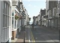
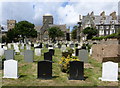
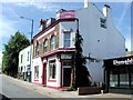
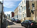
Photos of CT11 9EQ


Area Information
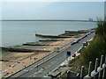
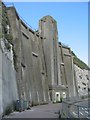
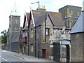
CT11 9EQ is a small residential postcode area nestled in Ramsgate, a historic coastal town on the Isle of Thanet in Kent. With a population of 1,813 spread across 1,012 square metres, this area is densely populated, reflecting the compact nature of its housing stock. Ramsgate itself is defined by its Royal Harbour, the only one in mainland Britain, and its 18th-century development as a seaside resort. Living here means proximity to a mix of historic sites, including the Shrine of St Augustine and Regency-era buildings on East Cliff. The area’s compact size and high population density suggest a tightly knit community, though the limited space may mean residents rely heavily on nearby amenities. The postcode’s location offers a blend of coastal charm and practical connectivity, with nearby rail stations and a ferry terminal providing links to surrounding areas. For those seeking a balance between heritage and modern convenience, CT11 9EQ’s character is shaped by its maritime history and accessible transport options.
- Area Type
- Postcode
- Area Size
- 1012 m²
- Population
- Not available
- Population Density
- Not available
The property market in CT11 9EQ is characterised by a 40% home ownership rate, with flats being the dominant accommodation type. This suggests a focus on smaller, multi-unit housing, which may cater to both renters and first-time buyers seeking affordable options. The high population density within a small area implies limited housing stock, potentially driving competition for properties. For buyers, the prevalence of flats could mean fewer large family homes, though the compact size of the postcode may offer proximity to amenities. The area’s small size also means the immediate surroundings are critical for property value considerations. Given the lack of protected natural areas or planning constraints, development opportunities may be more flexible, though the high population density could limit future expansion. Buyers should weigh the benefits of coastal proximity against the potential challenges of a tightly packed residential cluster.
House Prices in CT11 9EQ
No properties found in this postcode.
Energy Efficiency in CT11 9EQ
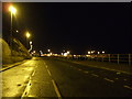
The lifestyle in CT11 9EQ is shaped by its proximity to a range of amenities. Retail options include five nearby shops, such as Waitrose Ramsgate and Co-op outlets, offering convenience for daily shopping. The Ramsgate Ferry Terminal provides access to coastal travel, while five rail stations, including Ramsgate Railway Station, ensure easy connections to broader networks. Kent International Airport is within reach for those needing air travel. The area’s historical character blends with modern practicality, with landmarks like the Royal Harbour and Regency-era buildings adding to its appeal. For leisure, the nearby coastline and historic sites offer recreational opportunities. However, the limited data on parks or green spaces means the extent of outdoor amenities remains unspecified. Overall, the mix of retail, transport, and coastal access creates a functional environment for residents.
Amenities
Schools
The only school explicitly mentioned near CT11 9EQ is The Old Priory School, a special school with a good Ofsted rating. This indicates a focus on supporting students with specific educational needs, though no mainstream schools are listed in the data. The presence of a special school may suggest the area caters to families requiring tailored educational provisions. However, the absence of primary or secondary schools raises questions about the availability of broader educational options for non-specialist learners. For families reliant on local schools, the limited data highlights the need to investigate further or consider nearby towns for additional schooling choices. The good Ofsted rating for The Old Priory School is a positive sign, but the overall school landscape in the immediate vicinity remains unclear.
| Rank | School | Type | Entry gender | Ages |
|---|---|---|---|---|
| 1 | The Old Priory School | special | N/A | N/A |
Explore more schools in this area
Go to Schools tabDemographics
The population of CT11 9EQ is predominantly adults aged 30–64, with a median age of 47. This suggests a community skewed toward middle-aged residents, likely established professionals or families. Home ownership rates stand at 40%, with flats being the primary accommodation type. This indicates a mix of owner-occupied and rental properties, though the lower home ownership percentage may reflect a higher proportion of tenants or shared housing. The predominant ethnic group is White, which aligns with broader demographic trends in the area. The age profile implies a stable, mature population, potentially with fewer young families compared to other regions. However, the absence of specific data on deprivation or income levels means the quality of life implications of these demographics remain unquantified. The community’s composition likely supports a quiet, low-traffic environment, though the high population density may influence local amenities and social dynamics.
Household Size
Accommodation Type
Tenure
Ethnic Group
Religion
Household Composition
Age
Household Deprivation
NS-SEC
Explore more demographic insights in this area
Go to Demographics tabPlanning
Planning Constraints
- Flood RiskPremium
- Ramsar Wetland SitesPremium
- Area of Outstanding Natural BeautyPremium
- Protected Nature ReservePremium
- Protected WoodlandPremium
- Crime RiskPremium