Area Overview for CT11 9DL
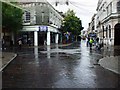
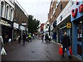
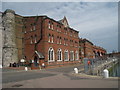
Photos of CT11 9DL

Area Information
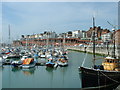
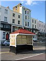
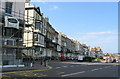
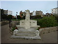
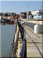
CT11 9DL is a small, densely populated residential area in Ramsgate, Kent, encompassing 388 square metres and home to 1,937 residents. This coastal town, known for its historic Royal Harbour—the only one in mainland Britain—offers a mix of historical significance and modern living. Ramsgate’s development as a seaside resort from the 18th century is reflected in its architecture, including Regency buildings and the 19th-century Clock House. The area’s compact size and high population density of 4,986,420 people per square kilometre suggest a tightly knit community. Residents here are predominantly adults aged 30–64, with a median age of 47, and the area is characterised by a high proportion of flats. While the postcode lacks natural beauty designations, its proximity to the sea and historic sites like the Shrine of St Augustine provide cultural and recreational value. Living in CT11 9DL means navigating a vibrant, compact environment with easy access to coastal amenities, though the high population density may influence the pace of daily life.
- Area Type
- Postcode
- Area Size
- 388 m²
- Population
- Not available
- Population Density
- Not available
The property market in CT11 9DL is dominated by flats, with 44% of homes owned by residents and the remainder likely rented. This suggests a rental market with limited owner-occupied properties, which may affect the availability of long-term investment opportunities. The small area size and high population density indicate a compact housing stock, potentially limiting property diversity. For buyers, this means a focus on flats rather than detached or semi-detached homes. The area’s proximity to Ramsgate’s coastal amenities and transport links may enhance its appeal, though the high population density could influence property values and availability. Given the small size of the postcode, buyers should consider the immediate surrounding areas for more housing options. The predominance of flats also implies a community-oriented living environment, suitable for those prioritising convenience over larger living spaces.
House Prices in CT11 9DL
No properties found in this postcode.
Energy Efficiency in CT11 9DL
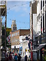
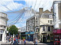
Living in CT11 9DL offers access to a range of amenities within practical reach. Retail options include Iceland Ramsgate, Waitrose Ramsgate, and The Southern Co-operative, providing grocery and household essentials. The Ramsgate Ferry Terminal facilitates sea travel, while five railway stations—Ramsgate, Dumpton Park, and Broadstairs—offer connections to the wider region. Kent International Airport is also nearby, catering to air travel needs. The area’s compact size ensures these amenities are easily accessible, supporting a convenient lifestyle. Residents can enjoy coastal walks, historic sites like the Royal Harbour, and cultural landmarks such as the Shrine of St Augustine. The mix of retail, transport, and recreational options makes daily life in CT11 9DL practical and varied, though the high population density may influence the pace of urban living.
Amenities
Schools
Residents of CT11 9DL have access to Clarendon House Grammar School, which operates as both a primary school and an academy. This dual designation offers families a range of educational options, though specific Ofsted ratings are not provided in the data. The presence of a primary school ensures early education is accessible within the area, while the academy may cater to older students or offer specialist programmes. The combination of school types suggests a focus on both foundational and advanced education, which could be beneficial for families seeking varied schooling. However, the lack of additional schools in the data means the educational landscape is limited to these two institutions. Parents should consider whether these schools meet their child’s needs, particularly if specialist provisions or a broader range of options are required.
| Rank | School | Type | Entry gender | Ages |
|---|---|---|---|---|
| 1 | Clarendon House Grammar School | primary | N/A | N/A |
| 2 | Clarendon House Grammar School | academy | N/A | N/A |
Explore more schools in this area
Go to Schools tabDemographics
The community in CT11 9DL is predominantly composed of adults aged 30–64, with a median age of 47. Home ownership accounts for 44% of properties, while the remaining 56% are likely rented, reflecting a mix of owner-occupied and rental housing. The area is characterised by flats as the primary accommodation type, which aligns with the high population density. The predominant ethnic group is White, though specific data on diversity or deprivation is not provided. The age profile suggests a mature population, potentially influencing local services and amenities. With 1,937 residents in a small area, social interactions and community cohesion may be pronounced. However, the lack of data on income distribution or deprivation means the quality of life in terms of access to services cannot be fully assessed from the available information.
Household Size
Accommodation Type
Tenure
Ethnic Group
Religion
Household Composition
Age
Household Deprivation
NS-SEC
Explore more demographic insights in this area
Go to Demographics tabPlanning
Planning Constraints
- Flood RiskPremium
- Ramsar Wetland SitesPremium
- Area of Outstanding Natural BeautyPremium
- Protected Nature ReservePremium
- Protected WoodlandPremium
- Crime RiskPremium