Area Overview for CT11 8AD
Photos of CT11 8AD


Area Information
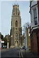
CT11 8AD represents a small residential cluster of just 1.1 hectares, hosting a population of 1435 people. This tight-knit location sits within the historic Royal town of Ramsgate on the Isle of Thanet, offering a specific slice of local life defined by ownership and proximity to the coast. The area size creates a natural boundary, resulting in close proximity between homes and community hubs. Living in CT11 8AD means residing in an environment where the resident count is low enough to foster neighbourliness yet integrated into the wider town. You will find yourself in a space where daily routines are shaped by the surrounding villages and the coastal town itself. The postcode covers distinct housing ground that sits apart from the broader municipal sprawl. Understanding the scale of this borough is key, as it defines the immediate physical world you will inhabit. The density suggests a established settlement rather than a developing estate, grounding you in a place with historical roots dating back to Anglo-Saxon times. Your daily life here involves a specific rhythm dictated by this compact footprint. This location offers a direct connection to the wider coastal environment without the anonymity of larger urban centres.
- Area Type
- Postcode
- Area Size
- 1.1 hectares
- Population
- Not available
- Population Density
- Not available
You are looking at a market dominated by houses, as this is the specific accommodation type found throughout CT11 8AD. The fact that 68% of residents own their homes tells you this is primarily an owner-occupied area rather than a rental hub. This high ownership figure means you will not encounter large blocks of social housing or short-term leasehold units in this immediate radius. The property stock consists of houses, which typically offer more space and garden areas than flats or apartments. Buying here means securing a home with potentially more historical character, aligning with the area's age. The 1.1 hectare size of the postcode indicates a contained market, possibly meaning competition for available homes could be immediate when new stock hits the market. The dominance of houses also suggests price points may reflect property sizes common in UK coastal towns. You are entering a market where capital growth often correlates with the stability of owner-occupation rather than speculative investment. The concentration of owner-occupiers creates a market less sensitive to rental yield targets, focusing instead on living standards and tenure security.
House Prices in CT11 8AD
No properties found in this postcode.
Energy Efficiency in CT11 8AD
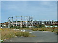
Your daily life in CT11 8AD is supported by a practical network of amenities within easy reach. You have 5 retail outlets close by, including Tesco Hereson, Aldi Hardres, and Iceland Ramsgate. These venues provide sufficient shopping options for groceries and daily household needs without requiring long journeys. Transport links are equally convenient, with 5 rail connections nearby. Dumpton Park Railway Station, Ramsgate Railway Station, and Broadstairs Railway Station offer easy access to wider Kent and London. Additionally, Ramsgate Ferry Terminal provides 1 ferry link, ideal for visitors or travel to northern Europe. You also have access to 1 airport, Kent International Airport, although this routes through the broader region rather than the immediate estate. Living in CT11 8AD means balancing the quiet residential cluster with these immediate services. The convenience of Tesco Hereson and Aldi Hardres means weekly shopping trips remain short. Rail and ferry connections integrate you into the town of Ramsgate, allowing you to access its historic Royal Harbour and beaches when you wish. This mix of local retail and broader transport hubs offers a lifestyle that is both convenient and connected to the coast.
Amenities
Schools
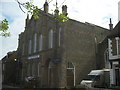
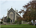
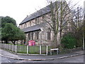
Families living in CT11 8AD have specific educational options within their reach, though the selection is limited. St Ethelbert's Catholic Primary School serves the local catchment as a primary institution and holds a Ofsted rating of Good. This provides a secure educational foundation for younger children in the area. For specialist education needs, East Court School is located nearby and specialises in special educational requirements. The presence of only one primary school and one special school near CT11 8AD means families must often look further for secondary options. The mixture of school types reflects the practical needs of a community with a median age of 47, where many children are older or local schools cater to specific niches. St Ethelbert's Catholic Primary School being rated Good is a concrete quality marker for this demographic. Families should verify catchment boundaries carefully, as the small footprint of the residential cluster means broader district planning applies. The lack of comprehensive secondary schools within the immediate vicinity is a logistical reality you must plan for. Choosing homes in CT11 8AD requires an understanding of these educational constraints and the commute times to outside schools.
| Rank | School | Type | Entry gender | Ages |
|---|---|---|---|---|
| 1 | St Ethelbert's Catholic Primary School | primary | N/A | N/A |
| 2 | East Court School | special | N/A | N/A |
Explore more schools in this area
Go to Schools tabDemographics
The community in CT11 8AD is defined by a mature demographic profile where the median age stands at 47 years. Adults aged between 30 and 64 years constitute the most common age range in the area, indicating a resident population that has largely settled down. Household stability is high, with 68% of residents owning their homes, which signals a deep-rooted connection to the locality. Houses form the predominant accommodation type, suggesting a landscape of detached or semi-detached family dwellings rather than high-rise blocks. The ethnic composition is predominantly White, reflecting the broader town's character. This demographic data paints a picture of a stable neighbourhood where long-term residents value their homes. The high ownership rate of 68% implies that financial pressure from monthly rentals is less prevalent than in younger housing markets. With a median age of 47, the neighbourhood likely sees less transient population turnover compared to university towns or commuter hotspots for workers in their twenties. You are joining a demographic that prioritises long-term investment and family stability. The lack of young children in the primary age bracket might mean schools are less crowded than in areas with younger populations. This age distribution supports a quiet, orderly atmosphere where community cohesion takes precedence.
Household Size
Accommodation Type
Tenure
Ethnic Group
Religion
Household Composition
Age
Household Deprivation
NS-SEC
Explore more demographic insights in this area
Go to Demographics tabPlanning
Planning Constraints
- Flood RiskPremium
- Ramsar Wetland SitesPremium
- Area of Outstanding Natural BeautyPremium
- Protected Nature ReservePremium
- Protected WoodlandPremium
- Crime RiskPremium