Area Overview for CT11 7RT
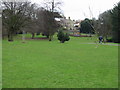
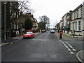
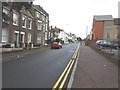
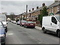
Photos of CT11 7RT
Area Information
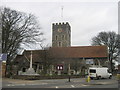
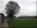
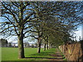
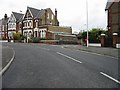
Living in CT11 7RT means residing in a compact residential cluster within the wider coastal town of Ramsgate. This postcode covers an area of just over 2,700 square metres, creating a densely populated environment where 1,584 residents share the local streets. The community sits in Kent, South East England, defined by its proximity to the historic Royal Harbour and the development of the area as a seaside resort since the 18th century. You are entering a neighbourhood shaped by a history that stretches back to the Anglo-Saxon name 'Hræfn's geat' and the arrival of St Augustine in AD 597. The site includes significant heritage landmarks such as the Church of St Laurence and the Regency buildings on East Cliff, adding character to the immediate surroundings. Daily life here is influenced by the town's maritime roots and its role during major historical events like the Napoleonic Wars and the Dunkirk evacuation. The high density suggests closely knit streets where neighbours know one another. While the area size is small, the location offers direct access to the unique Royal Harbour, which remains the only one of its kind in mainland Britain. Your daily routine will be shaped by easy access to these historic sites and the modern facilities that now serve the population. The combination of a rich past and a focused residential footprint defines the experience of moving into this specific cluster.
- Area Type
- Postcode
- Area Size
- 2722 m²
- Population
- Not available
- Population Density
- Not available
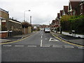
The property market in CT11 7RT is characterised by a strong preference for owning homes over renting. With 66% of the population registered as homeowners, this is distinctly an owner-occupied area rather than a transient rental hub. The predominant accommodation type listed for the area is houses, indicating that the physical stock consists mainly of detached or semi-detached family structures rather than flats or terraced dwellings. This housing profile suits the typical resident aged between 30 and 64 years, who often requires private storage space and garden areas found in houses. Buyers looking at this small cluster should expect a market driven by existing residents upgrading their properties or families consolidating into single-family homes. The high rate of home ownership implies that most transactions here involve buying and selling owner-occupied homes, potentially with a slower turnover than in new-build estates. When you search for homes in CT11 7RT, you are likely targeting properties owned by people who have lived in the community for an extended period. The lack of flat options in the default accommodation data reinforces the idea that this postcode serves a specific family demographic. The 2,722 square metres of land area limits the total number of homes, making available properties rare and valuable. Your search should focus on identifying which existing houses have come onto the market, as the overwhelming majority of stock remains in private hands. This market structure ensures that prices remain sensitive to the specific needs of the local adult population.
House Prices in CT11 7RT
No properties found in this postcode.
Energy Efficiency in CT11 7RT
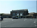
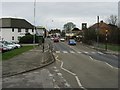
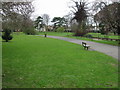
Your daily lifestyle in CT11 7RT benefits from a well-defined set of nearby amenities that cover retail, transport, and leisure needs. Five railway stations serve the wider area, including Ramsgate Railway Station, Dumpton Park Railway Station, and Broadstairs Railway Station, ensuring you are never far from a train line. For shopping, five retail locations are within easy reach, such as Asda Ramsgate, Aldi Hardres, and The Southern Co-operative Co. These supermarkets provide you with all the essentials without the need to travel far beyond the local town centre. Transport links are further enhanced by the Ramsgate Ferry Terminal, which connects Kent to France, and Kent International Airport, which is close enough for weekend getaways. The area's rich history is evident in landmarks like the Royal Harbour, built between 1749 and 1850, and the Church of St Laurence. You can explore the Shrine of St Augustine or walk along Madeira Walk at your leisure. The presence of the 19th-century Clock House, which originally housed a lifeboat station from 1802, adds a layer of historical interest to your walks. Kingston Road runs through the area, connecting you to the wider town infrastructure. The Nottingham Road area offers additional access points to commercial and residential zones. Your social life can revolve around the historic pubs and eateries found near the East Cliff and Wellington Crescent. The location allows you to enjoy a seaside lifestyle while maintaining convenient access to national transport networks and daily shopping necessities.
Amenities
Schools
| Rank | School | Type | Entry gender | Ages |
|---|
Explore more schools in this area
Go to Schools tabDemographics
The community in CT11 7RT is defined by a mature population with a median age of 47 years. The most common age group consists of adults between 30 and 64 years old, indicating a neighbourhood favoured by families and established professionals rather than young students or retirees. This age profile suggests a stable environment where long-term residents dominate the street scene. Home ownership stands at 66%, a significant majority that points to a settled community where many families have put down roots. The predominant accommodation type is houses, which aligns with the owner-occupied nature of the area and the habits of the adult demographic. White residents form the predominant ethnic group, reflecting the traditional demographic makeup of many South East English coastal towns. The presence of nearly two-thirds homeowners suggests a lower level of turnover compared to high-rental zones. This stability means you will likely encounter established front garden occurrences and known neighbours rather than a mobile renter population. The demographic skew towards middle-aged adults means local shops and services cater to practical family needs. The high density of 581,956 people per square kilometre, while technically an anomaly for such a small postcode footprint, underscores the intensity of residential clustering in this specific slice of Ramsgate. You are looking at a domain where the typical resident is a young adult to middle-aged professional seeking ownership in a coastal setting.
Household Size
Accommodation Type
Tenure
Ethnic Group
Religion
Household Composition
Age
Household Deprivation
NS-SEC
Explore more demographic insights in this area
Go to Demographics tabPlanning
Planning Constraints
- Flood RiskPremium
- Ramsar Wetland SitesPremium
- Area of Outstanding Natural BeautyPremium
- Protected Nature ReservePremium
- Protected WoodlandPremium
- Crime RiskPremium