Area Overview for CT11 0QU
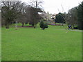
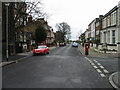
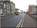
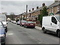
Photos of CT11 0QU
Area Information
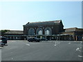
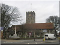
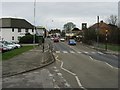
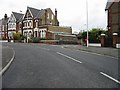
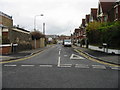
Living in CT11 0QU, a small residential cluster in Ramsgate, Kent, means being part of a coastal town steeped in history. With a population of 1,584 spread over 2,482 square metres, the area is densely populated yet retains a distinct character shaped by its Royal Harbour, a rare mainland UK feature built in the 18th century. Ramsgate’s identity as a historic seaside resort is evident in its Regency architecture, narrow streets, and proximity to the North Sea. Daily life here balances the charm of a traditional town with modern conveniences. The area’s compact size fosters a close-knit community, though the high population density of 638,098 people per square kilometre means space is limited. Residents benefit from nearby amenities, including rail links and retail outlets, while the town’s heritage offers walking routes along the East Cliff and visits to landmarks like the Shrine of St Augustine. For buyers, CT11 0QU represents a blend of historical significance and practical living, though its small footprint means proximity to larger services in Thanet or London is essential.
- Area Type
- Postcode
- Area Size
- 2482 m²
- Population
- Not available
- Population Density
- Not available
The property market in CT11 0QU is characterised by a high rate of home ownership (66%) and a predominance of houses. This suggests a market skewed towards owner-occupied properties rather than rentals, which may reflect the area’s historic housing stock and limited availability of newer developments. The compact size of the area, combined with its high population density, means the housing stock is likely to be tightly clustered, with little scope for expansion. For buyers, this presents a challenge: the small footprint limits the number of available properties, and the focus on houses rather than flats or apartments may restrict options for those seeking different housing types. However, the high ownership rate could indicate stable property values and a reliable market for long-term investment. Prospective buyers should consider the area’s proximity to larger towns like Ramsgate or Margate for additional housing diversity.
House Prices in CT11 0QU
No properties found in this postcode.
Energy Efficiency in CT11 0QU
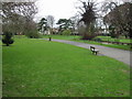
Living in CT11 0QU offers access to a mix of retail, transport, and travel options within practical reach. The area is served by five retail outlets, including Tesco Ramsgate, Morrisons Daily, and The Southern Co-operative, providing everyday shopping needs. Rail connectivity is strong, with five stations offering links to Ramsgate, Dumpton Park, and Broadstairs, facilitating travel to nearby towns and cities. A ferry terminal at Ramsgate connects residents to coastal destinations, while Kent International Airport is within reach for those needing air travel. The area’s proximity to Ramsgate’s historic sites, such as the Royal Harbour and Regency buildings, adds cultural value to daily life. While the small footprint limits local parks or leisure facilities, the town’s coastal setting and nearby attractions compensate with walking routes, historic walks, and access to larger services in Thanet. This blend of convenience and character defines the lifestyle in CT11 0QU.
Amenities
Schools
| Rank | School | Type | Entry gender | Ages |
|---|
Explore more schools in this area
Go to Schools tabDemographics
The community in CT11 0QU is predominantly middle-aged, with a median age of 47 and the most common age range being adults aged 30–64. This suggests a stable population with established households, likely reflecting the area’s appeal to families and professionals. Home ownership is high at 66%, indicating a strong presence of long-term residents rather than renters. The accommodation type is primarily houses, which aligns with the area’s historic character and limited space. The predominant ethnic group is White, though no specific data on diversity or deprivation is provided. The age profile and ownership figures suggest a mature, settled community with fewer young families or transient populations. This demographic structure may influence local services and amenities, which cater more to adult needs than to children or elderly residents.
Household Size
Accommodation Type
Tenure
Ethnic Group
Religion
Household Composition
Age
Household Deprivation
NS-SEC
Explore more demographic insights in this area
Go to Demographics tabPlanning
Planning Constraints
- Flood RiskPremium
- Ramsar Wetland SitesPremium
- Area of Outstanding Natural BeautyPremium
- Protected Nature ReservePremium
- Protected WoodlandPremium
- Crime RiskPremium