Area Overview for CT10 3ND
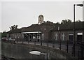
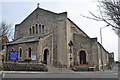
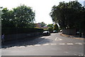
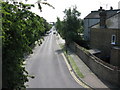
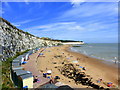
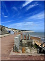
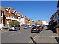
Photos of CT10 3ND
Area Information
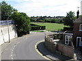
CT10 3ND lies within the coastal town of Broadstairs and St Peter’s in Kent, a historic area shaped by its Jutish roots and 14th-century fishing heritage. With a population of 1,359, it is a small, tightly knit residential cluster blending inland village charm with seaside accessibility. The area’s character is defined by its proximity to the Isle of Thanet’s cliffs, historic landmarks like the Shrine of Our Lady, and the 18th-century smuggling tunnels. Daily life here is influenced by its coastal location, with residents enjoying a mix of quiet village life and easy access to nearby towns. The postcode’s limited size means a close-knit community, where amenities like Broadstairs Railway Station and Ramsgate Ferry Terminal provide connectivity to larger centres. This is an area where history and modernity intersect, with broadband rated at 100 (excellent) and a low crime score, making it appealing for those seeking a tranquil yet well-connected lifestyle.
- Area Type
- Postcode
- Area Size
- Not available
- Population
- 1359
- Population Density
- Not available
CT10 3ND is overwhelmingly an owner-occupied area, with 91% of homes owned by residents rather than rented. The housing stock is dominated by houses, not flats, reflecting a preference for standalone properties in this small, rural postcode. This suggests a market tailored to families and professionals seeking private, spacious living. Given the area’s limited size, property availability is constrained, making it a niche market for buyers prioritising proximity to coastal amenities and historical sites. The high home ownership rate indicates strong community retention, with few rental properties available. Buyers should consider the area’s proximity to Broadstairs’ amenities, including retail and transport links, but note that the small population means limited scope for new developments.
House Prices in CT10 3ND
No properties found in this postcode.
Energy Efficiency in CT10 3ND
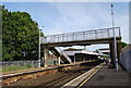
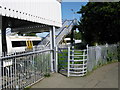
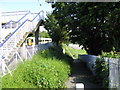
Living in CT10 3ND offers access to a range of practical amenities, from retail to transport. Nearby shops include Budgens, Co-op, and Tesco in Broadstairs, providing everyday essentials. The area’s coastal location brings leisure opportunities, with historical sites like the Shrine of Our Lady and the 18th-century smuggling tunnels adding local character. The Broadstairs & St Peter’s Chamber of Commerce promotes tourism, enhancing the town’s appeal. For transport, the Ramsgate Ferry Terminal and multiple railway stations ensure easy travel, while Kent International Airport caters to regional and international travel. This mix of retail, history, and connectivity creates a lifestyle that balances convenience with the charm of a historic coastal town.
Amenities
Schools
| Rank | School | Type | Entry gender | Ages |
|---|
Explore more schools in this area
Go to Schools tabDemographics
The population of CT10 3ND has a median age of 47, with the majority of residents aged 30–64. This suggests a community skewed toward middle-aged adults, likely including families and professionals. Home ownership is exceptionally high at 91%, indicating a stable, long-term resident base. The area is predominantly composed of houses, not flats, which aligns with the demographic profile of older, established households. The predominant ethnic group is White, though no specific data on diversity or deprivation is provided. The age range and ownership figures imply a mature, settled population with fewer transient residents. This profile may appeal to buyers seeking a quiet, family-friendly environment with minimal turnover. The absence of specific diversity metrics means the community’s cultural makeup remains unquantified, but the data suggests a homogeneous, stable demographic.
Household Size
Accommodation Type
Tenure
Ethnic Group
Religion
Household Composition
Age
Household Deprivation
NS-SEC
Explore more demographic insights in this area
Go to Demographics tabPlanning
Planning Constraints
- Flood RiskPremium
- Ramsar Wetland SitesPremium
- Area of Outstanding Natural BeautyPremium
- Protected Nature ReservePremium
- Protected WoodlandPremium
- Crime RiskPremium