Area Overview for CT10 2RL
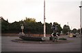
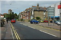
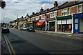
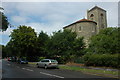
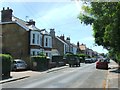
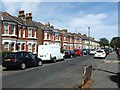
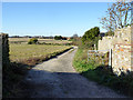
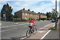
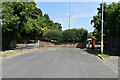
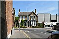
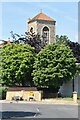
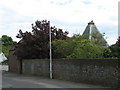
Photos of CT10 2RL
Area Information
CT10 2RL is a small, densely populated residential cluster in the Isle of Thanet, Kent, encompassing parts of the coastal town of Broadstairs and the historic village of St Peter’s. With a population of 1,437 spread over just 1.8 hectares, it is a compact area with a strong sense of community. The postcode lies in a region steeped in history, from the 14th-century fishing hamlet of Broadstairs to the medieval parish church of St Peter’s. Daily life here is shaped by its coastal location, with easy access to the sea and nearby amenities. The area benefits from proximity to Broadstairs Railway Station and Ramsgate Ferry Terminal, linking residents to broader networks. Its compact size means residents are close to local shops, schools, and historic sites like the Shrine of Our Lady. The mix of traditional architecture and modern infrastructure reflects its evolution from a seaside resort to a contemporary residential hub, blending heritage with practical living.
- Area Type
- Postcode
- Area Size
- 1.8 hectares
- Population
- 1437
- Population Density
- 1859 people/km²
CT10 2RL is predominantly an owner-occupied area, with 72% of homes owned by residents rather than rented. The accommodation type is mainly houses, which is typical for small, established residential clusters. Given the area’s size and high population density, the housing stock is limited, making it a niche market for buyers seeking proximity to coastal amenities and historic sites. The focus on houses rather than flats or apartments suggests a preference for private, family-friendly living. Buyers should consider the area’s compact nature, which means properties are likely to be close to local shops, schools, and transport links. The high home ownership rate also indicates a stable market, with fewer turnover pressures compared to rental-heavy areas. However, the small size of CT10 2RL means that buyers may need to look beyond immediate surroundings for larger housing options.
House Prices in CT10 2RL
No properties found in this postcode.
Energy Efficiency in CT10 2RL
Living in CT10 2RL offers access to a range of amenities within practical reach. Retail options include Asda Broadstairs, Co-op St, and Budgens Broadstairs, providing everyday shopping needs. The area’s proximity to Broadstairs Railway Station and Ramsgate Ferry Terminal ensures easy access to wider networks, while Kent International Airport is available for those requiring air travel. Historically, the area was a seaside resort, and this legacy persists in its character, with landmarks like the Shrine of Our Lady and Waterloo Stairs adding to its appeal. The local economy is supported by tourism and the Broadstairs & St Peter’s Chamber of Commerce, which funds community initiatives. Residents benefit from a mix of retail, transport, and historical sites, creating a lifestyle that balances convenience with a connection to the past.
Amenities
Schools
Residents of CT10 2RL have access to a range of educational institutions. Bromstone Primary School in Broadstairs is a primary school with a good Ofsted rating, offering a solid foundation for younger children. The Charles Dickens School serves as both a primary school and an academy, with the latter also holding a good Ofsted rating. This mix of school types provides families with options, from traditional primary education to academies that may offer specialized curricula or resources. The presence of two schools with good ratings suggests a commitment to quality education in the area. For families, this means a choice between established primary institutions and academies that may align with specific educational preferences. The proximity of these schools to CT10 2RL ensures that daily commutes for children are manageable, reinforcing the area’s appeal for families.
| Rank | School | Type | Entry gender | Ages |
|---|---|---|---|---|
| 1 | Bromstone Primary School, Broadstairs | primary | N/A | N/A |
| 2 | The Charles Dickens School | primary | N/A | N/A |
| 3 | The Charles Dickens School | academy | N/A | N/A |
Explore more schools in this area
Go to Schools tabDemographics
The population of CT10 2RL is predominantly adults aged 30–64, with a median age of 47. This suggests a mature, stable community, likely with established families and professionals. Home ownership is high at 72%, indicating a strong presence of long-term residents. The accommodation type is primarily houses, which aligns with the area’s residential character and suggests a preference for private, family-oriented living. The predominant ethnic group is White, reflecting the broader demographic trends in the Isle of Thanet. The high population density of 78,985 people per square kilometre is notable for such a small area, implying a mix of compact housing and shared spaces. This density, combined with the age profile, suggests a community focused on stability and proximity to local services, with limited reliance on rental properties.
Household Size
Accommodation Type
Tenure
Ethnic Group
Religion
Household Composition
Age
Household Deprivation
NS-SEC
Explore more demographic insights in this area
Go to Demographics tabPlanning
Planning Constraints
- Flood RiskPremium
- Ramsar Wetland SitesPremium
- Area of Outstanding Natural BeautyPremium
- Protected Nature ReservePremium
- Protected WoodlandPremium