Area Overview for CT10 1HX
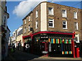
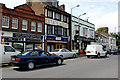
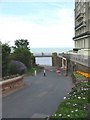
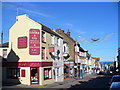
Photos of CT10 1HX
Area Information
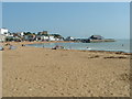
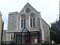
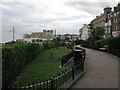
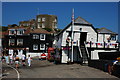
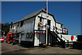
CT10 1HX lies within the coastal town of Broadstairs and St. Peter’s on the Isle of Thanet, Kent. This small residential cluster covers just 611 m², yet it is densely populated, with 1,174 residents packed into a compact area. The postcode area reflects a blend of history and modernity, with roots tracing back to the 7th century Jutish settlement of St Peter’s and the 14th-century fishing hamlet of Broadstairs. Today, the area thrives as a coastal community with access to both seaside charm and inland amenities. Daily life here is shaped by proximity to rail networks, retail hubs, and the nearby Ramsgate Ferry Terminal, which connects to the mainland. The population density of 1,920,844 people per km² underscores its compact nature, where residents share a tight-knit environment. While the area lacks sprawling green spaces, its historical landmarks—such as the Shrine of Our Lady and Waterloo Stairs—add cultural depth. For buyers, CT10 1HX offers a unique mix of coastal living and practical connectivity, though its small size means every decision about living here is intimate and immediate.
- Area Type
- Postcode
- Area Size
- 611 m²
- Population
- 1174
- Population Density
- 3952 people/km²
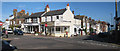
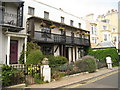
The property market in CT10 1HX is characterised by a strong presence of owner-occupied homes, with 56% of residents owning their properties. This contrasts with areas where rental markets dominate, indicating a preference for long-term investment in local housing. The accommodation type is primarily houses, which are more common than flats or apartments in this postcode. Given the small area size of 611 m², the housing stock is likely limited, with properties clustered closely together. This density may mean that buyers must consider proximity to neighbours and shared amenities. The high proportion of homeowners suggests a stable market, but the small scale of the area could limit availability for new buyers. Those seeking properties in CT10 1HX may find a focus on character homes, reflecting the area’s historical roots. However, the compact nature of the postcode means that the immediate surroundings—such as nearby villages or coastal areas—may offer more options for those prioritising space or specific architectural styles.
House Prices in CT10 1HX
No properties found in this postcode.
Energy Efficiency in CT10 1HX
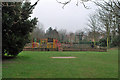
Living in CT10 1HX offers access to a range of practical amenities within easy reach. The area is served by five rail stations, including Broadstairs and Dumpton Park, facilitating travel to nearby towns and cities. For retail needs, residents can shop at Co-op Broadstairs, Budgens Broadstairs, and Iceland Broadstairs, ensuring everyday essentials are within walking distance. The Ramsgate Ferry Terminal provides a direct link to the mainland, while Kent International Airport offers regional and international flight connections. The coastal setting also brings leisure opportunities, with historical landmarks such as the Shrine of Our Lady and Waterloo Stairs adding cultural value. The compact nature of the area means that daily life is efficient, with minimal travel required for most needs. However, the absence of large parks or recreational spaces suggests that residents may need to venture slightly further for outdoor activities. The blend of retail, transport, and historical sites creates a lifestyle that balances convenience with the charm of a small coastal community.
Amenities
Schools
| Rank | School | Type | Entry gender | Ages |
|---|
Explore more schools in this area
Go to Schools tabDemographics
The community in CT10 1HX is predominantly composed of adults aged 30-64, with a median age of 47. This suggests a mature population, likely with established careers and families. Home ownership stands at 56%, indicating a stable housing market where nearly half of residents own their properties. The accommodation type is primarily houses, which contrasts with areas dominated by flats or apartments. The predominant ethnic group is White, reflecting the area’s historical and cultural continuity. With no specific data on diversity or deprivation, the demographic profile suggests a cohesive, middle-aged population with a focus on long-term residency. The high proportion of homeowners may imply a lower turnover of properties, fostering a sense of permanence. However, the absence of detailed information on income levels or deprivation means the quality of life in terms of access to services remains unquantified. The age profile also suggests a community with a strong presence of professionals and retirees, shaping local needs and amenities.
Household Size
Accommodation Type
Tenure
Ethnic Group
Religion
Household Composition
Age
Household Deprivation
NS-SEC
Explore more demographic insights in this area
Go to Demographics tabPlanning
Planning Constraints
- Flood RiskPremium
- Ramsar Wetland SitesPremium
- Area of Outstanding Natural BeautyPremium
- Protected Nature ReservePremium
- Protected WoodlandPremium
- Crime RiskPremium