Area Overview for CT1 2NH
Photos of CT1 2NH

Area Information
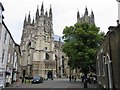
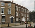
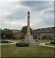
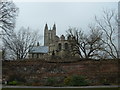
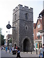
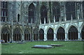
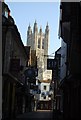
Living in CT1 2NH means being part of a compact, densely populated residential cluster in the historic city of Canterbury, a UNESCO World Heritage Site. The area covers just 1,712 square metres, housing 2,499 residents in a high-density arrangement. Its proximity to Canterbury’s medieval heritage, including Barton Hall and historic precincts, offers a blend of historical significance and modern convenience. The median age of 22 reflects a young adult demographic, with 47% of residents owning their homes and the majority living in houses. Daily life here is shaped by easy access to retail, rail, and education, with Tesco, M&S, and Waitrose within reach. The area’s small size means a tight-knit community, though its limited footprint also means housing stock is constrained. For those seeking a mix of history, practicality, and youthful energy, CT1 2NH offers a distinct microcosm of Canterbury’s character.
- Area Type
- Postcode
- Area Size
- 1712 m²
- Population
- Not available
- Population Density
- Not available
The property market in CT1 2NH is characterised by a 47% home ownership rate, with houses forming the predominant accommodation type. This suggests a mix of owner-occupied and rental properties, though the small area size of 1,712 square metres implies limited housing stock. Given the high population density, competition for homes may be keen, particularly for buyers seeking properties in this historic city. The presence of houses rather than flats or apartments indicates a preference for traditional, possibly family-oriented housing. For buyers, this small area’s proximity to Canterbury’s amenities and transport links could be a draw, though the constrained footprint may mean limited options for expansion or development.
House Prices in CT1 2NH
No properties found in this postcode.
Energy Efficiency in CT1 2NH
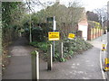
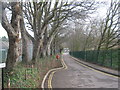
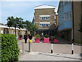
The lifestyle in CT1 2NH is shaped by its proximity to retail and transport hubs. Within walking distance are major retailers like Tesco Canterbury, M&S Canterbury, and Waitrose Canterbury, offering a range of shopping options. The area’s rail network, with stations such as Canterbury East and Sturry, facilitates easy commuting to nearby towns and cities. While the data does not mention parks or leisure facilities, the historic context of Canterbury suggests access to cultural attractions and green spaces in the wider city. The compact nature of the area means amenities are closely clustered, contributing to a convenient, though potentially limited, lifestyle.
Amenities
Schools
The nearest educational institution to CT1 2NH is Canterbury College, a sixth-form college offering post-16 education. No primary or secondary schools are listed in the data, meaning families may need to look beyond the immediate area for younger children’s schooling. The absence of schools within the postcode suggests that residents rely on nearby institutions in Canterbury’s broader network. For those prioritising sixth-form education, Canterbury College provides a direct option, though the lack of primary and secondary schools may influence decisions about long-term residency. Parents should consider the availability of alternative schools in the surrounding area when evaluating the suitability of CT1 2NH for families.
| Rank | School | Type | Entry gender | Ages |
|---|---|---|---|---|
| 1 | Canterbury College | sixth-form | N/A | N/A |
Explore more schools in this area
Go to Schools tabDemographics
CT1 2NH’s population of 2,499 is predominantly young, with a median age of 22 and the most common age range being 15–29 years. This suggests a community skewed towards students, early-career professionals, and young families. Home ownership stands at 47%, indicating a mix of renters and homeowners, with houses being the primary accommodation type. The predominant ethnic group is White, reflecting the broader demographic trends in Canterbury. The high population density of 1,459,331 people per square kilometre underscores the area’s compact nature, which may influence social dynamics and housing availability. While the data does not specify deprivation levels, the young demographic and rental market suggest a transient population, which can shape the area’s social fabric and community cohesion.
Household Size
Accommodation Type
Tenure
Ethnic Group
Religion
Household Composition
Age
Household Deprivation
NS-SEC
Explore more demographic insights in this area
Go to Demographics tabPlanning
Planning Constraints
- Flood RiskPremium
- Ramsar Wetland SitesPremium
- Area of Outstanding Natural BeautyPremium
- Protected Nature ReservePremium
- Protected WoodlandPremium
- Crime RiskPremium