Area Overview for CT1 2JG
Photos of CT1 2JG


Area Information
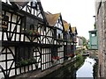
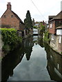
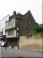
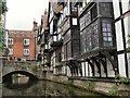
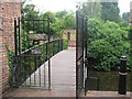
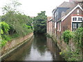
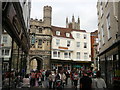
CT1 2JG is a small residential postcode cluster in Canterbury, England, centred around the historic Westgate, the city’s medieval entrance on the London Road. With a population of 1,295, this area blends historical significance with modern living. The Westgate itself, a Grade I listed structure, is a defining landmark—built in the late 14th century as a defensive gate and later repurposed as a jail, museum, and café. Its presence adds a unique character to the neighbourhood, which is compact but well-connected. Daily life here is shaped by proximity to Canterbury’s city centre, with easy access to retail, transport, and cultural sites. The area attracts young adults, reflected in its median age of 22, and offers a mix of independent schools and practical amenities. While small, it is positioned near key infrastructure, including multiple railway stations and major supermarkets, making it a convenient base for those working in the city or commuting further afield.
- Area Type
- Postcode
- Area Size
- Not available
- Population
- Not available
- Population Density
- Not available
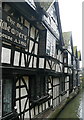
The property market in CT1 2JG is defined by a 44% home ownership rate, indicating that more than half of residents rent their homes. This suggests a rental market that accommodates the area’s young, transient population. The accommodation type is predominantly houses, which is unusual for a small postcode cluster but may reflect the historical character of the area, including properties near the Westgate. Given the limited size of the postcode, the housing stock is likely constrained, with limited scope for expansion. Buyers should consider that the area’s small footprint may mean competition for properties, particularly near historic sites or transport links. The presence of houses rather than flats or apartments may appeal to those seeking traditional living spaces, though the market’s dynamics are shaped by the need to balance affordability with the area’s unique heritage and connectivity.
House Prices in CT1 2JG
No properties found in this postcode.
Energy Efficiency in CT1 2JG
Living in CT1 2JG offers access to a range of practical amenities within easy reach. The area is served by five retail outlets, including Sainsburys Canterbury, M&S Canterbury, and Tesco Canterbury, ensuring convenience for daily shopping needs. The proximity to railway stations enhances mobility, connecting residents to broader networks for work, leisure, or travel. The historic Westgate, a Grade I listed site, adds cultural and architectural interest, though it is not a park or green space. While the data does not mention parks or leisure facilities, the area’s compact size and location near Canterbury’s city centre suggest that residents can access larger recreational spaces nearby. The combination of retail, transport, and historical landmarks creates a lifestyle that balances practicality with a touch of heritage, ideal for those seeking convenience without sacrificing character.
Amenities
Schools
The schools nearest to CT1 2JG include The King’s School Canterbury and The Family School, both of which are independent institutions. These schools cater to families seeking private education, though no Ofsted ratings are provided in the data. The absence of state schools in the list suggests that the area’s educational options are primarily private, which may be a consideration for families prioritising independent schooling. The proximity of these schools to the postcode cluster indicates that the area is well-served for families with children, though the lack of public school options could limit accessibility for those without the financial means to pay for private education. The mix of independent schools reflects the demographic profile of the area, which skews young and possibly middle- to upper-income.
| Rank | School | Type | Entry gender | Ages |
|---|---|---|---|---|
| 1 | The King's School Canterbury | independent | N/A | N/A |
| 2 | The Family School | independent | N/A | N/A |
Explore more schools in this area
Go to Schools tabDemographics
The population of CT1 2JG is predominantly young, with a median age of 22 and the most common age range being 15–29 years. This suggests a community skewed toward students, recent graduates, or young professionals. Home ownership rates here are 44%, meaning more than half of residents rent, reflecting a rental market that caters to transient or budget-conscious households. The area’s accommodation is primarily houses, which aligns with the residential cluster’s character. The predominant ethnic group is White, though the data does not specify the proportion of other groups. The young demographic and high proportion of renters imply a dynamic, possibly student-influenced community. While no specific deprivation data is provided, the mix of renters and young residents may indicate a focus on affordability over long-term stability, which could influence local services and amenities.
Household Size
Accommodation Type
Tenure
Ethnic Group
Religion
Household Composition
Age
Household Deprivation
NS-SEC
Explore more demographic insights in this area
Go to Demographics tabPlanning
Planning Constraints
- Flood RiskPremium
- Ramsar Wetland SitesPremium
- Area of Outstanding Natural BeautyPremium
- Protected Nature ReservePremium
- Protected WoodlandPremium
- Crime RiskPremium